101. Properties near the intersection of Oak Avenue and Northfield Road and Turkey Hill Road Format: Photographs Collection: 1950 Aerial Mapping of Lunenburg, Ma. Date: May 3, 1950 Institution: Lunenburg Massachusetts Historical Society
102. Properties near the intersection of Page Street and Burrage Street and Arbor Street Format: Photographs Collection: 1950 Aerial Mapping of Lunenburg, Ma. Date: May 9, 1950 Institution: Lunenburg Massachusetts Historical Society
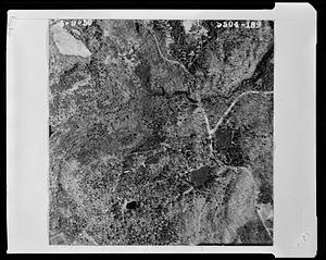
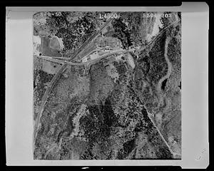
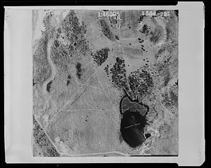
103. Properties near the intersection of Reservoir Road and Flat Hill Road Format: Photographs Collection: 1950 Aerial Mapping of Lunenburg, Ma. Date: May 9, 1950 Institution: Lunenburg Massachusetts Historical Society
104. Properties near the intersection of Summer Street and Whalom Road Format: Photographs Collection: 1950 Aerial Mapping of Lunenburg, Ma. Date: May 3, 1950 Institution: Lunenburg Massachusetts Historical Society
105. Properties near the intersection of Sunny Hill Road and West Street Format: Photographs Collection: 1950 Aerial Mapping of Lunenburg, Ma. Date: May 3, 1950 Institution: Lunenburg Massachusetts Historical Society
106. Properties near the intersection of the Leominster town line with Lincoln Street and Leominster Road Format: Photographs Collection: 1950 Aerial Mapping of Lunenburg, Ma. Date: May 3, 1950 Institution: Lunenburg Massachusetts Historical Society
107. Properties near the intersection of the Shirley town line and the Townsend town line Format: Photographs Collection: 1950 Aerial Mapping of Lunenburg, Ma. Date: May 9, 1950 Institution: Lunenburg Massachusetts Historical Society
108. Properties near the intersection of Townsend Harbor Road and the Townsend town line Format: Photographs Collection: 1950 Aerial Mapping of Lunenburg, Ma. Date: May 9, 1950 Institution: Lunenburg Massachusetts Historical Society
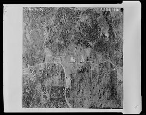
109. Properties near the intersection of West Street and Hollis Road Format: Photographs Collection: 1950 Aerial Mapping of Lunenburg, Ma. Date: [May 3, 1950] Institution: Lunenburg Massachusetts Historical Society
110. Properties near the intersection of West Street and Sunny Hill Road Format: Photographs Collection: 1950 Aerial Mapping of Lunenburg, Ma. Date: May 3, 1950 Institution: Lunenburg Massachusetts Historical Society
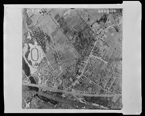
111. Properties near the intersection of West Street with Pratt Street and Pleasant Street Format: Photographs Collection: 1950 Aerial Mapping of Lunenburg, Ma. Date: May 3, 1950 Institution: Lunenburg Massachusetts Historical Society
112. Properties near the intersection of West Townsend Road and Howard Street Format: Photographs Collection: 1950 Aerial Mapping of Lunenburg, Ma. Date: May 3, 1950 Institution: Lunenburg Massachusetts Historical Society
113. Properties near the intersections of Leominster Road with Old Leominster Road and Fairview Road Format: Photographs Collection: 1950 Aerial Mapping of Lunenburg, Ma. Date: May 3, 1950 Institution: Lunenburg Massachusetts Historical Society
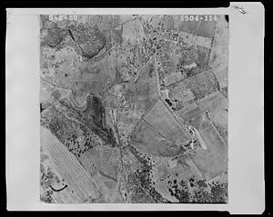
114. Properties near the Lancaster town line and the intersection of Leominster Shirley Road and B.M.R.R. railroad tracks Format: Photographs Collection: 1950 Aerial Mapping of Lunenburg, Ma. Date: May 9, 1950 Institution: Lunenburg Massachusetts Historical Society
115. Properties near the Lancaster town line Turner's pond and Leominster Shirley Road Format: Photographs Collection: 1950 Aerial Mapping of Lunenburg, Ma. Date: May 9, 1950 Institution: Lunenburg Massachusetts Historical Society
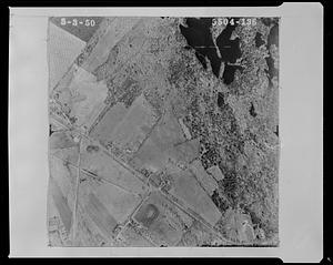
116. Properties near the Leominster town line and edge of Lake Whalom Format: Photographs Collection: 1950 Aerial Mapping of Lunenburg, Ma. Date: May 3, 1950 Institution: Lunenburg Massachusetts Historical Society
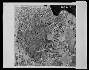
117. Properties near the Leominster town line and the intersection of Gibson Street and Lancaster Avenue Format: Photographs Collection: 1950 Aerial Mapping of Lunenburg, Ma. Date: May 9, 1950 Institution: Lunenburg Massachusetts Historical Society
118. Properties near the Leominster town line and the intersection of Leominster Shirley Road and B.M.R.R. railroad tracks Format: Photographs Collection: 1950 Aerial Mapping of Lunenburg, Ma. Date: May 9, 1950 Institution: Lunenburg Massachusetts Historical Society
119. Properties near the Leominster town line and the intersection of Leominster Shirley Road and Lancaster Avenue Format: Photographs Collection: 1950 Aerial Mapping of Lunenburg, Ma. Date: May 9, 1950 Institution: Lunenburg Massachusetts Historical Society
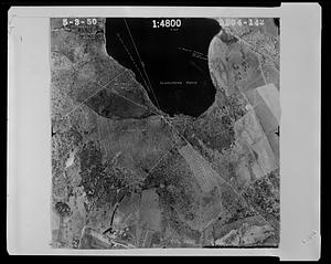
120. Properties near the Leominster town line and the southern end of Massapoag Pond Format: Photographs Collection: 1950 Aerial Mapping of Lunenburg, Ma. Date: May 3, 1950 Institution: Lunenburg Massachusetts Historical Society