Skip to search
Skip to main content
Skip to first result
Digital Commonwealth
Folders
Sign Up / Log In
Search for
Search
Search
Search
Basic
Advanced
Explore
Map
Collections
Institutions
Formats
For Educators
Primary Source Sets
Lesson Plans
Using Primary Sources
Searching Digital Commonwealth
For Institutions
Join Digital Commonwealth
Conferences, Trainings, & Events
How to Contribute Collections
Digitization Services
Board & Committees
Frequently Asked Questions
About
About Digital Commonwealth
News & Announcements
Copyright & Terms of Use
Harmful Content Statement
Partners
API
Contact Us
Search
Search Constraints
Start Over
Save Search
Your search:
More Like
commonwealth:9s161980s
✖
Remove constraint More Like: commonwealth:9s161980s
« Prev.
|
11,121
-
11,140
of
11,498
|
Next »
Sort
by relevance
relevance
title
date (asc)
date (desc)
recently added
Number of results to display per page
20
per page
per page
10
per page
20
per page
50
per page
100
per page
View results as:
List
list view
Maps
map view
Gallery
grid view
Search Results
11121.
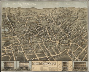
View of Middletown, N.Y : 1874
11122.
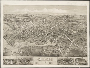
View of Milford, Conn : 1882
11123.
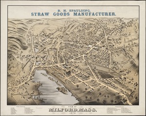
View of Milford, Mass : 1876
11124.
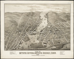
View of Mystic River & Mystic Bridge, Conn. 1879
11125.
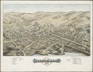
View of Natick, Mass : 1877, population about 8000
11126.
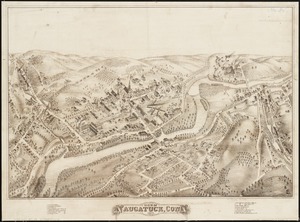
View of Naugatuck, Conn : 1877
11127.
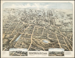
View of New Britain, Conn : 1875
11128.
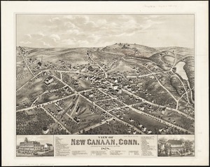
View of New Canaan, Conn : 1878
11129.
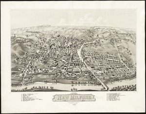
View of New Milford, Conn : 1882
11130.
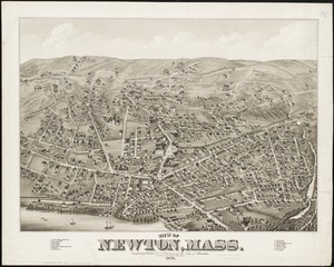
View of Newton, Mass : comprising Wards 1 & 7 & environs of the city of Newton
11131.
View of North Easton, Massachusetts, 1881
11132.
View of North Manchester, Connecticut : 1880
11133.
View of Northborough, Massachusetts : 1887
11134.
View of Oneida, N.Y : 1874
11135.
View of Palmer, Mass
11136.
A view of part of the town of Boston in New-England and Brittish [sic] ships of war landing their troops! 1768
11137.
View of Peabody, Mass : 1877
11138.
A view of Port Hood, sailing into the harbor : A view of the Plaister Cliffs, in George's Bay
11139.
A view of Portsmouth in Piscataqua River
11140.
View of Public Square, Atlanta, Ga.
« Previous
Next »
1
2
…
553
554
555
556
557
558
559
560
561
…
574
575
Limit your search
Subject
Real property--Massachusetts--Boston--Maps
2,281
Landowners--Massachusetts--Boston--Maps
2,120
Boston (Mass.)--Maps
1,974
Roxbury (Boston, Mass.)--Maps
352
Dorchester (Boston, Mass.)--Maps
317
Cambridge (Mass.)--Maps
266
Brookline (Mass.)--Maps
236
Real property--Massachusetts--Cambridge--Maps
216
more
Subject
»
Place
North and Central America
8,731
United States
7,650
Massachusetts
4,971
Suffolk (county)
3,366
Boston
3,224
Europe
1,392
Middlesex (county)
620
Canada
449
more
Place
»
Format
Maps/Atlases
11,437
Manuscripts
215
Prints
56
Books
36
Objects/Artifacts
10
Drawings/Illustrations
8
Posters
5
Available to use
No known restrictions
11,425
Creative Commons license
47
Date
View distribution
Current results range from
1482
to
2023
Date range begin
Date range end
View larger »
Collection
Norman B. Leventhal Map & Education Center Collection
11,483
Boston and New England Maps (Collection of Distinction)
5,153
Urban Maps (Collection of Distinction)
4,924
Maritime Charts and Atlases (Collection of Distinction)
1,083
American Revolutionary War-Era Maps (Collection of Distinction)
614
Boston Redevelopment Authority Collection
98
Massachusetts Real Estate Atlases
2
Massachusetts Board of Harbor and Land Commissioners
1
more
Collection
»
Institution
Boston Public Library
11,494
State Library of Massachusetts
4
We'd love your feedback!
×
Would you be interested in taking a short survey about Digital Commonwealth?


![A view of part of the town of Boston in New-England and Brittish [sic] ships of war landing their troops! 1768](https://bpldcassets.blob.core.windows.net/derivatives/images/commonwealth:4m90f851p/image_thumbnail_300.jpg)


