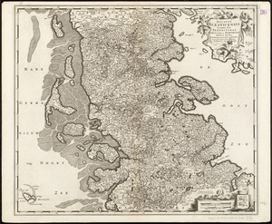
4601. Ducatus Brunsvicensis fere[que] Lunaeburgensis, cum adjacentibus Episcopatibus, Comit. Domin. etc., descriptio geographica Creator: Dauthendey, Caspar. Format: Maps/Atlases Collection: Norman B. Leventhal Map & Education Center Collection Date: [ca. 1640] Institution: Boston Public Library
4602. Ducatus Chablasius et Lacus Lemanus cum regionibus adjacentibus Creator: Blaeu, Joan, 1596-1673 Format: Maps/Atlases Collection: Norman B. Leventhal Map & Education Center Collection Date: [1682] Institution: Boston Public Library
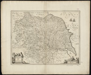
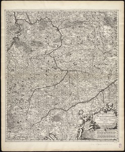
4603. Ducatus Eboracensis, anglice Yorkshire Creator: Jansson, Jan, 1588-1664 Format: Maps/Atlases Collection: Norman B. Leventhal Map & Education Center Collection Date: [1646?] Institution: Boston Public Library
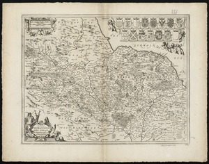
4604. Ducatus Eboracensis pars borealis = the Northridinge of Yorkeshire Creator: Jansson, Jan, 1588-1664 Format: Maps/Atlases Collection: Norman B. Leventhal Map & Education Center Collection Date: [1646–1680] Institution: Boston Public Library
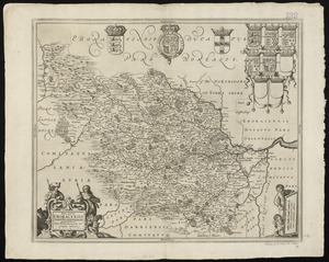
4605. Ducatus Eboracensis pars occidentalis = the Westriding of York Shire Creator: Jansson, Jan, 1588-1664 Format: Maps/Atlases Collection: Norman B. Leventhal Map & Education Center Collection Date: [1646–1680] Institution: Boston Public Library
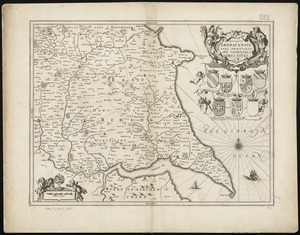
4606. Ducatus Eboracensis pars orientalis = The Eastriding of Yorke Shire Creator: Jansson, Jan, 1588-1664 Format: Maps/Atlases Collection: Norman B. Leventhal Map & Education Center Collection Date: [1646–1680] Institution: Boston Public Library
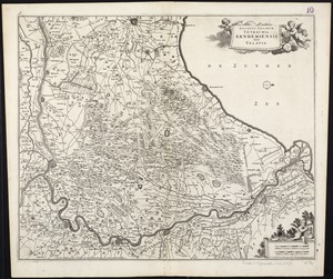
4607. Ducatus Geldriae Tetrachia Arnhemiensis sive Velavia Creator: Wit, Frederik de. Format: Maps/Atlases Collection: Norman B. Leventhal Map & Education Center Collection Date: [1680] Institution: Boston Public Library
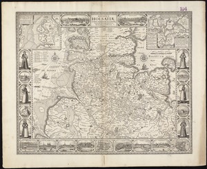
4608. Ducatus Holsatiae, summa diligentia accurataque censura noviter Creator: Visscher, Claes Jansz., 1586 or 7-1652 Format: Maps/Atlases Collection: Norman B. Leventhal Map & Education Center Collection Date: [1666] Institution: Boston Public Library
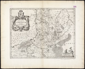
4609. Ducatus Limburgum Creator: Martini, Aegidius. Format: Maps/Atlases Collection: Norman B. Leventhal Map & Education Center Collection Date: 1635 Institution: Boston Public Library
4610. Ducatus Meklenburgicus in quo sunt Ducatus Vandaliae et Meklenburgi Comitatus et Episcopatus Swerinensis Rostochiense et Stargardiense Domin Creator: Wit, Frederik de. Format: Maps/Atlases Collection: Norman B. Leventhal Map & Education Center Collection Date: [ca. 1680] Institution: Boston Public Library
4611. Ducatus Pomeraniae tabula generalis, in qua sunt Ducatus Pomeraniae, Stettinensis, Cassubiae, Vandaliae, et Bardensis, Principatus Rugiae, ac Insulae, Comitatus... Creator: Wit, Frederik de. Format: Maps/Atlases Collection: Norman B. Leventhal Map & Education Center Collection Date: [1690?–1699?] Institution: Boston Public Library
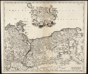
4612. Ducatus Slesvicensis in omnes suas praefecturas circulos et provincias distinte divisus Creator: Wit, Frederik de. Format: Maps/Atlases Collection: Norman B. Leventhal Map & Education Center Collection Date: [1680–1690] Institution: Boston Public Library
4613. Ducatus Wurtenbergensis : cum adjacentibus quibusdam Sueviae regionibus Creator: Visscher, Nicolaes, 1649-1702 Format: Maps/Atlases Collection: Norman B. Leventhal Map & Education Center Collection Date: [1704?] Institution: Boston Public Library
4614. Dunn County, Wis. Format: Maps/Atlases; Manuscripts Collection: Norman B. Leventhal Map & Education Center Collection Date: [ca. 1880–1889] Institution: Boston Public Library
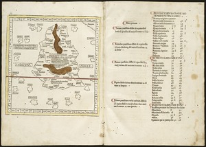
4615. Duodecima Asiae tabula Creator: Ptolemy, 2nd cent Format: Maps/Atlases Collection: Norman B. Leventhal Map & Education Center Collection Date: 1511 Institution: Boston Public Library
4616. Duodecima et Ultima Asie tabula continet Taprobana insulam cum certeris insulis adiacentibus Creator: Ptolemy, 2nd cent; Hol, Lienhart Format: Maps/Atlases Collection: Norman B. Leventhal Map & Education Center Collection Date: [1482] Institution: Boston Public Library
4617. The Dutch colony of Surinam, as laid down by L: Colonel Spiering, Chief Engineer at Surinam Creator: Jefferys, Thomas, -1771, Spiering, J.H.C., Lieutenant Colonel, and Sayer, Robert, 1725-1794 Format: Maps/Atlases Collection: Norman B. Leventhal Map & Education Center Collection Date: [1768] Institution: Boston Public Library
4618. The Dutch colony of the Cape of Good Hope Creator: Delarochette, L. (Louis), 1731-1802, Delarochette, L. (Louis), 1731-1802, and Faden, William, 1749-1836 Format: Maps/Atlases Collection: Norman B. Leventhal Map & Education Center Collection Date: 1782 Institution: Boston Public Library
4619. The Dutch islands of St. Eustatia, Saba, and St. Martins ; the French island of St. Bartholomew ; the English islands of St. Christophers, Nevis, and Anguilla ; with... Format: Maps/Atlases Collection: American Revolutionary War-Era Maps (Collection of Distinction) / Norman B. Leventhal Map & Education Center Collection Date: 1781 Institution: Boston Public Library
4620. E. & G.W. Blunt's corrected map of the seat of war near Richmond, July 10th, 1862 Creator: E. & G.W. Blunt (Firm) Format: Maps/Atlases Collection: Norman B. Leventhal Map & Education Center Collection Date: [1862] Institution: Boston Public Library
![Ducatus Brunsvicensis fere[que] Lunaeburgensis, cum adjacentibus Episcopatibus, Comit. Domin. etc., descriptio geographica](https://bpldcassets.blob.core.windows.net/derivatives/images/commonwealth:cj82kr74v/image_thumbnail_300.jpg)