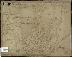
21. Map of South Reading Creator: Eaton, Henry L. Format: Maps/Atlases Collection: Lucius Beebe Memorial Library Historic Maps Date: 1840 Institution: Lucius Beebe Memorial Library
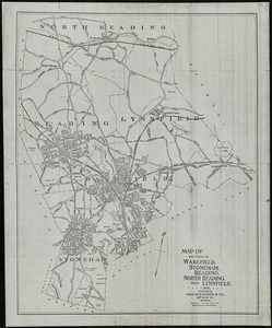
22. Map of the towns of Wakefield, Stoneham, Reading, North Reading, and Lynnfield, 1907 Creator: Whitman, H. T. Format: Maps/Atlases Collection: Lucius Beebe Memorial Library Historic Maps Date: 1907 Institution: Lucius Beebe Memorial Library
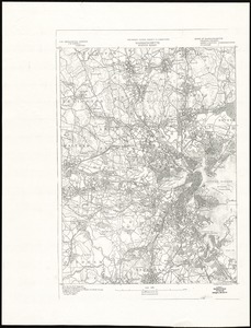
23. Massachusetts, Boston sheet Creator: Geological Survey (U.S.), Gannett, Henry, 1846-1914, and Forbes Albertype Co. Format: Maps/Atlases Collection: Lucius Beebe Memorial Library Historic Maps Date: [1886?] Institution: Lucius Beebe Memorial Library
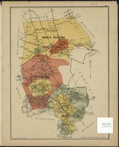
24. North Reading, Reading, and Wakefield, Mass. Format: Maps/Atlases Collection: Lucius Beebe Memorial Library Historic Maps Date: (c) 1889 Institution: Lucius Beebe Memorial Library
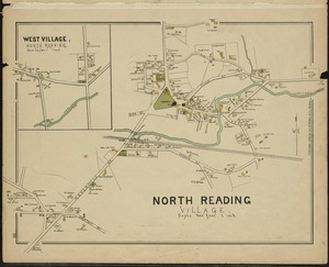
25. North Reading Village Format: Maps/Atlases Collection: Lucius Beebe Memorial Library Historic Maps Date: (c) 1889 Institution: Lucius Beebe Memorial Library
26. Part of Wakefield [Massachusetts] Format: Maps/Atlases Collection: Lucius Beebe Memorial Library Historic Maps Date: (c) 1889 Institution: Lucius Beebe Memorial Library
27. Part of Wakefield [Massachusetts] Greenwood ; Town of Wakefield Format: Maps/Atlases Collection: Lucius Beebe Memorial Library Historic Maps Date: (c) 1889 Institution: Lucius Beebe Memorial Library
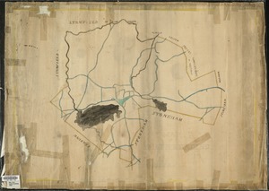
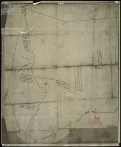
28. Plan of north precinct, Reading, 1732 : showing precinct boundaries, rivers, and location of meeting house Creator: Senefelder Lith. Co. Format: Maps/Atlases Collection: Lucius Beebe Memorial Library Historic Maps Date: [1732] Institution: Lucius Beebe Memorial Library
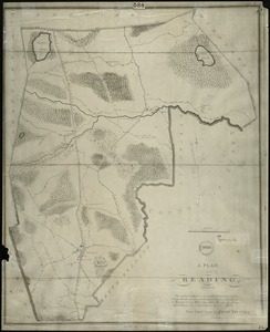
29. Plan of Reading, Mass. : showing roads, bodies of water, woodlands, homes, churches, schools, post offices, and taverns Creator: Parker, Edmund; Senefelder Lith. Co. Format: Maps/Atlases Collection: Lucius Beebe Memorial Library Historic Maps Date: 1831 Institution: Lucius Beebe Memorial Library
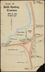
30. Plan of South Reading Common, Nov. 19, 1826 Creator: Gerry, Robert Format: Maps/Atlases Collection: Lucius Beebe Memorial Library Historic Maps Date: [1826] Institution: Lucius Beebe Memorial Library
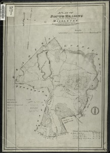
31. A plan of South Reading in the County of Middlesex Creator: Hales, John Groves Format: Maps/Atlases Collection: Lucius Beebe Memorial Library Historic Maps Date: [1830] Institution: Lucius Beebe Memorial Library
32. A plan of the 3rd Parish of the Town of Reading in the County of Middlesex Creator: Needham, Daniel; Bancroft, Clinton L. Format: Maps/Atlases Collection: Lucius Beebe Memorial Library Historic Maps Date: 1930 Institution: Lucius Beebe Memorial Library
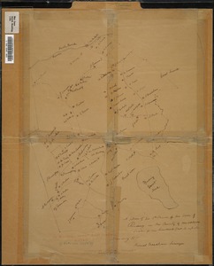
33. A plan of the Town of Reading in the County of Middlesex and the Town of Lynnfield in the County of Essex Creator: Needham, Daniel; Bancroft, Clinton L. Format: Maps/Atlases Collection: Lucius Beebe Memorial Library Historic Maps Date: [1794] Institution: Lucius Beebe Memorial Library
34. Plan or map showing the laying out of Rail Road Street Format: Maps/Atlases Collection: Lucius Beebe Memorial Library Historic Maps Date: 1845 Institution: Lucius Beebe Memorial Library
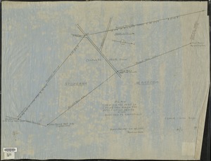
35. Plan showing the part of Stoneham which the petitioners desire to have annexed to Wakefield Format: Maps/Atlases Collection: Lucius Beebe Memorial Library Historic Maps Date: 1888 Institution: Lucius Beebe Memorial Library
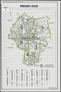
36. Precinct atlas, Town of Wakefield Format: Maps/Atlases Collection: Lucius Beebe Memorial Library Historic Maps Date: 2000 Institution: Lucius Beebe Memorial Library
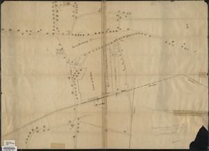
37. Reading Village, east side [Massachusetts] : showing streets, buildings, property boundaries and owners, railroad lines, and cemeteries Format: Maps/Atlases Collection: Lucius Beebe Memorial Library Historic Maps Date: (c) 1889 Institution: Lucius Beebe Memorial Library
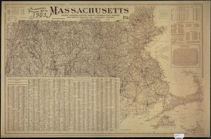
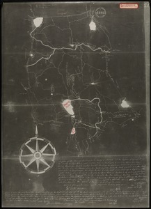
38. Scarborough's topographic map of Massachusetts : showing railroads, electric railways, steamboat lines, highways, post offices, villages, etc. Creator: Scarborough Company Format: Maps/Atlases Collection: Lucius Beebe Memorial Library Historic Maps Date: 1903 Institution: Lucius Beebe Memorial Library
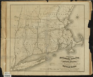
39. Sketch of the states of Massachusetts, Connecticut, and Rhode Island, and parts of New Hampshire & New York exhibiting the several rail road routes completed,... Creator: Kennedy, Archibald, active 1850; Morse and Tuttle Format: Maps/Atlases Collection: Lucius Beebe Memorial Library Historic Maps Date: 1838 Institution: Lucius Beebe Memorial Library
40. South Reading Format: Maps/Atlases Collection: Lucius Beebe Memorial Library Historic Maps Date: 1850 Institution: Lucius Beebe Memorial Library
![Part of Wakefield [Massachusetts]](https://bpldcassets.blob.core.windows.net/derivatives/images/commonwealth:c534g4366/image_thumbnail_300.jpg)
![Part of Wakefield [Massachusetts] Greenwood ; Town of Wakefield](https://bpldcassets.blob.core.windows.net/derivatives/images/commonwealth:c534g394w/image_thumbnail_300.jpg)
![Reading Village, east side [Massachusetts]](https://bpldcassets.blob.core.windows.net/derivatives/images/commonwealth:pv63g493p/image_thumbnail_300.jpg)