1. Amended zoning map for town of Wakefield Mass. Format: Maps/Atlases Collection: Lucius Beebe Memorial Library Historic Maps Date: 1946 Institution: Lucius Beebe Memorial Library
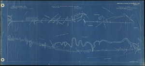
2. Around Wakefield's lake Creator: White, S. P. Format: Maps/Atlases Collection: Lucius Beebe Memorial Library Historic Maps Date: 1889 Institution: Lucius Beebe Memorial Library
3. Census tract outline maps : Wakefield, MA : (Census 2000) Creator: United States. Bureau of the Census Format: Maps/Atlases Collection: Lucius Beebe Memorial Library Historic Maps Date: 2000 Institution: Lucius Beebe Memorial Library
4. Facsimile of Col. Nichols' plan of the First Parish of Reading, the present towns of Wakefield and Reading, plotted in 1765 Format: Maps/Atlases Collection: Lucius Beebe Memorial Library Historic Maps Date: 1889 Institution: Lucius Beebe Memorial Library
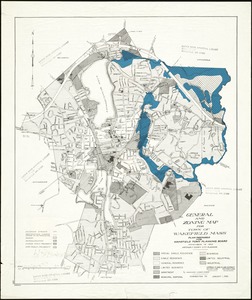
5. General and zoning map for town of Wakefield Mass. Creator: Comey, Arthur C. (Arthur Coleman), 1886-1954 Format: Maps/Atlases Collection: Lucius Beebe Memorial Library Historic Maps Date: 1981 Institution: Lucius Beebe Memorial Library
6. General and zoning map for town of Wakefield Mass. Creator: Comey, Arthur C. (Arthur Coleman), 1886-1954 Format: Maps/Atlases Collection: Lucius Beebe Memorial Library Historic Maps Date: 1971 Institution: Lucius Beebe Memorial Library
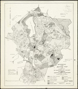
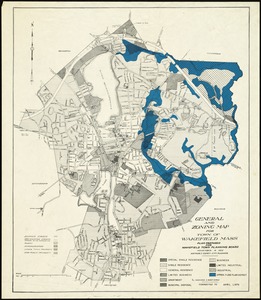
7. General and zoning map for town of Wakefield, Mass. Creator: Comey, Arthur C. (Arthur Coleman), 1886-1954 Format: Maps/Atlases Collection: Lucius Beebe Memorial Library Historic Maps Date: 1941 Institution: Lucius Beebe Memorial Library
8. General and zoning map for town of Wakefield Mass. Creator: Comey, Arthur C. (Arthur Coleman), 1886-1954 Format: Maps/Atlases Collection: Lucius Beebe Memorial Library Historic Maps Date: 1988 Institution: Lucius Beebe Memorial Library
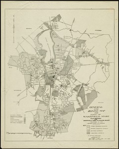
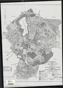
9. General and zoning map for town of Wakefield Mass. Creator: Comey, Arthur C. (Arthur Coleman), 1886-1954 Format: Maps/Atlases Collection: Lucius Beebe Memorial Library Historic Maps Date: 1976 Institution: Lucius Beebe Memorial Library
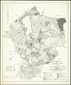
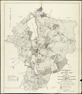
10. General and zoning map for town of Wakefield Mass. Creator: Comey, Arthur C. (Arthur Coleman), 1886-1954 Format: Maps/Atlases Collection: Lucius Beebe Memorial Library Historic Maps Date: 1956 Institution: Lucius Beebe Memorial Library
11. General and zoning map for town of Wakefield Mass. Creator: Comey, Arthur C. (Arthur Coleman), 1886-1954 Format: Maps/Atlases Collection: Lucius Beebe Memorial Library Historic Maps Date: 1994 Institution: Lucius Beebe Memorial Library
12. Greenwood, Town of Wakefield [Massachusetts] Format: Maps/Atlases Collection: Lucius Beebe Memorial Library Historic Maps Date: (c) 1889 Institution: Lucius Beebe Memorial Library
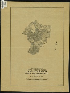
13. Land Utilization : Town of Wakefield Creator: Massachusetts. State Planning Board Format: Maps/Atlases Collection: Lucius Beebe Memorial Library Historic Maps Date: June 1940 Institution: Lucius Beebe Memorial Library
14. Location of the Boston & Maine extension rail road : from Boston to Wilmington Format: Maps/Atlases Collection: Lucius Beebe Memorial Library Historic Maps Date: 1845 Institution: Lucius Beebe Memorial Library
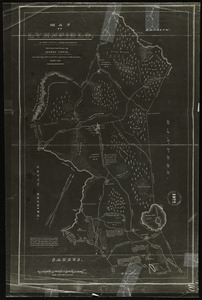
15. Map of Lynnfield, in Essex County, Massachusetts Creator: Lewis, Alonzo. Format: Maps/Atlases Collection: Lucius Beebe Memorial Library Historic Maps Date: 1922 Institution: Lucius Beebe Memorial Library
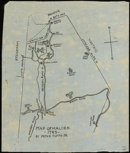
16. Map of Malden, 1795 Creator: Tufts, Peter Format: Maps/Atlases Collection: Lucius Beebe Memorial Library Historic Maps Date: [1795] Institution: Lucius Beebe Memorial Library
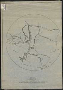
17. Map of old Reading, Massachusetts Bay Colony, 1647 Format: Maps/Atlases Collection: Lucius Beebe Memorial Library Historic Maps Date: [1647] Institution: Lucius Beebe Memorial Library
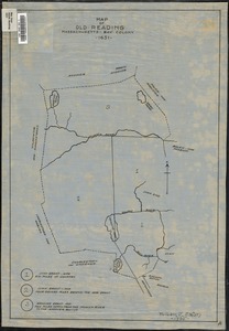
18. Map of old Reading, Massachusetts Bay Colony, 1651 Creator: Eaton, William E. Format: Maps/Atlases Collection: Lucius Beebe Memorial Library Historic Maps Date: 1935 Institution: Lucius Beebe Memorial Library
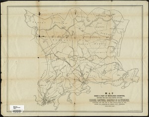
19. Map of parts of Essex & part of Middlesex counties, showing the rail road routes between Salem, Lowell, Boston & Lawrence Creator: Parrott, George B.; Nott, Samuel Format: Maps/Atlases Collection: Lucius Beebe Memorial Library Historic Maps Date: 1848 Institution: Lucius Beebe Memorial Library
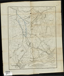
20. Map of parts of Middlesex & Essex counties showing the rail road routes between Salem, Lowell, Boston & Methuen Creator: Parrott, George B., Nott, Samuel, and Bouvé, Ephraim W., 1817-1897 Format: Maps/Atlases Collection: Lucius Beebe Memorial Library Historic Maps Date: 1847 Institution: Lucius Beebe Memorial Library


![Greenwood, Town of Wakefield [Massachusetts]](https://bpldcassets.blob.core.windows.net/derivatives/images/commonwealth:c534g392b/image_thumbnail_300.jpg)