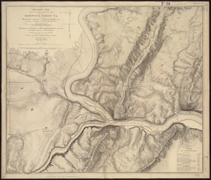
41. Military map showing the topographical features of the country adjacent to Harper's Ferry, Va : including Maryland, Loudoun, and Bolivar Heights, and portions of South... Creator: Weyss, J. E. Format: Maps/Atlases Collection: Norman B. Leventhal Map & Education Center Collection Date: [1863?] Institution: Boston Public Library
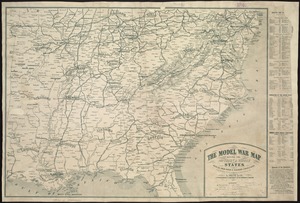
42. The model war map giving the southern & middle states, with all their water & railroad connections Creator: Louis Prang and Company Format: Maps/Atlases Collection: Norman B. Leventhal Map & Education Center Collection Date: [1862?] Institution: Boston Public Library
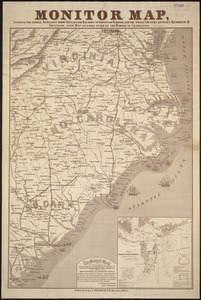
43. Monitor map, showing the whole seacoast from Chesapeake Bay, down to Savannah harbor, and the whole country between Richmond & Savannah, with map on large scale of the... Creator: Louis Prang and Company Format: Maps/Atlases Collection: Norman B. Leventhal Map & Education Center Collection Date: [ca. 1863] Institution: Boston Public Library
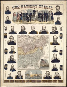
44. Our Nation's Heroes Creator: Ensign, Bridgman & Fanning Format: Maps/Atlases Collection: Norman B. Leventhal Map & Education Center Collection Date: [ca. 1863] Institution: Boston Public Library
45. Perrine's new topographical war map of the southern states : taken from the latest government surveys and official reports Creator: Perrine, C. O. (Charles O.) Format: Maps/Atlases Collection: Norman B. Leventhal Map & Education Center Collection Date: [ca. 1863] Institution: Boston Public Library
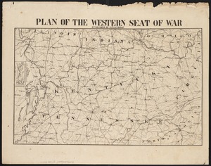
46. Plan of the western seat of war Creator: Lathrop, H. P. Format: Maps/Atlases Collection: Norman B. Leventhal Map & Education Center Collection Date: [1865?] Institution: Boston Public Library
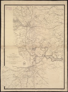
47. Region embraced in the operations of the armies against Richmond and Petersburg Creator: United States. Army. Corps of Engineers Format: Maps/Atlases Collection: Norman B. Leventhal Map & Education Center Collection Date: 1865 Institution: Boston Public Library
48. Richmond Petersburg and vicinity Format: Maps/Atlases Collection: Norman B. Leventhal Map & Education Center Collection Date: [1864?] Institution: Boston Public Library
49. Richmond Petersburg and vicinity Creator: J.H. Bufford's Lith Format: Maps/Atlases Collection: Norman B. Leventhal Map & Education Center Collection Date: [1864?] Institution: Boston Public Library
50. Route of the late expedition commanded by Act'g Rear Admiral D.D. Porter U.S.N. attempting to get into the Yazoo River by the way of Steels Bayou and Deer Creek Creator: Strausz, A. Format: Maps/Atlases Collection: Norman B. Leventhal Map & Education Center Collection Date: 1863 Institution: Boston Public Library
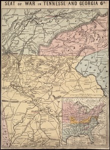
51. Seat of war in Tennesse and Georgia : 6D Creator: Bacon & Co Format: Maps/Atlases Collection: Norman B. Leventhal Map & Education Center Collection Date: [1863] Institution: Boston Public Library
52. Seat of war in Virginia Creator: Weller, Edward, d. 1884 Format: Maps/Atlases Collection: Norman B. Leventhal Map & Education Center Collection Date: 1862 Institution: Boston Public Library
53. Seat of war in Virginia and Maryland Format: Maps/Atlases Collection: Norman B. Leventhal Map & Education Center Collection Date: [1862] Institution: Boston Public Library
54. Siege operations at Spanish Fort, Mobile Bay : by the U.S. forces under Maj. Gen. Canby. Captured by the Army of West Miss. on the night of April 8 & 9, 1865 Creator: McAlester, M. D. Format: Maps/Atlases Collection: Norman B. Leventhal Map & Education Center Collection Date: [1865–1869] Institution: Boston Public Library
55. War maps and diagrams Creator: Hall, Edward S., approximately 1840-; New York herald Format: Maps/Atlases Collection: Norman B. Leventhal Map & Education Center Collection Date: 1861 Institution: Boston Public Library
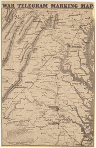
56. War telegram marking map Creator: L. Prang & Co Format: Maps/Atlases Collection: Other Date: 1862 Institution: State Library of Massachusetts
57. What the administration has done : map showing the progress of the national armies during the years 1861, 1862, 1863, and 1864 Format: Maps/Atlases Collection: Norman B. Leventhal Map & Education Center Collection Date: [1864] Institution: Boston Public Library
58. Wyld's military map of the United States, the northern states, and the southern Confederate states : with the forts, harbours, arsenals, and military positions Creator: Wyld, James, 1812-1887 Format: Maps/Atlases Collection: Norman B. Leventhal Map & Education Center Collection Date: 1861 Institution: Boston Public Library
59. The 1976 proposed regional open space plan Creator: Massachusetts. Metropolitan Area Planning Council Format: Maps/Atlases Collection: Boston and New England Maps (Collection of Distinction) / David Judkins Weaver Papers / Norman B. Leventhal Map & Education Center Collection Date: 1976 Institution: Boston Public Library
60. Airbrush base for the Pelorus Linea region of Europa Creator: Geological Survey (U.S.), United States. National Aeronautics and Space Administration, and Planetary Geology Program (U.S.) Format: Maps/Atlases Collection: David Judkins Weaver Papers / Norman B. Leventhal Map & Education Center Collection Date: 1984 Institution: Boston Public Library