Skip to search
Skip to main content
Skip to first result
Digital Commonwealth
Folders
Sign Up / Log In
Search for
Search
Search
Search
Basic
Advanced
Explore
Map
Collections
Institutions
Formats
For Educators
Primary Source Sets
Lesson Plans
Using Primary Sources
Searching Digital Commonwealth
For Institutions
Join Digital Commonwealth
Conferences, Trainings, & Events
How to Contribute Collections
Digitization Services
Board & Committees
Frequently Asked Questions
About
About Digital Commonwealth
News & Announcements
Copyright & Terms of Use
Harmful Content Statement
Partners
API
Contact Us
Search
Search Constraints
Start Over
Save Search
Your search:
More Like
commonwealth:df65xz51j
✖
Remove constraint More Like: commonwealth:df65xz51j
« Prev.
|
141
-
160
of
172
|
Next »
Sort
by relevance
relevance
title
date (asc)
date (desc)
recently added
Number of results to display per page
20
per page
per page
10
per page
20
per page
50
per page
100
per page
View results as:
List
list view
Maps
map view
Gallery
grid view
Search Results
141.
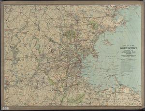
Road Map of the Boston District showing the Metropolitan park system
142.
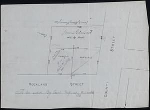
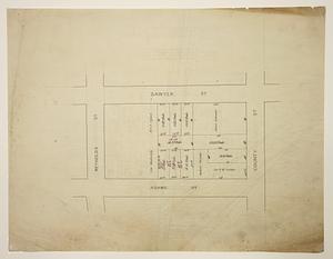
Rockland and County Streets
143.
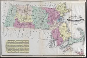
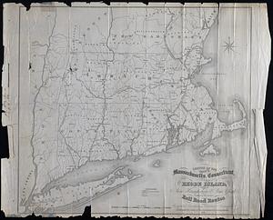
Russell's map of Massachusetts
144.
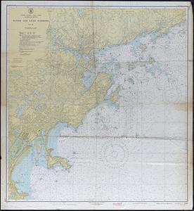
Salem and Lynn Harbor
145.
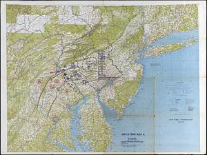
Situation Map A : New York - Washington
146.
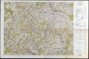
Situation Map A : Rothenburg Germany
147.
Sixteen Shilling Purchase
148.
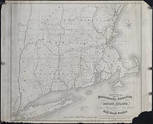
Sketch of the states of Massachusetts, Connecticut, and Rhode Island, New Hampshire and New York exhibiting the railroad routes
149.
Sketch of the states of Massachusetts, Connecticut, and Rhode Island, New Hampshire and New York exhibiting the railroad routes
150.
Snipetuet or Tomson's Purchase
151.
South Purchase Lots - Middleborough, MA
152.
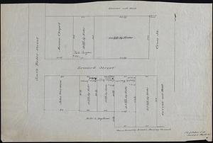
South Water and Leonard Streets
153.
Southern New Bedford and Dartmouth Homesteads (Crane Survey)
154.
Southwest Fairhaven (Crane Survey)
155.
Survey Land Belonging to George Kirby or G.A. Macomber
156.
Survey of Land Belonging to Capt. George Hitch
157.
Survey of Part of Ward 2, New Bedford
158.
Survey of Part of Ward 2, New Bedford
159.
Survey of Part of Wards 1 - 2, New Bedford
160.
Swift World Maps
« Previous
Next »
1
2
…
4
5
6
7
8
9
Limit your search
Subject
Landowners
32
Military topography
11
Election districts
9
Railroads
9
Whales
8
Whaling
8
1700–1799
7
Population--Maps
4
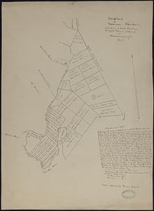
more
Subject
»
Place
North and Central America
126
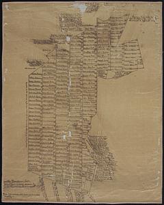
United States
120
Massachusetts
96
Bristol (county)
67
New Bedford
48
Dartmouth
23
Europe
19
Pacific Ocean
10
more
Place
»
Format
Maps/Atlases
170
Manuscripts
57
Prints
1
Available to use
Creative Commons license
172
Date
View distribution
Current results range from
1695
to
1985
Date range begin
Date range end
View larger »
Collection
Map and Chart Collection
172
Institution
New Bedford Free Public Library
172
We'd love your feedback!
×
Would you be interested in taking a short survey about Digital Commonwealth?