Skip to search
Skip to main content
Skip to first result
Digital Commonwealth
Folders
Sign Up / Log In
Search for
Search
Search
Search
Basic
Advanced
Explore
Map
Collections
Institutions
Formats
For Educators
Primary Source Sets
Lesson Plans
Using Primary Sources
Searching Digital Commonwealth
For Institutions
Join Digital Commonwealth
Conferences, Trainings, & Events
How to Contribute Collections
Digitization Services
Board & Committees
Frequently Asked Questions
About
About Digital Commonwealth
News & Announcements
Copyright & Terms of Use
Harmful Content Statement
Partners
API
Contact Us
Search
Search Constraints
Start Over
Save Search
Your search:
More Like
commonwealth:g158bx56b
✖
Remove constraint More Like: commonwealth:g158bx56b
« Prev.
|
41
-
60
of
1,279
|
Next »
Sort
by relevance
relevance
title
date (asc)
date (desc)
recently added
Number of results to display per page
20
per page
per page
10
per page
20
per page
50
per page
100
per page
View results as:
List
list view
Maps
map view
Gallery
grid view
Search Results
41.
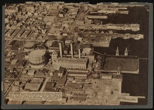
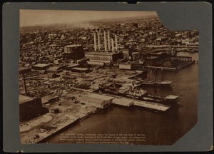
Aerial view of New Bedford Gas and Edison Light Company plant on waterfront
42.
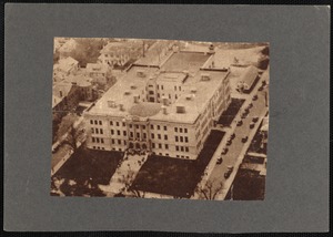
Aerial view of New Bedford High School
43.
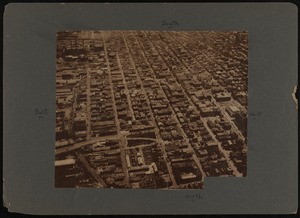
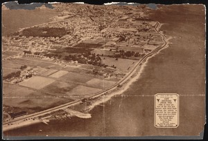
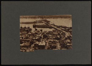
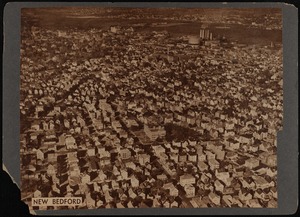
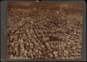
Aerial view of New Bedford, MA
44.
Aerial view of New Bedford, MA
45.
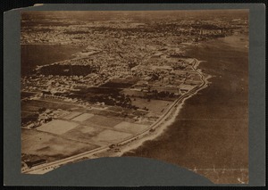
Aerial view of New Bedford, MA and harbor
46.
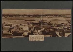
Aerial view of New Bedford, MA harbor taken from the top of the Standard Times
47.
Aerial view of New Bedford, MA looking northwest
48.
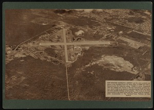
Aerial view of New Bedford, MA municipal airport and city's outskirts taken at 8,000 feet
49.
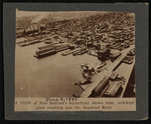
Aerial view of New Bedford, MA waterfront showing piers and Acushnet River
50.
Aerial view of New Bedford, MA waterfront with Fairhaven Bridge to the right
51.
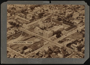
Aerial view of New Bedford Vocational High School from the Standard Times plane.
52.
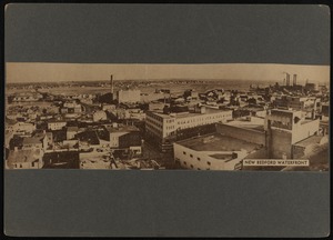
Aerial view of New Bedford waterfront
53.
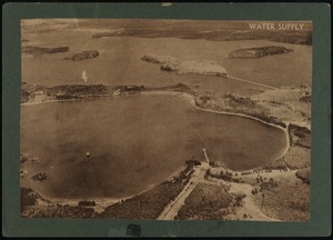
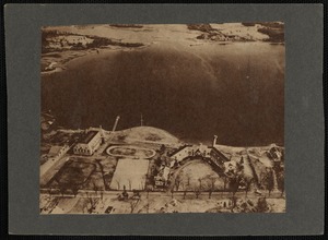
Aerial view of New Bedford's water supply
54.
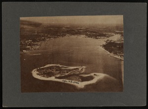
Aerial view of Ram Island in Marion Harbor (MA)
55.
Aerial view of Round Hill Estate, Dartmouth, MA.
56.
Aerial view of south end of New Bedford, MA
57.
Aerial view of south end of New Bedford, MA
58.
Aerial view of Tabor Academy buildings, Marion, MA
59.
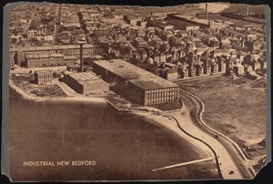
Aerial view of textile mills and worker housing, New Bedford, MA.
60.
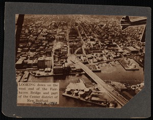
Aerial view of the west end of the Fairhaven, MA bridge and part of the center district of New Bedford, MA
« Previous
Next »
1
2
3
4
5
6
7
…
63
64
Limit your search
Subject
Buildings
430
Exteriors
254
Ships
158
Business enterprises
132
Streets
130
Whaling
108
Piers & wharves
84
Transportation
74
more
Subject
»
Place
North and Central America
432
United States
431
Massachusetts
425
Bristol (county)
406
New Bedford
359
Fairhaven
22
Dukes (county)
6
Fish Island
6
more
Place
»
Format
Photographs
1,279
Available to use
Creative Commons license
1,279
Date
View distribution
Current results range from
1800
to
1959
Date range begin
Date range end
View larger »
Unknown
1
Collection
Rotogravure Collection
1,279
Institution
New Bedford Free Public Library
1,279