Skip to search
Skip to main content
Skip to first result
Digital Commonwealth
Folders
Sign Up / Log In
Search for
Search
Search
Search
Basic
Advanced
Explore
Map
Collections
Institutions
Formats
For Educators
Primary Source Sets
Lesson Plans
Using Primary Sources
Searching Digital Commonwealth
For Institutions
Join Digital Commonwealth
Conferences, Trainings, & Events
How to Contribute Collections
Digitization Services
Board & Committees
Frequently Asked Questions
About
About Digital Commonwealth
News & Announcements
Copyright & Terms of Use
Harmful Content Statement
Partners
API
Contact Us
Search
Search Constraints
Start Over
Save Search
Your search:
More Like
commonwealth:hq37vv584
✖
Remove constraint More Like: commonwealth:hq37vv584
« Prev.
|
141
-
160
of
163
|
Next »
Sort
by relevance
relevance
title
date (asc)
date (desc)
recently added
Number of results to display per page
20
per page
per page
10
per page
20
per page
50
per page
100
per page
View results as:
List
list view
Maps
map view
Gallery
grid view
Search Results
141.
Porti della Nuova York e Perthamboy
142.
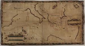
Portolan chart of the Mediterranean Sea
143.
Praeclara Ferna[n]di Cortesii de Noua maris Oceani Hyspania Narratio . . .
144.
Preliminary sketch showing the positions of Davis' Shoal and other dangers recently discovered by the Coast Survey and the...
145.
Quarte partie du monde
146.
Recens edita totius Novi Belgii in America Septentrionali siti
147.
Scandinavia
148.
Septentrionalium terrarum descriptio
149.
Sketch A No. 5 showing proposed site for a light house on Sow and Pigs Reef
150.
Sketch A showing the progress of the survey in section no. 1 from 1844 to 1881
151.
The state of Massachusetts
152.
The state of Massachusetts from the best information
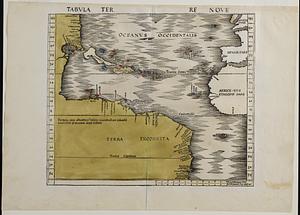
153.
Tabula terre nove
154.
Terra de Lavoratore
155.
Theatro del mondo di Abrahamo Ortelio : da lui poco inanzi la sua morte riueduto, & di tauole nuoue, et commenti adorno, &...
156.
Typus orbis terrarum
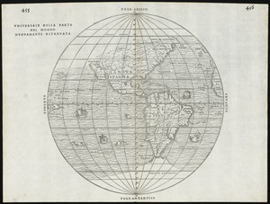
157.
Universale della parte del mondo nuovamente ritrovata
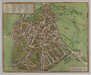
158.
Vicenza
159.
Virginia et Nova Francia
160.
The world
« Previous
Next »
1
2
…
4
5
6
7
8
9
Limit your search
Subject
World maps--Early works to 1800
76
New England--Maps--Early works to 1800
15
America--Maps--Early works to 1800
11
Massachusetts--Maps
8
North America--Maps--Early works to 1800
8
Western Hemisphere--Maps--Early works to 1800
8
Connecticut--Maps--Early works to 1800
5
Cook, James, 1728-1779
5
more
Subject
»
Place
World
69
North and Central America
50
United States
37
New England
21
Massachusetts
17
Rhode Island
8
New York
7
North America
7
more
Place
»
Format
Maps/Atlases
163
Manuscripts
2
Books
1
Available to use
No known restrictions
45
Creative Commons license
19
Date
View distribution
Current results range from
1478
to
1990
Date range begin
Date range end
View larger »
Collection
Sidney R. Knafel Map Collection at Phillips Academy
99
Norman B. Leventhal Map & Education Center Collection
64
American Revolutionary War-Era Maps (Collection of Distinction)
29
Mapping Boston Collection
19
Institution
Phillips Academy
99
Boston Public Library
45
Private Collection
19

![Praeclara Ferna[n]di Cortesii de Noua maris Oceani Hyspania Narratio . . .](https://bpldcassets.blob.core.windows.net/derivatives/images/commonwealth:zk51wc44m/image_thumbnail_300.jpg)