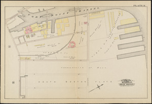
21. Atlas of the city of Boston : South & East Boston : plate G Creator: G.W. Bromley & Co. Format: Maps/Atlases Collection: Boston and New England Maps (Collection of Distinction) / Norman B. Leventhal Map & Education Center Collection / Urban Maps (Collection of Distinction) Date: 1884 Institution: Boston Public Library
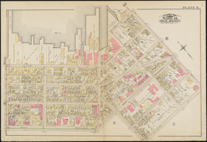
22. Atlas of the city of Boston : South & East Boston : plate A Creator: G.W. Bromley & Co. Format: Maps/Atlases Collection: Boston and New England Maps (Collection of Distinction) / Norman B. Leventhal Map & Education Center Collection / Urban Maps (Collection of Distinction) Date: 1884 Institution: Boston Public Library
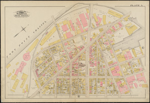
23. Atlas of the city of Boston : South & East Boston : plate K Creator: G.W. Bromley & Co. Format: Maps/Atlases Collection: Boston and New England Maps (Collection of Distinction) / Norman B. Leventhal Map & Education Center Collection / Urban Maps (Collection of Distinction) Date: 1884 Institution: Boston Public Library
24. Insurance map of Boston : volume 2 Creator: Sanborn, D. A. (Daniel Alfred), -1883 Format: Maps/Atlases Collection: Boston and New England Maps (Collection of Distinction) / Norman B. Leventhal Map & Education Center Collection / Urban Maps (Collection of Distinction) Date: 1870 Institution: Boston Public Library
25. Insurance map of Boston : volume 2 Creator: Sanborn, D. A. (Daniel Alfred), -1883 Format: Maps/Atlases Collection: Boston and New England Maps (Collection of Distinction) / Norman B. Leventhal Map & Education Center Collection / Urban Maps (Collection of Distinction) Date: 1868 Institution: Boston Public Library
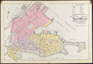
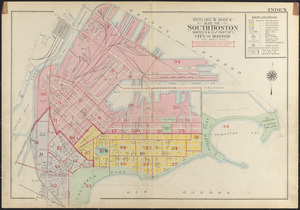
26. Outline & index map of South Boston, wards 13, 14, & 15, and part of 16, city of Boston Creator: Bromley, George Washington; Bromley, Walter Scott Format: Maps/Atlases Collection: Boston and New England Maps (Collection of Distinction) / Norman B. Leventhal Map & Education Center Collection / Urban Maps (Collection of Distinction) Date: 1899 Institution: Boston Public Library
27. Outline & index map of South Boston, wards 13, 14, & 15, and part of 16, city of Boston Creator: Bromley, George Washington; Bromley, Walter Scott Format: Maps/Atlases Collection: Boston and New England Maps (Collection of Distinction) / Norman B. Leventhal Map & Education Center Collection / Urban Maps (Collection of Distinction) Date: 1910 Institution: Boston Public Library
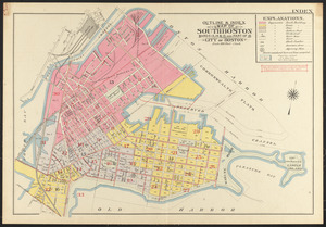
28. Outline & index map of South Boston, wards 9 & 10 and part of 11, city of Boston Creator: Bromley, George Washington; Bromley, Walter Scott Format: Maps/Atlases Collection: Boston and New England Maps (Collection of Distinction) / Norman B. Leventhal Map & Education Center Collection / Urban Maps (Collection of Distinction) Date: 1919 Institution: Boston Public Library
29. Plan for the occupation of flats owned by the Commonwealth in Boston Harbor Format: Maps/Atlases Collection: Boston and New England Maps (Collection of Distinction) / Norman B. Leventhal Map & Education Center Collection Date: 1868 Institution: Boston Public Library
30. Plan of two lots of valuable land in Washington Village, South Boston : to be sold at Public Auction, on Wednesday April 22d 1857, at 4 o'clock p.m. on the premises Creator: Boston (Mass.). Engineering Dept Format: Maps/Atlases Collection: Boston and New England Maps (Collection of Distinction) / Norman B. Leventhal Map & Education Center Collection / Urban Maps (Collection of Distinction) Date: [1857] Institution: Boston Public Library
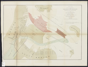
31. Plan showing approximate location of Eastern Avenue : Sept. 18th 1861 Creator: Boston (Mass.). Engineering Dept Format: Maps/Atlases Collection: Norman B. Leventhal Map & Education Center Collection Date: 1861 Institution: Boston Public Library
32. Boston Harbor Creator: Walker Lith. and Publishing Co Format: Maps/Atlases Collection: Historic Maps Institution: Salem State University Archives and Special Collections
33. [Chart of Boston Harbor and the surrounding areas] Creator: Des Barres, Joseph F. W. (Joseph Frederick Wallet), 1722-1824 Format: Maps/Atlases Collection: American Antiquarian Society Collection / American Revolutionary War-Era Maps (Collection of Distinction) Date: 1775 Institution: American Antiquarian Society
34. Map to accompany report of State Board on Docks and Terminal Facilities : showing existing conditions and proposed changes at the Port of Boston Creator: Geo. H. Walker & Co.; Massachusetts. State Board on Docks and Terminal Facilities Format: Maps/Atlases Collection: Boston and New England Maps (Collection of Distinction) / Mapping Boston Collection / Norman B. Leventhal Map & Education Center Collection / Urban Maps (Collection of Distinction) Date: 1896 Institution: Boston Public Library
35. Plan no. 2 for the occupation of the flats owned by the Commonwealth in Boston harbor: and for connecting the same with the city of Boston Creator: Meisel, Augustus, 1824-1885.; Massachusetts. Board of Harbor Commissioners Format: Maps/Atlases Collection: Massachusetts Board of Harbor and Land Commissioners Date: December 12, 1867 Institution: State Library of Massachusetts
36. Plan of Boston Creator: Mitchell, S. Augustus (Samuel Augustus), 1792-1868 Format: Maps/Atlases Collection: Boston and New England Maps (Collection of Distinction) / Mapping Boston Collection / Norman B. Leventhal Map & Education Center Collection / Urban Maps (Collection of Distinction) Date: 1882 Institution: Boston Public Library
37. Plan of Boston Creator: Mitchell, S. Augustus (Samuel Augustus), 1792-1868 Format: Maps/Atlases Collection: Boston and New England Maps (Collection of Distinction) / Mapping Boston Collection / Norman B. Leventhal Map & Education Center Collection / Urban Maps (Collection of Distinction) Date: 1860 Institution: Boston Public Library
38. Port facilities at Boston, MA Creator: United States. Board of Engineers for Rivers and Harbors Format: Maps/Atlases Collection: Boston Redevelopment Authority Collection / Boston and New England Maps (Collection of Distinction) / Urban Maps (Collection of Distinction) Date: 1976 Institution: Boston Public Library
39. Plan for the occupation of flats owned by the Commonwealth in Boston Harbor Creator: Board of Harbor and Land Commissioners of Massachusetts Format: Maps/Atlases Collection: Boston and New England Maps (Collection of Distinction) / Mapping Boston Collection / Norman B. Leventhal Map & Education Center Collection / Urban Maps (Collection of Distinction) Date: 1868 Institution: Boston Public Library
40. Boston Bay and Harbor Creator: Boston (Mass.). Parks and Recreation Dept Format: Maps/Atlases Collection: Boston and New England Maps (Collection of Distinction) / Norman B. Leventhal Map & Education Center Collection Date: [1888] Institution: Boston Public Library


![[Chart of Boston Harbor and the surrounding areas]](https://bpldcassets.blob.core.windows.net/derivatives/images/commonwealth:6108vs71d/image_thumbnail_300.jpg)