Skip to search
Skip to main content
Skip to first result
Digital Commonwealth
Folders
Sign Up / Log In
Search for
Search
Search
Search
Basic
Advanced
Explore
Map
Collections
Institutions
Formats
For Educators
Primary Source Sets
Lesson Plans
Using Primary Sources
Searching Digital Commonwealth
For Institutions
Join Digital Commonwealth
Conferences, Trainings, & Events
How to Contribute Collections
Digitization Services
Board & Committees
Frequently Asked Questions
About
About Digital Commonwealth
News & Announcements
Copyright & Terms of Use
Harmful Content Statement
Partners
API
Contact Us
Search
Search Constraints
Start Over
Save Search
Your search:
More Like
commonwealth:nc583b25g
✖
Remove constraint More Like: commonwealth:nc583b25g
« Prev.
|
41
-
60
of
172
|
Next »
Sort
by relevance
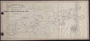
relevance
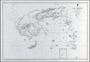
title
date (asc)
date (desc)
recently added
Number of results to display per page
20
per page
per page
10
per page
20
per page
50
per page
100
per page
View results as:
List
list view
Maps
map view
Gallery
grid view
Search Results
41.
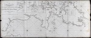
Coast of France
42.
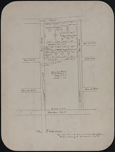
The Common
43.
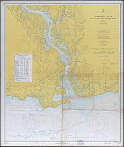
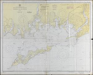
Connecticut River, Long Island Sound to Deep River
44.
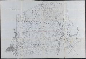
County Map, MA and RI
45.
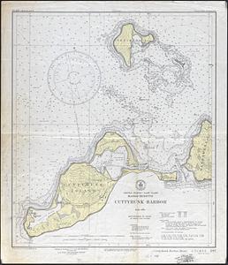
Cuttyhunk Harbor
46.
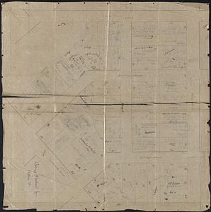
Dartmouth Surveys
47.
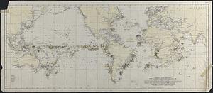
Distribution of Bowhead and Humpback Whales based on logbook records - mostly nineteenth century
48.
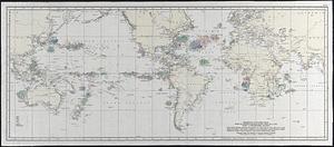
Distribution of Northern and Southern Right Whales based on logbook records dating from 1785 to 1913
49.
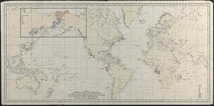
Distribution of the Sperm Whale based on Logbook Records dating from 1761-1920 : Chart A, April-September, inclusive
50.
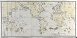
Distribution of the Sperm Whale based on Logbook Records dating from 1761-1920 : Chart B, October-March, inclusive
51.
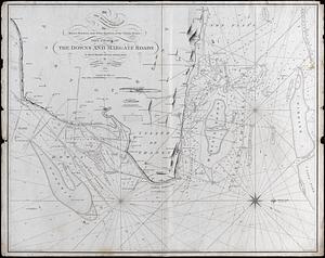
The Downs and Margate Roads
52.
Downtown New Bedford
53.
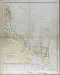
Edgartown Harbor
54.
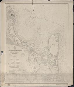
Edgartown Harbor, Martha's Vineyard
55.
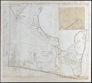
Edgartown, Shire Town of Dukes County
56.
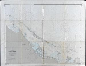
Elizabeth Harbor and Approaches
57.
Elizabeth Islands Vineyard Sound, the property of James Temple-Bowdoin Esq. 1836
58.
Fiji Island
59.
Fishers Island Sound
60.
George Howland - Allen St.
« Previous
Next »
1
2
3
4
5
6
7
8
9
Limit your search
Subject
Landowners
32
Military topography
10
Election districts
9
Railroads
9
Whales
8
Whaling
8
1700–1799
7
Population--Maps
4
more
Subject
»
Place
North and Central America
127
United States
121
Massachusetts
97
Bristol (county)
67
New Bedford
48
Dartmouth
23
Europe
18
Pacific Ocean
10
more
Place
»
Format
Maps/Atlases
170
Manuscripts
57
Prints
1
Available to use
Creative Commons license
172
Date
View distribution
Current results range from
1695
to
1985
Date range begin
Date range end
View larger »
Collection
Map and Chart Collection
172
Institution
New Bedford Free Public Library
172