1. Atlas of the towns of Topsfield, Ipswich, Essex, Hamilton and Wenham, Essex County, Massachusetts : from official plans and actual surveys Creator: Walker Lith. & Pub. Co. Format: Maps/Atlases; Books Collection: Boston and New England Maps (Collection of Distinction) / Norman B. Leventhal Map & Education Center Collection / Urban Maps (Collection of Distinction) Date: 1910 Institution: Boston Public Library
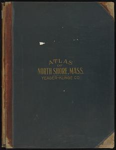
2. Atlas of the North Shore, Beverly to Magnolia, Essex Co., Massachusetts Creator: Yeager-Klinge Co. Format: Maps/Atlases Collection: Massachusetts Real Estate Atlases Date: 1919 Institution: State Library of Massachusetts
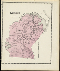
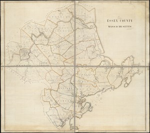
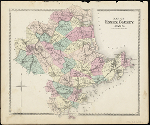
3. Atlas of Essex County, Massachusetts Creator: Geo. H. Walker & Co. Format: Maps/Atlases; Books Collection: Boston and New England Maps (Collection of Distinction) / Norman B. Leventhal Map & Education Center Collection / Urban Maps (Collection of Distinction) Date: 1884 Institution: Boston Public Library
4. Atlas of Cape Ann, Gloucester, Rockport and Manchester, Essex County, Mass. : from official plans and actual surveys Creator: Geo. W. Stadly & Co. Format: Maps/Atlases; Books Collection: Boston and New England Maps (Collection of Distinction) / Norman B. Leventhal Map & Education Center Collection / Urban Maps (Collection of Distinction) Date: 1899 Institution: Boston Public Library
5. Atlas of Essex County, Massachusetts : from actual surveys and official records Creator: D.G. Beers & Co.; Worley & Bracher Format: Maps/Atlases; Books Collection: Boston and New England Maps (Collection of Distinction) / Norman B. Leventhal Map & Education Center Collection / Urban Maps (Collection of Distinction) Date: 1872 Institution: Boston Public Library
6. Atlas of the North Shore : Beverly to Magnolia, Essex Co. Mass. : from official plans and records and actual surveys Creator: Yeager-Klinge Co. Format: Maps/Atlases; Books Collection: Boston and New England Maps (Collection of Distinction) / Norman B. Leventhal Map & Education Center Collection / Urban Maps (Collection of Distinction) Date: 1919 Institution: Boston Public Library
7. Land use shading test plot shadeset PI and lu21-pi.lut Creator: MassGIS (Office : Mass.); Massachusetts. Executive Office of Environmental Affairs Format: Maps/Atlases Collection: Boston and New England Maps (Collection of Distinction) / David Judkins Weaver Papers / Norman B. Leventhal Map & Education Center Collection Date: 1990 Institution: Boston Public Library
8. Atlas of Massachusetts Creator: Walker, O. W. (Oscar W.); Geo. H. Walker & Co. Format: Maps/Atlases Collection: Massachusetts Real Estate Atlases Date: 1891 Institution: State Library of Massachusetts
9. Essex Creator: D.G. Beers & Co Format: Maps/Atlases Collection: Historic Maps Date: 1872 Institution: Salem State University Archives and Special Collections
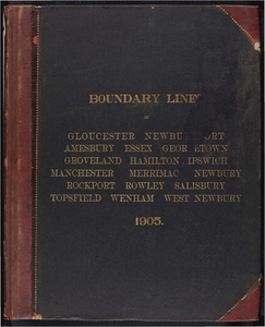
10. Atlas of the boundaries of the cities of Gloucester and Newburyport and towns of Amesbury, Essex, Georgetown, Groveland, Hamilton, Ipswich, Manchester, Merrimac,... Creator: Board of Harbor and Land Commissioners of Massachusetts Format: Maps/Atlases Collection: Massachusetts Board of Harbor and Land Commissioners Date: 1905 Institution: State Library of Massachusetts
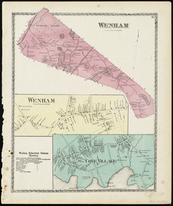
11. Wenham Creator: D.G. Beers & Co Format: Maps/Atlases Collection: Historic Maps Date: 1872 Institution: Salem State University Archives and Special Collections
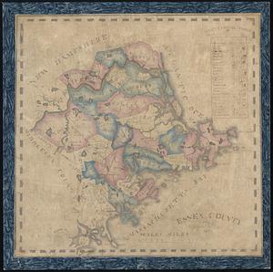
12. The County of Essex from actual survey Creator: Hales, John Groves Format: Maps/Atlases Collection: Boston and New England Maps (Collection of Distinction) / Norman B. Leventhal Map & Education Center Collection Date: [1825] Institution: Boston Public Library
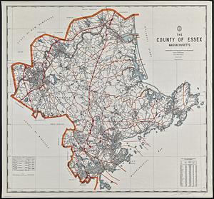
13. The county of Essex, Massachusetts Creator: Essex County (Mass.). Engineering Department, Gelotti, F. Richard, and Dupont, J. L. Format: Maps/Atlases Collection: Boston and New England Maps (Collection of Distinction) / David Judkins Weaver Papers / Norman B. Leventhal Map & Education Center Collection Date: 1982 Institution: Boston Public Library
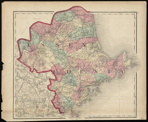
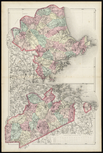
14. Essex County Creator: Walling & Gray Format: Maps/Atlases Collection: Historic Maps Date: 1871 Institution: Salem State University Archives and Special Collections
15. Essex County Format: Maps/Atlases Collection: Boston and New England Maps (Collection of Distinction) / Norman B. Leventhal Map & Education Center Collection Date: 1832 Institution: Boston Public Library
16. Essex County, Massachusetts Format: Maps/Atlases; Manuscripts Collection: Norman B. Leventhal Map & Education Center Collection Date: [1870?] Institution: Boston Public Library
17. Essex County; Norfolk County Creator: Henry Francis Walling & Ormando Willis Gray Format: Maps/Atlases Collection: Historic Maps Date: 1880 Institution: Salem State University Archives and Special Collections
18. Geological map of Essex County, Massachusetts Creator: Sears, John Henry. Format: Maps/Atlases Collection: Boston and New England Maps (Collection of Distinction) / Norman B. Leventhal Map & Education Center Collection Date: 1893 Institution: Boston Public Library
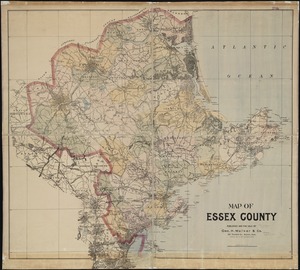
19. Map of Essex County Creator: Geo. H. Walker & Co Format: Maps/Atlases Collection: Boston and New England Maps (Collection of Distinction) / Norman B. Leventhal Map & Education Center Collection Date: 1891 Institution: Boston Public Library
20. Map of Essex County Mass. Creator: D.G. Beers & Co Format: Maps/Atlases Collection: Historic Maps Date: 1872 Institution: Salem State University Archives and Special Collections