Search
Search Results
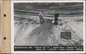
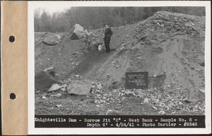
- Creator:
- Massachusetts. Metropolitan District Water Supply Commission; Barbier, Ernest E., 1912-2007
- Format:
- Photographs
- Collection:
- Massachusetts Metropolitan District Water Supply Commission, Quabbin Reservoir, Photographs of Real Estate in the Swift River Valley, and of General Engineering of Quabbin Reservoir, 1927-1950
- Date:
- April 24, 1941
- Institution:
- Massachusetts Archives
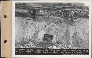
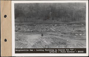
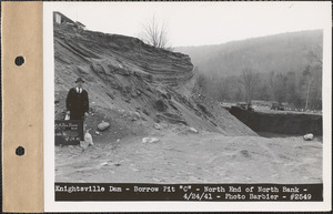
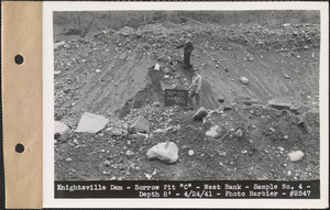
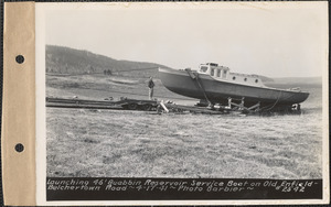
- Creator:
- Massachusetts. Metropolitan District Water Supply Commission; Barbier, Ernest E., 1912-2007
- Format:
- Photographs
- Collection:
- Massachusetts Metropolitan District Water Supply Commission, Quabbin Reservoir, Photographs of Real Estate in the Swift River Valley, and of General Engineering of Quabbin Reservoir, 1927-1950
- Date:
- April 17, 1941
- Institution:
- Massachusetts Archives
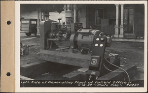
- Creator:
- Massachusetts. Metropolitan District Water Supply Commission; Pike, Stuart D., 1910-1978
- Format:
- Photographs
- Collection:
- Massachusetts Metropolitan District Water Supply Commission, Quabbin Reservoir, Photographs of Real Estate in the Swift River Valley, and of General Engineering of Quabbin Reservoir, 1927-1950
- Date:
- November 16, 1939
- Institution:
- Massachusetts Archives
- Creator:
- Massachusetts. Metropolitan District Commission. Water Division
- Format:
- Photographs
- Collection:
- Massachusetts Metropolitan District Water Supply Commission, Quabbin Reservoir, Photographs of Real Estate in the Swift River Valley, and of General Engineering of Quabbin Reservoir, 1927-1950
- Date:
- [ca. 1948]
- Institution:
- Massachusetts Archives
- Creator:
- Massachusetts. Metropolitan District Water Supply Commission; Pike, Stuart D., 1910-1978
- Format:
- Photographs
- Collection:
- Massachusetts Metropolitan District Water Supply Commission, Quabbin Reservoir, Photographs of Real Estate in the Swift River Valley, and of General Engineering of Quabbin Reservoir, 1927-1950
- Date:
- April 15, 1940
- Institution:
- Massachusetts Archives
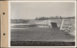
- Creator:
- Massachusetts. Metropolitan District Water Supply Commission; Pike, Stuart D., 1910-1978
- Format:
- Photographs
- Collection:
- Massachusetts Metropolitan District Water Supply Commission, Quabbin Reservoir, Photographs of Real Estate in the Swift River Valley, and of General Engineering of Quabbin Reservoir, 1927-1950
- Date:
- May 7, 1940
- Institution:
- Massachusetts Archives
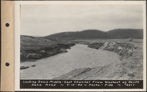
- Creator:
- Massachusetts. Metropolitan District Water Supply Commission; Pike, Stuart D., 1910-1978
- Format:
- Photographs
- Collection:
- Massachusetts Metropolitan District Water Supply Commission, Quabbin Reservoir, Photographs of Real Estate in the Swift River Valley, and of General Engineering of Quabbin Reservoir, 1927-1950
- Date:
- April 5, 1940
- Institution:
- Massachusetts Archives
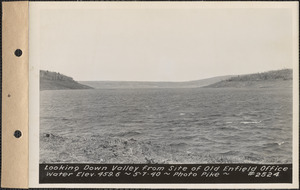
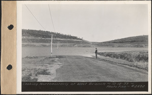
- Creator:
- Massachusetts. Metropolitan District Water Supply Commission; Pike, Stuart D., 1910-1978
- Format:
- Photographs
- Collection:
- Massachusetts Metropolitan District Water Supply Commission, Quabbin Reservoir, Photographs of Real Estate in the Swift River Valley, and of General Engineering of Quabbin Reservoir, 1927-1950
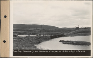
- Date:
- November 3, 1939
- Institution:
- Massachusetts Archives
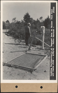
- Creator:
- Massachusetts. Metropolitan District Water Supply Commission; Barbier, Ernest E., 1912-2007
- Format:
- Photographs
- Collection:
- Massachusetts Metropolitan District Water Supply Commission, Quabbin Reservoir, Photographs of Real Estate, Sanitary Conditions, and Flooding in the Ware River Watershed, and of General Engineering, 1928-1948
- Date:
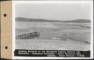
- September 10, 1941
- Institution:
- Massachusetts Archives
- Creator:
- Massachusetts. Metropolitan District Water Supply Commission; Pike, Stuart D., 1910-1978
- Format:
- Photographs
- Collection:
- Massachusetts Metropolitan District Water Supply Commission, Quabbin Reservoir, Photographs of Real Estate in the Swift River Valley, and of General Engineering of Quabbin Reservoir, 1927-1950
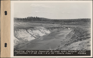
- Date:
- April 2, 1940
- Institution:
- Massachusetts Archives
- Creator:
- Massachusetts. Metropolitan District Water Supply Commission; Pike, Stuart D., 1910-1978
- Format:
- Photographs
- Collection:
- Massachusetts Metropolitan District Water Supply Commission, Quabbin Reservoir, Photographs of Real Estate in the Swift River Valley, and of General Engineering of Quabbin Reservoir, 1927-1950
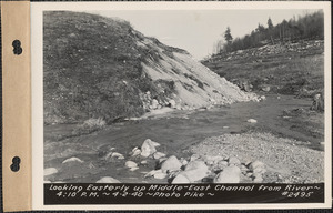
- Date:
- April 2, 1940
- Institution:
- Massachusetts Archives
- Creator:
- Massachusetts. Metropolitan District Water Supply Commission; Barbier, Ernest E., 1912-2007
- Format:
- Photographs
- Collection:
- Massachusetts Metropolitan District Water Supply Commission, Quabbin Reservoir, Photographs of Real Estate in the Swift River Valley, and of General Engineering of Quabbin Reservoir, 1927-1950
- Date:
- September 22, 1941
- Institution:
- Massachusetts Archives
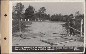
- Creator:
- Massachusetts. Metropolitan District Water Supply Commission; Barbier, Ernest E., 1912-2007
- Format:
- Photographs
- Collection:
- Massachusetts Metropolitan District Water Supply Commission, Quabbin Reservoir, Photographs of Real Estate, Sanitary Conditions, and Flooding in the Ware River Watershed, and of General Engineering, 1928-1948
- Date:
- September 10, 1941
- Institution:
- Massachusetts Archives
- Creator:
- Massachusetts. Metropolitan District Water Supply Commission; Pike, Stuart D., 1910-1978
- Format:
- Photographs
- Collection:
- Massachusetts Metropolitan District Water Supply Commission, Quabbin Reservoir, Photographs of Real Estate in the Swift River Valley, and of General Engineering of Quabbin Reservoir, 1927-1950
- Date:
- October 18, 1939
- Institution:
- Massachusetts Archives
- Creator:
- Massachusetts. Metropolitan District Water Supply Commission; Barbier, Ernest E., 1912-2007
- Format:
- Photographs
- Collection:
- Massachusetts Metropolitan District Water Supply Commission, Quabbin Reservoir, Photographs of Real Estate in the Swift River Valley, and of General Engineering of Quabbin Reservoir, 1927-1950
- Date:
- September 22, 1941
- Institution:
- Massachusetts Archives