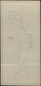
21. Harvard Forest Slab City - 1944 Creator: Spurr, Stephen H., 1918-1990 Format: Maps/Atlases Collection: The Harvard Forest Map Collection Date: 1944 Institution: Harvard Forest Archives
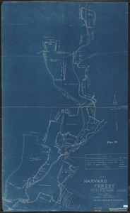
22. Harvard Forest Slab City 1908 Creator: Caswell, Lilley Brewer, 1848-; Cary, Austin, 1865-1936 Format: Maps/Atlases Collection: The Harvard Forest Map Collection Date: April 1, 1908 Institution: Harvard Forest Archives
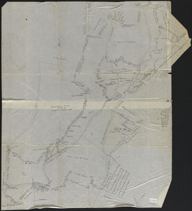
23. Harvard Forest Slab City 1911 Creator: Smith, R. C. Format: Maps/Atlases Collection: The Harvard Forest Map Collection Date: 1911 Institution: Harvard Forest Archives
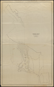
24. Harvard Forest Tom Swamp Block Format: Maps/Atlases Collection: The Harvard Forest Map Collection Date: 1907–1937 Institution: Harvard Forest Archives
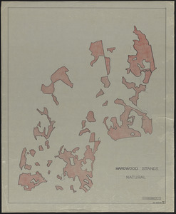
25. Harvard Stands Natural Forest Prospect Hill -overlays Format: Maps/Atlases Collection: The Harvard Forest Map Collection Date: November 1955 Institution: Harvard Forest Archives
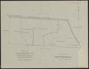
26. Higginson Lot 1937 Stand map Creator: Rowlands, W. Format: Maps/Atlases Collection: The Harvard Forest Map Collection Date: 1937 Institution: Harvard Forest Archives
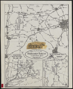
27. How to find the Harvard Forest Creator: Raisz, Erwin, 1893-1968 Format: Maps/Atlases Collection: The Harvard Forest Map Collection Date: 1931–1968 Institution: Harvard Forest Archives
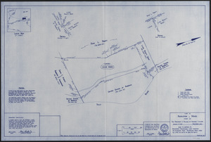
28. Land in Royalston MASS Owned by The President Fellows of Harvard College Plan No 127 Creator: Lanpher, G. D. , Jr. Format: Maps/Atlases Collection: The Harvard Forest Map Collection Date: April 2000 Institution: Harvard Forest Archives
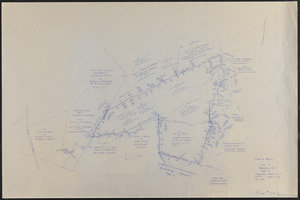
29. Land in Royalston Mass Owned by The President Fellows of Harvard College Plan No 140 Creator: Lanpher, G. D. , Jr. Format: Maps/Atlases Collection: The Harvard Forest Map Collection Date: December 2001 Institution: Harvard Forest Archives
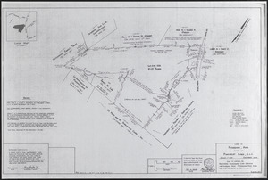
30. Land owned by Pinecrest Acres L.L.C. (Edward Gould Woodlot) Creator: Lanpher, G. D. , Jr. Format: Maps/Atlases Collection: The Harvard Forest Map Collection Date: 2006 Institution: Harvard Forest Archives
31. Land owned by Pinecrest Acres L.L.C. (Edward Gould Woodlot) Final Survey Creator: Lanpher, G. D. , Jr. Format: Maps/Atlases Collection: The Harvard Forest Map Collection Date: December 6, 2006 Institution: Harvard Forest Archives
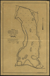
32. Map of Harvard Pond Creator: Rowlands, W. Format: Maps/Atlases Collection: The Harvard Forest Map Collection Date: November 1938 Institution: Harvard Forest Archives
33. Map of the Schwarz Lot Creator: Averill, C. C., Scholz, H.F., and Frost, L.M. Format: Maps/Atlases Collection: The Harvard Forest Map Collection Date: [1930?–1939?] Institution: Harvard Forest Archives
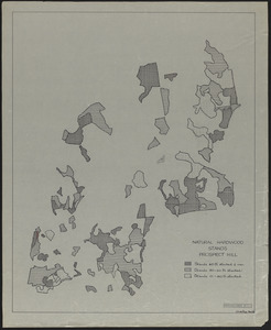
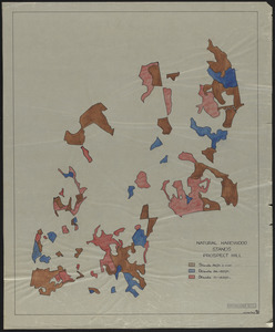
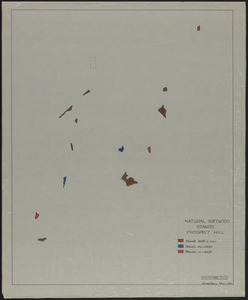
34. Natural Hardwood Stands Prospect Hill - overlay Format: Maps/Atlases Collection: The Harvard Forest Map Collection Date: November 1955 Institution: Harvard Forest Archives
35. Natural Hardwood Stands Prospect Hill - overlay Format: Maps/Atlases Collection: The Harvard Forest Map Collection Date: November 1955 Institution: Harvard Forest Archives
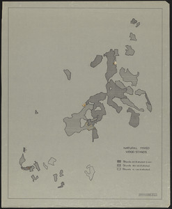
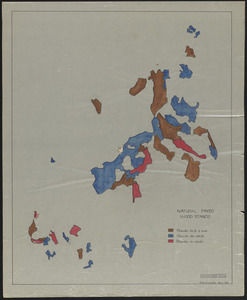
36. Natural Mixed Wood Stands - overlay Format: Maps/Atlases Collection: The Harvard Forest Map Collection Date: November 1955 Institution: Harvard Forest Archives
37. Natural Mixed Wood Stands - overlay Format: Maps/Atlases Collection: The Harvard Forest Map Collection Date: November 1955 Institution: Harvard Forest Archives
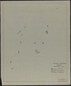
38. Natural Softwood Stands Prospect Hill - overlay Format: Maps/Atlases Collection: The Harvard Forest Map Collection Date: November 1955 Institution: Harvard Forest Archives
39. Natural Softwood Stands Prospect Hill - overlay Format: Maps/Atlases Collection: The Harvard Forest Map Collection Date: November 1955 Institution: Harvard Forest Archives
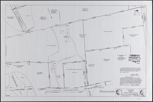
40. Onesime E. and Charlotte E. Nault Land Creator: Berry, W. L. Format: Maps/Atlases Collection: The Harvard Forest Map Collection Date: September 17, 1974 Institution: Harvard Forest Archives