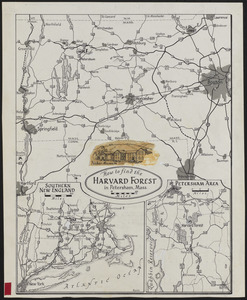
81. How to find the Harvard Forest Creator: Raisz, Erwin, 1893-1968 Format: Maps/Atlases Collection: The Harvard Forest Map Collection Date: 1931–1968 Institution: Harvard Forest Archives
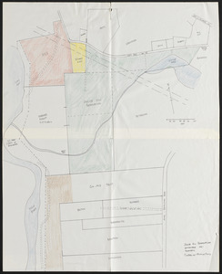
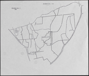
82. Jacob Hill Reservation Format: Maps/Atlases Collection: The Harvard Forest Map Collection Date: September 1981 Institution: Harvard Forest Archives
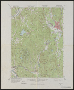
83. Keene Quadrangle Topographic Maps Creator: Geological Survey (U.S.) Format: Maps/Atlases Collection: The Harvard Forest Map Collection Date: 1958 Institution: Harvard Forest Archives
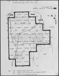
84. Key Sheet for White Pine Blister Control Study Format: Maps/Atlases Collection: The Harvard Forest Map Collection Date: 1938 Institution: Harvard Forest Archives
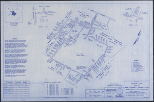
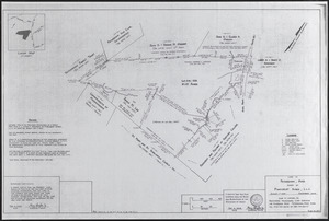
85. Land in Petersham Ma Owned by Bruce S. Lockhart and Stephen G. Block Creator: Lanpher, G. D. Format: Maps/Atlases Collection: The Harvard Forest Map Collection Date: January 2014 Institution: Harvard Forest Archives
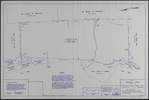
86. Land in Royalston MASS Owned by The President Fellows of Harvard College Plan No 127 Creator: Lanpher, G. D. , Jr. Format: Maps/Atlases Collection: The Harvard Forest Map Collection Date: April 2000 Institution: Harvard Forest Archives
87. Land in Royalston Mass Owned by The President Fellows of Harvard College Plan No 140 Creator: Lanpher, G. D. , Jr. Format: Maps/Atlases Collection: The Harvard Forest Map Collection Date: December 2001 Institution: Harvard Forest Archives
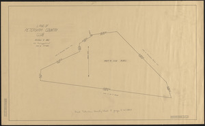
88. Land of Petersham Country Club Creator: Tarbox, E. E. Format: Maps/Atlases Collection: The Harvard Forest Map Collection Date: October 9, 1922 Institution: Harvard Forest Archives
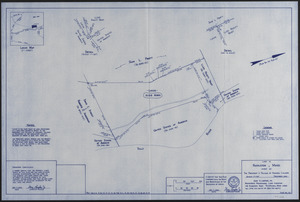
89. Land owned by Pinecrest Acres L.L.C. (Edward Gould Woodlot) Creator: Lanpher, G. D. , Jr. Format: Maps/Atlases Collection: The Harvard Forest Map Collection Date: 2006 Institution: Harvard Forest Archives
90. Land owned by Pinecrest Acres L.L.C. (Edward Gould Woodlot) Final Survey Creator: Lanpher, G. D. , Jr. Format: Maps/Atlases Collection: The Harvard Forest Map Collection Date: December 6, 2006 Institution: Harvard Forest Archives
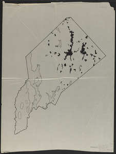
91. Land Use Maps of Petersham, Showing Wooded and Open Areas - 1830 Creator: Lyford, Walter Henry, 1909- Format: Maps/Atlases Collection: The Harvard Forest Map Collection Date: October 9, 1965 Institution: Harvard Forest Archives
92. Land Use Maps of Petersham, Showing Wooded and Open Areas 1938 Creator: Lyford, Walter Henry, 1909- Format: Maps/Atlases Collection: The Harvard Forest Map Collection Date: October 9, 1965 Institution: Harvard Forest Archives
93. Land Use Maps of Petersham, Showing Wooded and Open Areas 1965 Creator: Lyford, Walter Henry, 1909- Format: Maps/Atlases Collection: The Harvard Forest Map Collection Date: October 9, 1965 Institution: Harvard Forest Archives
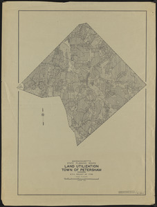
94. Land Utilization Town of Petersham Creator: Massachusetts. State Planning Board Format: Maps/Atlases Collection: The Harvard Forest Map Collection Date: January 1938 Institution: Harvard Forest Archives
95. Location of Gast's White Pine Collections, Petersham Creator: Rowlands, W. Format: Maps/Atlases Collection: The Harvard Forest Map Collection Date: 1938 Institution: Harvard Forest Archives
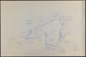
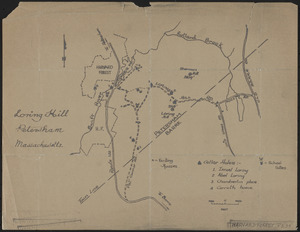
96. Loring Hill Format: Maps/Atlases Collection: The Harvard Forest Map Collection Date: 1907–2014 Institution: Harvard Forest Archives
97. Lyford Grid Map with Points Creator: Lyford, Walter Henry, 1909- Format: Maps/Atlases Collection: The Harvard Forest Map Collection Date: 1969 Institution: Harvard Forest Archives
98. Lyford Grid overlayed onto 1947 Prospect Hill I and VII map Creator: Lyford, Walter Henry, 1909- Format: Maps/Atlases Collection: The Harvard Forest Map Collection Date: 1969 Institution: Harvard Forest Archives
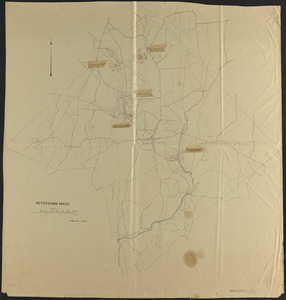
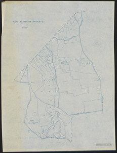
99. Map 1 Petersham Properties Creator: Harvard Forest (Research facility) Format: Maps/Atlases Collection: The Harvard Forest Map Collection Date: 1947 Institution: Harvard Forest Archives
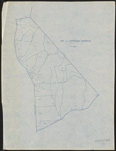
100. Map 2 Petersham Properties Creator: Harvard Forest (Research facility) Format: Maps/Atlases Collection: The Harvard Forest Map Collection Date: 1947 Institution: Harvard Forest Archives