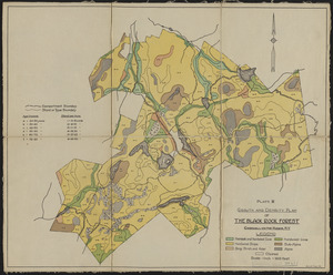
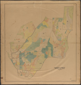
1. Growth and Density Plan of the Black Rock Forest Creator: Tryon, H. H. Format: Maps/Atlases Collection: The Harvard Forest Map Collection Date: 1930 Institution: Harvard Forest Archives
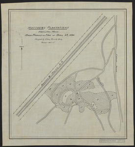
2. Nathan Matthews Plantations Area Burned in Fire April 29, 1930 Creator: Cline, A. C.; Borg, R. M. Format: Maps/Atlases Collection: The Harvard Forest Map Collection Date: 1930 Institution: Harvard Forest Archives
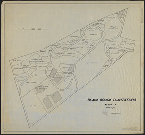
3. Nathan Matthews Plantations Block A - Locations of Experimental Plots Format: Maps/Atlases Collection: The Harvard Forest Map Collection Date: [1930?] Institution: Harvard Forest Archives
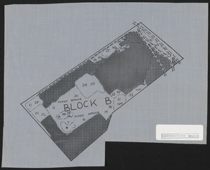
4. Nathan Matthews Plantations Block B Creator: Foster, D. R. Format: Maps/Atlases Collection: The Harvard Forest Map Collection Date: 1984 Institution: Harvard Forest Archives
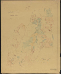
5. Prospect Hill 1930 Block Creator: Hosley, N. W. (Neil Wetmore), 1901-, Salls, M. R., and Borg, R. M. Format: Maps/Atlases Collection: The Harvard Forest Map Collection Date: 1930 Institution: Harvard Forest Archives
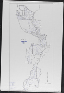
6. Slab City Forest Types 1930 Creator: Hall, J. Format: Maps/Atlases Collection: The Harvard Forest Map Collection Date: 2003 Institution: Harvard Forest Archives
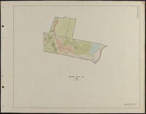
7. Slab City II 1930 Stand Map Creator: Bauer, E. Format: Maps/Atlases Collection: The Harvard Forest Map Collection Date: 1930 Institution: Harvard Forest Archives
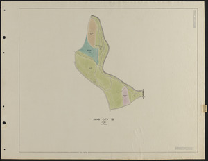
8. Slab City IV 1930 Stand Map Creator: Bauer, E. Format: Maps/Atlases Collection: The Harvard Forest Map Collection Date: 1930 Institution: Harvard Forest Archives
9. Slab City Stand Map - 1930 Creator: Hosley, N. W. (Neil Wetmore), 1901-, Salls, M. R., and Borg, R. M. Format: Maps/Atlases Collection: The Harvard Forest Map Collection Date: 1930 Institution: Harvard Forest Archives
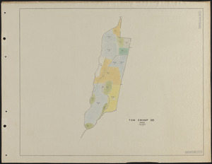
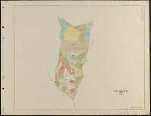
10. Tom Swamp III 1930 stand map Creator: Borg, R. M. Format: Maps/Atlases Collection: The Harvard Forest Map Collection Date: 1930 Institution: Harvard Forest Archives
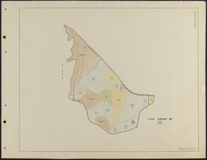
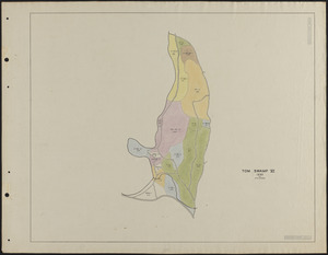
11. Tom Swamp IV 1930 stand map Format: Maps/Atlases Collection: The Harvard Forest Map Collection Date: 1930 Institution: Harvard Forest Archives
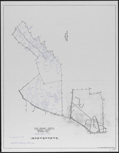
12. Tom Swamp North forest types 1930 Creator: Spurr, Stephen H., 1918-1990, Varnet, M., and Hall, J. Format: Maps/Atlases Collection: The Harvard Forest Map Collection Date: 2003 Institution: Harvard Forest Archives
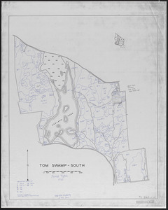
13. Tom Swamp South forest types 1930 Creator: Stephens, E. P.; Hall, J. Format: Maps/Atlases Collection: The Harvard Forest Map Collection Date: 2003 Institution: Harvard Forest Archives
14. Tom Swamp V 1930 stand map Creator: Borg, R. M. Format: Maps/Atlases Collection: The Harvard Forest Map Collection Date: 1930 Institution: Harvard Forest Archives
15. Tom Swamp VI 1930 stand map Creator: Bauer, E. Format: Maps/Atlases Collection: The Harvard Forest Map Collection Date: 1930 Institution: Harvard Forest Archives
16. Zvi Jankelowitz Creator: Yiddish Book Center (Chad) Format: Film/Video Collection: Oral Histories Date: April 11, 2013 Institution: Yiddish Book Center
17. 1956 Cruise of Timber, Prospect Hill Block - 1956 Format: Maps/Atlases Collection: The Harvard Forest Map Collection Date: 1956 Institution: Harvard Forest Archives
18. 3-cut shelterwood. Adams-Fay Lot (TS IX) 1934 Creator: Karnig, Jack J. Format: Maps/Atlases Collection: The Harvard Forest Map Collection Date: December 1934 Institution: Harvard Forest Archives
19. Adams-Fay Lot (TS IX) 1929 stand map Creator: Salls, M. R. Format: Maps/Atlases Collection: The Harvard Forest Map Collection Date: 1929 Institution: Harvard Forest Archives
20. Aerial Photograph of Matthews Plantation Format: Photographs Collection: The Harvard Forest Map Collection Date: June 11, 1971 Institution: Harvard Forest Archives