Skip to search
Skip to main content
Skip to first result
Digital Commonwealth
Folders
Sign Up / Log In
Search for
Search
Search
Search
Basic
Advanced
Explore
Map
Collections
Institutions
Formats
For Educators
Primary Source Sets
Lesson Plans
Using Primary Sources
Searching Digital Commonwealth
For Institutions
Join Digital Commonwealth
Conferences, Trainings, & Events
How to Contribute Collections
Digitization Services
Board & Committees
Frequently Asked Questions
About
About Digital Commonwealth
News & Announcements
Copyright & Terms of Use
Harmful Content Statement
Partners
API
Contact Us
Search
Search Constraints
Start Over
Save Search
Your search:
More Like
commonwealth:qv33t847v
✖
Remove constraint More Like: commonwealth:qv33t847v
« Prev.
|
321
-
340
of
647
|
Next »
Sort
by relevance
relevance
title
date (asc)
date (desc)
recently added
Number of results to display per page
20
per page
per page
10
per page
20
per page
50
per page
100
per page
View results as:
List
list view
Maps
map view
Gallery
grid view
Search Results
321.
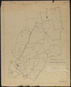
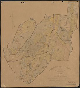
Prospect Hill Location of Sample Plots, Experiment 44-8 and 1956
322.
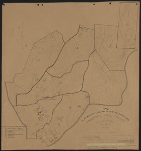
Prospect Hill Map of Cutting Operations - 1916
323.
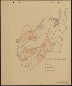
Prospect Hill Plantings - 1942
324.
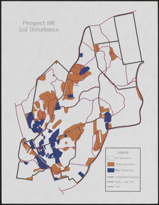
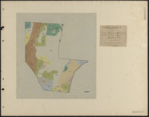
Prospect Hill Soil Disturbance map
325.
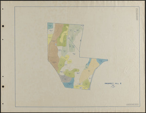
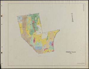
Prospect Hill Soils 1944
326.
Prospect Hill Soils 1951
327.
Prospect Hill Stand and Plantation map - 1919
328.
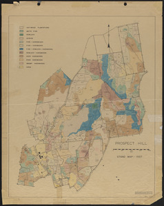
Prospect Hill Stand Map - 1937
329.
Prospect Hill Stand map 1908
330.
Prospect Hill Tract 1910 Topographic map
331.
Prospect Hill Tract Original Proprietors Grants
332.
Prospect Hill Type map - 1913
333.
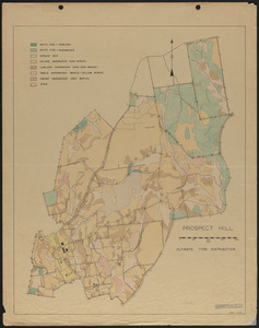
Prospect Hill Ultimate Type Distribution - 1944
334.
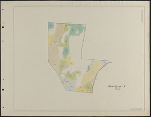
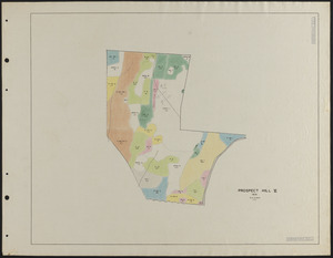
Prospect Hill V - Forest Inventory
335.
Prospect Hill V 1929-30 Stand Map
336.
Prospect Hill V 1931 Stand Map
337.
Prospect Hill V 1935 Stand Map
338.
Prospect Hill V 1937 Stand Map
339.
Prospect Hill V Stand Maps 1925, 1926, 1927
340.
Prospect Hill VI - Forest Inventory
« Previous
Next »
1
2
…
13
14
15
16
17
18
19
20
21
…
32
33
Limit your search
Subject
Boundaries
151
Forest operations
47
1937
44
1938
41
Hurricanes
37
Land use
37
1946
31
Forest Operations
27
more
Subject
»
Place
North and Central America
647
United States
647
Massachusetts
623
Worcester (county)
596
Petersham
587
Tom Swamp
157
Prospect Hill
153
Tom Swamp Tract
97
more
Place
»
Format
Maps/Atlases
646
Manuscripts
4
Photographs
1
Available to use
Creative Commons license
647
Date
View distribution
Current results range from
1755
to
2016
Date range begin
Date range end
View larger »
Collection
The Harvard Forest Map Collection
647
Institution
Harvard University
647