Skip to search
Skip to main content
Skip to first result
Digital Commonwealth
Folders
Sign Up / Log In
Search for
Search
Search
Search
Basic
Advanced
Explore
Map
Collections
Institutions
Formats
For Educators
Primary Source Sets
Lesson Plans
Using Primary Sources
Searching Digital Commonwealth
For Institutions
Join Digital Commonwealth
Conferences, Trainings, & Events
How to Contribute Collections
Digitization Services
Board & Committees
Frequently Asked Questions
About
About Digital Commonwealth
News & Announcements
Copyright & Terms of Use
Harmful Content Statement
Partners
API
Contact Us
Search
Search Constraints
Start Over
Save Search
Your search:
More Like
commonwealth:qv33t9935
✖
Remove constraint More Like: commonwealth:qv33t9935
« Prev.
|
201
-
220
of
647
|
Next »
Sort
by relevance
relevance
title
date (asc)
date (desc)
recently added
Number of results to display per page
20
per page
per page
10
per page
20
per page
50
per page
100
per page
View results as:
List
list view
Maps
map view
Gallery
grid view
Search Results
201.
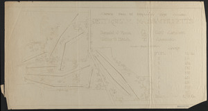
Plan of Land in Petersham - Estate of Georgina P. (Fisher) Howland
202.
Plan of Land in Petersham - owned by Petersham Country Club
203.
Plan of Land in Royalston Mass Owned by The President Fellows of Harvard College Plan No 140
204.
Plan of land of John Lincoln Waldo (TS X)
205.
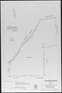
Plan of land owned by Richard Neil Bryant, Petersham, MA
206.
Plan of Land Sold - Tall Timbers
207.
Plan of property line - Simes Tract
208.
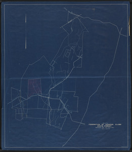
Plan of proposed Federation of Women's Clubs State Forest 1930
209.
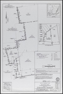
Plan of proposed golf course, Petersham County Club
210.
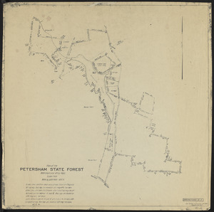
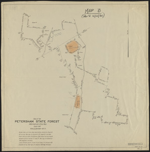
Plan of the Petersham State Forest
211.
Plan of the Petersham State Forest
212.
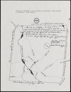
Plan of the town of Petersham, 1795, showing roads, mills, etc.
213.
Plan Showing Property - Tall Timbers
214.
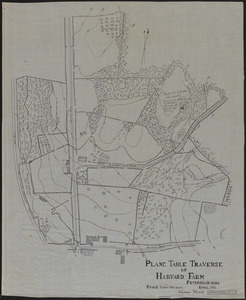
Plane Table Traverse of Harvard Farm 1911
215.
Plantation Maps of Prospect Hill Tract
216.
Plantation Maps of Slab City Tract
217.
Plantation Maps of Tom Swamp Tract
218.
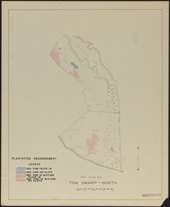
Plantation reassessment, Tom Swamp North 1947
219.
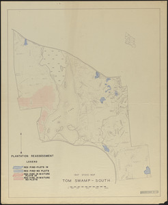
Plantation reassessment, Tom Swamp South 1947
220.
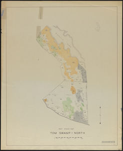
Plantations, open land, swamps and ponds, Tom Swamp North
« Previous
Next »
1
2
…
7
8
9
10
11
12
13
14
15
…
32
33
Limit your search
Subject
Boundaries
151
Forest operations
47
1937
44
1938
41
Hurricanes
37
Land use
37
1946
31
Forest Operations
27
more
Subject
»
Place
North and Central America
647
United States
647
Massachusetts
623
Worcester (county)
596
Petersham
587
Tom Swamp
158
Prospect Hill
153
Tom Swamp Tract
97
more
Place
»
Format
Maps/Atlases
646
Manuscripts
4
Photographs
1
Available to use
Creative Commons license
647
Date
View distribution
Current results range from
1755
to
2016
Date range begin
Date range end
View larger »
Collection
The Harvard Forest Map Collection
647
Institution
Harvard University
647
We'd love your feedback!
×
Would you be interested in taking a short survey about Digital Commonwealth?