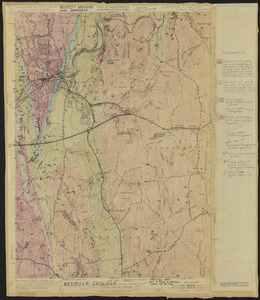
121. Bedrock Geology of the Athol Quadrangle Creator: Geological Survey (U.S.); Eschman, D.F. Format: Maps/Atlases Collection: The Harvard Forest Map Collection Date: 1954 Institution: Harvard Forest Archives
122. Beirne B. Brues Property Deeded to President and Fellows of Harvard College – Tall Timbers Creator: Norberg, Edward Format: Maps/Atlases Collection: The Harvard Forest Map Collection Date: August 6, 1964 Institution: Harvard Forest Archives
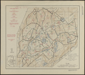
123. Black Rock Forest Standing Timber - 1981 Creator: Scholz, H. F., Smith, K., and Denny, Charles Storrow, 1911- Format: Maps/Atlases Collection: The Harvard Forest Map Collection Date: 1981 Institution: Harvard Forest Archives
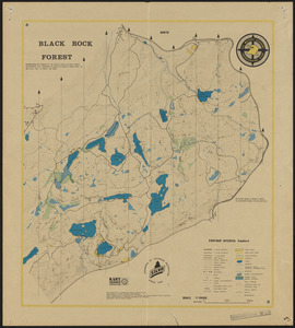
124. Black Rock Forest Topography and Natural Features Creator: United States Military Academy Format: Maps/Atlases Collection: The Harvard Forest Map Collection Date: 1978 Institution: Harvard Forest Archives
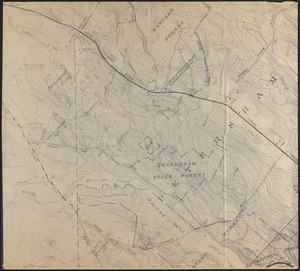
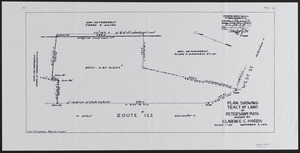
125. Blow up of USGS Map of Petersham Showing Harvard and Petersham State Forests Creator: Geological Survey (U.S.) Format: Maps/Atlases Collection: The Harvard Forest Map Collection Date: 1907–2014 Institution: Harvard Forest Archives
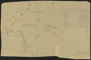
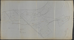
126. Boundary Survey of the Town of Petersham Format: Maps/Atlases Collection: The Harvard Forest Map Collection Date: February 16, 1934 Institution: Harvard Forest Archives
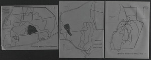
127. Brooks Woodland Preserve Creator: Trustees of Reservations (Mass.); Gould, E. M. Format: Maps/Atlases Collection: The Harvard Forest Map Collection Date: 1970 Institution: Harvard Forest Archives
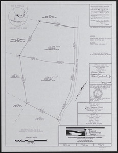
128. Bruce E. Laboffa and Steven Lange Land Creator: Wilson, B. E. , Jr. Format: Maps/Atlases Collection: The Harvard Forest Map Collection Date: December 7, 2005 Institution: Harvard Forest Archives
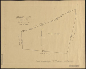
129. Bryant Lots Petersham Creator: Tarbox, E. E. Format: Maps/Atlases Collection: The Harvard Forest Map Collection Date: October 9, 1922 Institution: Harvard Forest Archives
130. Clarence C. Harris Land Creator: Larson, C. H. Format: Maps/Atlases Collection: The Harvard Forest Map Collection Date: November 7, 1951 Institution: Harvard Forest Archives
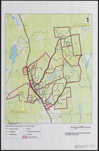
131. Compartments on Prospect Hill - 2008 Creator: Hall, B. Format: Maps/Atlases Collection: The Harvard Forest Map Collection Date: July 14, 2008 Institution: Harvard Forest Archives
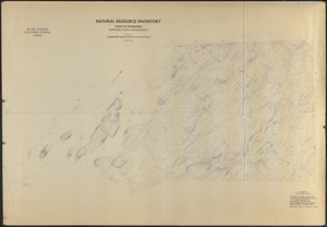
132. Composite of USGS Topographic Maps of Petersham ('Natural Resource Inventory') Creator: United States. Soil Conservation Service Format: Maps/Atlases Collection: The Harvard Forest Map Collection Date: November 1973 Institution: Harvard Forest Archives
133. Estate of Nathan Matthews Hamilton Mass Creator: Cline, A. C.; Harvard Forest (Research facility) Format: Maps/Atlases Collection: The Harvard Forest Map Collection Date: April 1923 Institution: Harvard Forest Archives
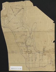
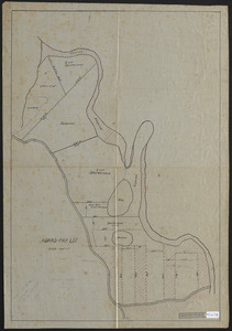
134. Experimental reproduction cuttings, Adams-Fay Lot (TS IX) Format: Maps/Atlases Collection: The Harvard Forest Map Collection Date: [1924?] Institution: Harvard Forest Archives
135. Experimental reproduction cuttings, Adams-Fay Lot (TS IX) Creator: Cline, A. C. Format: Maps/Atlases Collection: The Harvard Forest Map Collection Date: 1924 Institution: Harvard Forest Archives
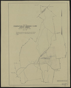
136. Federation of Women's Clubs State Forest Creator: Bowers, F.; Hall, F. G. Format: Maps/Atlases Collection: The Harvard Forest Map Collection Date: August 1931–May 1933 Institution: Harvard Forest Archives
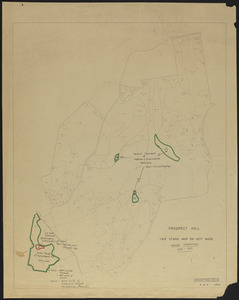
137. Forest Operations 1962-1963, Prospect Hill Creator: Spurr, Stephen H., 1918-1990 Format: Maps/Atlases Collection: The Harvard Forest Map Collection Date: 1963 Institution: Harvard Forest Archives
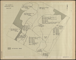
138. Forest operations, Tom Swamp I, 1909-1956 Format: Maps/Atlases Collection: The Harvard Forest Map Collection Date: [ca. 1956] Institution: Harvard Forest Archives
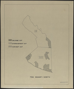
139. Forest operations, Tom Swamp North Creator: Foster, D. R. Format: Maps/Atlases Collection: The Harvard Forest Map Collection Date: 1990 Institution: Harvard Forest Archives
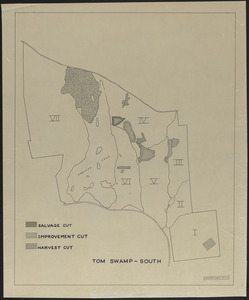
140. Forest operations, Tom Swamp South Creator: Foster, D. R. Format: Maps/Atlases Collection: The Harvard Forest Map Collection Date: 1990 Institution: Harvard Forest Archives