21. Town boundary, Braintree and Quincy, Pine Hill Creator: Parker, Warren S. Format: Photographs Collection: Parker Collection Date: December 18, 1920 Institution: Thomas Crane Public Library
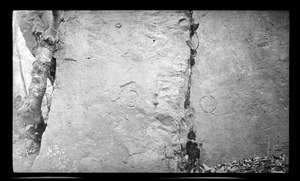
22. Town boundary mark at ledge, Quincy Neck Creator: Parker, Warren S. Format: Photographs Collection: Parker Collection Date: [ca. 1870–1930] Institution: Thomas Crane Public Library
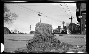
23. Town boundary marker. Hancock & Squantum Sts. May 16, 1921 Creator: Parker, Warren S. Format: Photographs Collection: Parker Collection Date: May 16, 1921 Institution: Thomas Crane Public Library
24. Town boundary, Milton and Quincy, Forrest Street Creator: Parker, Warren S. Format: Photographs Collection: Parker Collection Date: December 18, 1920 Institution: Thomas Crane Public Library
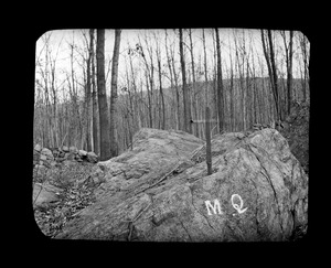
25. Town boundary Milton-Quincy Creator: Parker, Warren S. Format: Photographs Collection: Parker Collection Date: [ca. 1870–1930] Institution: Thomas Crane Public Library
26. Town boundary M-Q corner Hancock & Squantum Sts. Creator: Parker, Warren S. Format: Photographs Collection: Parker Collection Date: [ca. 1870–1930] Institution: Thomas Crane Public Library
27. Town boundary north at Quincy Neck Creator: Parker, Warren S. Format: Photographs Collection: Parker Collection Date: November 12, 1920 Institution: Thomas Crane Public Library
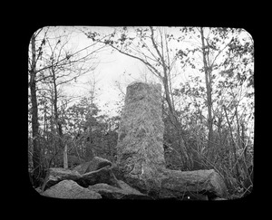
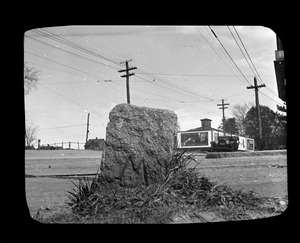
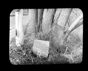
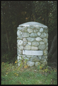
28. Town boundary Pine Hill Creator: Parker, Warren S. Format: Photographs Collection: Parker Collection Date: November 12, 1920 Institution: Thomas Crane Public Library
29. Town boundary, Quincy and Randolph, Randolph Avenue Creator: Parker, Warren S. Format: Photographs Collection: Parker Collection Date: December 18, 1920 Institution: Thomas Crane Public Library
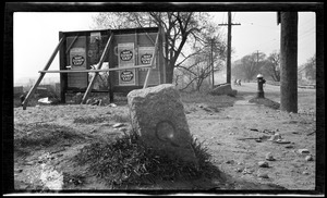
30. Town boundary West Howard Street Creator: Parker, Warren S. Format: Photographs Collection: Parker Collection Date: November 18, 1920 Institution: Thomas Crane Public Library
31. Town mark Pine Hill (double exposure) November 18, 1920 Creator: Parker, Warren S. Format: Photographs Collection: Parker Collection Date: November 18, 1920 Institution: Thomas Crane Public Library
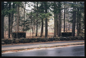
32. Cold Comfort Farm, 862 Bay Road Format: Photographs Collection: Hamilton Historical Society Collection Date: July 2005 Institution: Hamilton Historical Society
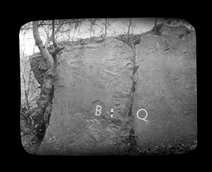
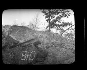
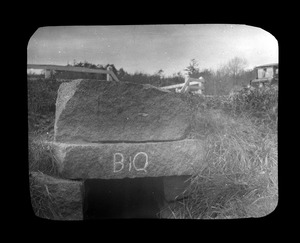
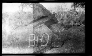
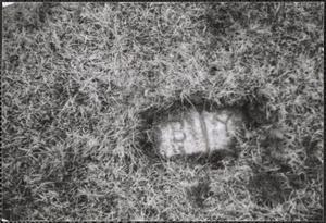
33. Ground Marker "B/Y" on Coleman property showing boundry between Barnstable and Yarmouth Format: Photographs Collection: Historical Society of Old Yarmouth Archives and Local History Collection Date: [ca. 1850–2001] Institution: Historical Society of Old Yarmouth
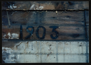
34. House marking 1903 Format: Photographs Collection: Hamilton Historical Society Collection Date: June 1989 Institution: Hamilton Historical Society
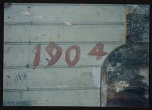
35. House marking 1904 Format: Photographs Collection: Hamilton Historical Society Collection Date: June 1989 Institution: Hamilton Historical Society
36. Main entrance to George V. L. Meyer residence, 720 Bay Road Format: Photographs Collection: Hamilton Historical Society Collection Date: April 1998 Institution: Hamilton Historical Society
37. One stone pillar at the rear entrance on Moulton Street to the Brackenside property of Augustus Goodwin, 1925 Format: Photographs Collection: Hamilton Historical Society Collection Date: [ca. 1870–2000] Institution: Hamilton Historical Society
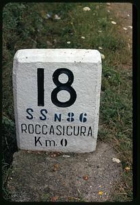
38. Road marker, Roccasicura, Italy Creator: Mitchell, Edmund L., 1905-1981 Format: Photographs Collection: Edmund L. Mitchell Collection Date: 1972 Institution: Boston Public Library
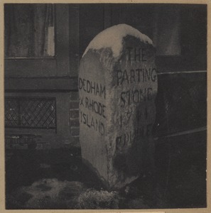
39. Roxbury, parting stone Format: Photographs Collection: Archive of Photographic Documentation of Early Massachusetts Architecture Date: [ca. 1895–1905] Institution: Boston Public Library
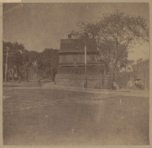
40. Roxbury, Riley's store, Eliot Square, a commissary store in 1775 + Paul Dudley parting stone, 1774. Format: Photographs Collection: Archive of Photographic Documentation of Early Massachusetts Architecture Date: [ca. 1895–1905] Institution: Boston Public Library