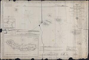
21. Chart of the Azores or Western Islands Improved from those of Fleurien and Tolino with the Rectification of longitude given in Purdy's Memoir on the Atlantic, as... Format: Maps/Atlases Collection: Map and Chart Collection Date: 1842 Institution: New Bedford Free Public Library
22. Chart of the Coast of China and of the Japan Islands including the Marianes and a part of the Philippines Creator: Maury, William L. Format: Maps/Atlases Collection: Map and Chart Collection Date: 1855 Institution: New Bedford Free Public Library
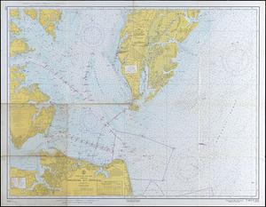
23. Chesapeake Bay Entrance Format: Maps/Atlases Collection: Map and Chart Collection Date: 1965 Institution: New Bedford Free Public Library
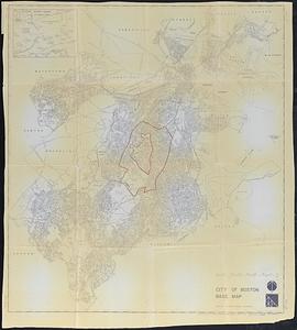
24. City of Boston Base Map Creator: Boston Redevelopment Authority Format: Maps/Atlases Collection: Map and Chart Collection Date: 1972 Institution: New Bedford Free Public Library
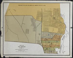
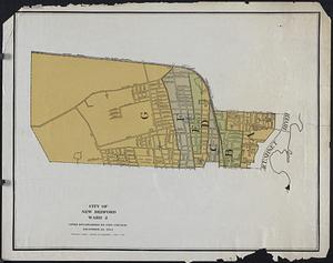
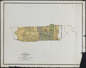
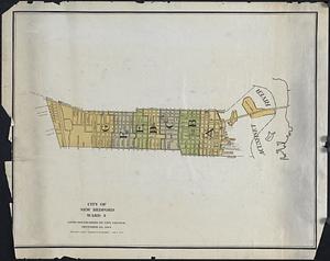
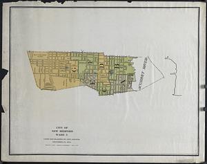
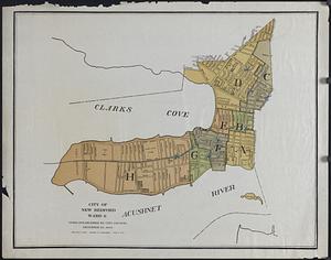
25. City of New Bedford Wards Format: Maps/Atlases Collection: Map and Chart Collection Date: 1921 Institution: New Bedford Free Public Library
26. City of New Bedford Wards Format: Maps/Atlases Collection: Map and Chart Collection Date: 1921 Institution: New Bedford Free Public Library
27. City of New Bedford Wards Format: Maps/Atlases Collection: Map and Chart Collection Date: 1921 Institution: New Bedford Free Public Library
28. City of New Bedford Wards Format: Maps/Atlases Collection: Map and Chart Collection Date: 1921 Institution: New Bedford Free Public Library
29. City of New Bedford Wards Format: Maps/Atlases Collection: Map and Chart Collection Date: 1921 Institution: New Bedford Free Public Library
30. City of New Bedford Wards Format: Maps/Atlases Collection: Map and Chart Collection Date: 1921 Institution: New Bedford Free Public Library
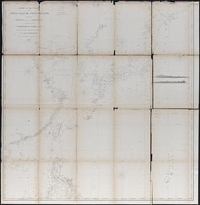
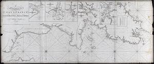
31. Coast of France Creator: Heather, William, 1764-1812; Stephenson, J. (Engraver) Format: Maps/Atlases Collection: Map and Chart Collection Date: 1797 Institution: New Bedford Free Public Library
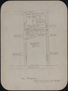
32. The Common Format: Maps/Atlases; Manuscripts Collection: Map and Chart Collection Date: [1822–1899] Institution: New Bedford Free Public Library
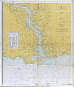
33. Connecticut River, Long Island Sound to Deep River Format: Maps/Atlases Collection: Map and Chart Collection Date: 1966 Institution: New Bedford Free Public Library
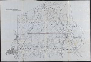
34. County Map, MA and RI Format: Maps/Atlases; Manuscripts Collection: Map and Chart Collection Date: [ca. 1900–1939] Institution: New Bedford Free Public Library
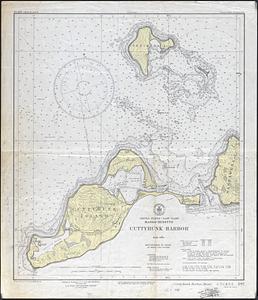
35. Cuttyhunk Harbor Creator: U.S. Coast and Geodetic Survey Format: Maps/Atlases Collection: Map and Chart Collection Date: 1939 Institution: New Bedford Free Public Library
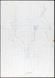
36. Dartmouth Surveys Format: Maps/Atlases; Manuscripts Collection: Map and Chart Collection Date: [ca. 1840–1890] Institution: New Bedford Free Public Library
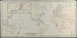
37. Distribution of Bowhead and Humpback Whales based on logbook records - mostly nineteenth century Creator: Townsend, Charles Haskins, 1859-1944; Watson, Arthur C. (Arthur Chace), 1897- Format: Maps/Atlases Collection: Map and Chart Collection Date: [ca. 1900–1939] Institution: New Bedford Free Public Library
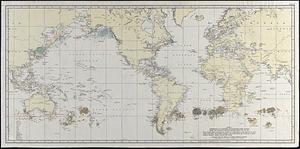
38. Distribution of Northern and Southern Right Whales based on logbook records dating from 1785 to 1913 Creator: Townsend, Charles Haskins, 1859-1944; Watson, Arthur C. (Arthur Chace), 1897- Format: Maps/Atlases Collection: Map and Chart Collection Date: [ca. 1913–1922] Institution: New Bedford Free Public Library
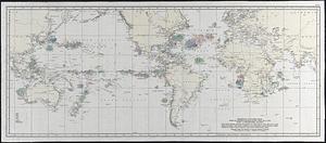
39. Distribution of the Sperm Whale based on Logbook Records dating from 1761-1920 : Chart A, April-September, inclusive Creator: Townsend, Charles Haskins, 1859-1944; Watson, Arthur C. (Arthur Chace), 1897- Format: Maps/Atlases Collection: Map and Chart Collection Date: [ca. 1920–1929] Institution: New Bedford Free Public Library
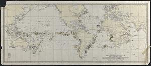
40. Distribution of the Sperm Whale based on Logbook Records dating from 1761-1920 : Chart B, October-March, inclusive Creator: Townsend, Charles Haskins, 1859-1944; Watson, Arthur C. (Arthur Chace), 1897- Format: Maps/Atlases Collection: Map and Chart Collection Date: [ca. 1920–1929] Institution: New Bedford Free Public Library