201. Railroad map of New England & eastern New York complied from the most authentic sources Creator: Goldthwait, J. H. Format: Maps/Atlases Collection: Boston and New England Maps (Collection of Distinction) / Norman B. Leventhal Map & Education Center Collection Date: 1849 Institution: Boston Public Library
202. Railroad map of New England, with adjacent portions of New York & Canada Creator: Pearson, J. W. Format: Maps/Atlases Collection: Boston and New England Maps (Collection of Distinction) / Norman B. Leventhal Map & Education Center Collection Date: 1840 Institution: Boston Public Library
203. Railway map of the New England states, engraved expressly for the Pathfinder railway guide Creator: Rand, Avery & Co Format: Maps/Atlases Collection: Boston and New England Maps (Collection of Distinction) / Norman B. Leventhal Map & Education Center Collection Date: [1870–1879] Institution: Boston Public Library
204. Relief practice map Creator: Klemm, L. R. (Louis Richard), 1845-1925; Harison, William Beverley Format: Maps/Atlases Collection: Boston and New England Maps (Collection of Distinction) / Norman B. Leventhal Map & Education Center Collection Date: 1894 Institution: Boston Public Library
205. Sketch A. Illustrating the Progress of the Eastern Section of the Survey of the Coast in 1845. Creator: United States Coast Survey Format: Maps/Atlases Collection: Historic Maps Date: 1845 Institution: Salem State University Archives and Special Collections
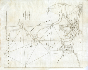
206. Sketch A showing the progress of the survey in section no. 1 from 1844 to 1881 Creator: U.S. Coast and Geodetic Survey Format: Maps/Atlases Collection: Sidney R. Knafel Map Collection at Phillips Academy Date: 1881 Institution: Phillips Academy
207. Sketch of the states of Massachusetts, Connecticut, and Rhode Island, and parts of New Hampshire & New York exhibiting the several rail road routes completed,... Creator: Kennedy, Archibald, active 1850 Format: Maps/Atlases Collection: Boston and New England Maps (Collection of Distinction) / Norman B. Leventhal Map & Education Center Collection Date: 1846 Institution: Boston Public Library
208. Sketch of the states of Massachusetts, Connecticut, and Rhode Island, and parts of New Hampshire & New York exhibiting the several rail road routes completed,... Creator: Kennedy, Archibald, fl. 1850 Format: Maps/Atlases Collection: Boston and New England Maps (Collection of Distinction) / Norman B. Leventhal Map & Education Center Collection Date: 1838 Institution: Boston Public Library
209. A small map of the sea coast of New England together with the outlines of several of the provinces lying thereon, 1738 Format: Maps/Atlases Collection: Norman B. Leventhal Map & Education Center Collection Date: [1900–1999] Institution: Boston Public Library
210. Summer resorts of the coast, lake, and mountain regions along the Boston & Maine Railroad and connections Creator: Boston and Maine Railroad. General Passenger Department; Matthews-Northrup Works Format: Maps/Atlases Collection: Boston and New England Maps (Collection of Distinction) / Norman B. Leventhal Map & Education Center Collection Date: [1912] Institution: Boston Public Library
211. Telegraph and rail road map of the New England states Creator: Williams, Alexander. Format: Maps/Atlases Collection: Boston and New England Maps (Collection of Distinction) / Norman B. Leventhal Map & Education Center Collection Date: 1854 Institution: Boston Public Library
212. To the honourable Walter Younge, barronet, one of the commissioners for his majestie's collonis : this description of New England in America is most humbly dedicated &... Creator: Hacke, William. Format: Maps/Atlases Collection: Norman B. Leventhal Map & Education Center Collection Date: [1880?–1889?] Institution: Boston Public Library
213. Trolley pathfinder birds eye map of interurban trolley lines in New England Creator: Geo. H. Walker & Co.; Metropolitan News Company (Boston, Mass.) Format: Maps/Atlases Collection: Boston and New England Maps (Collection of Distinction) / Norman B. Leventhal Map & Education Center Collection Date: 1905 Institution: Boston Public Library
214. Vereinigte Staaten von Nord-Amerika in 6 blattern, bl. 3 Creator: Petermann, A. (August Heinrich), 1822-1878 Format: Maps/Atlases Collection: Norman B. Leventhal Map & Education Center Collection Date: 1881 Institution: Boston Public Library
215. Williams' telegraph and rail road map of the New England states, eastern portion of New York state and Canada Creator: Williams, Alexander. Format: Maps/Atlases Collection: Boston and New England Maps (Collection of Distinction) / Norman B. Leventhal Map & Education Center Collection Date: 1852 Institution: Boston Public Library
216. An accurate map of North America Creator: Robert de Vaugondy, Gilles, 1688-1766; Rollos, G., active 1754-1789 Format: Maps/Atlases Collection: American Antiquarian Society Collection / American Revolutionary War-Era Maps (Collection of Distinction) Date: [1760?] Institution: American Antiquarian Society
217. An accurate map, of the District of Maine : being part of the commonwealth of Massachusetts Creator: Carleton, Osgood, 1742-1816, Carleton, Osgood, 1742-1816, Norman, John, 1748?-1817, and Norman, William, -1807 Format: Maps/Atlases Collection: American Antiquarian Society Collection / American Revolutionary War-Era Maps (Collection of Distinction) Date: [1795] Institution: American Antiquarian Society
218. An Accurate map of the United States of America. : According to the Treaty of Peace of 1783 Creator: Anderson, Alexander, 1775-1870; Smith, Reid & Wayland Format: Maps/Atlases Collection: American Antiquarian Society Collection / American Revolutionary War-Era Maps (Collection of Distinction) Date: [1796] Institution: American Antiquarian Society
219. An accurate map of the West Indies, : containing the Bahama & Carribe islands, the Great & Little Antilles, with the Leward and Windward Islands & part of the American... Creator: Bowen, Emanuel, -1767 Format: Maps/Atlases Collection: American Antiquarian Society Collection / American Revolutionary War-Era Maps (Collection of Distinction) Date: [1758] Institution: American Antiquarian Society
220. An accurate map of the West Indies Creator: Bowen, Emanuel, -1767 Format: Maps/Atlases Collection: American Antiquarian Society Collection / American Revolutionary War-Era Maps (Collection of Distinction) Date: [1752] Institution: American Antiquarian Society