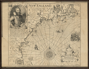
Skip to search
Skip to main content
Skip to first result
Digital Commonwealth
Folders
Sign Up / Log In
Search for
Search
Search
Search
Basic
Advanced
Explore
Map
Collections
Institutions
Formats
For Educators
Primary Source Sets
Lesson Plans
Using Primary Sources
Searching Digital Commonwealth
For Institutions
Join Digital Commonwealth
Conferences, Trainings, & Events
How to Contribute Collections
Digitization Services
Board & Committees
Frequently Asked Questions
About
About Digital Commonwealth
News & Announcements
Copyright & Terms of Use
Harmful Content Statement
Partners
API
Contact Us
Search
Search Constraints
Start Over
Save Search
Your search:
More Like
commonwealth:z603vf99f
✖
Remove constraint More Like: commonwealth:z603vf99f
« Prev.
|
141
-
160
of
329
|
Next »
Sort
by relevance
relevance
title
date (asc)
date (desc)
recently added
Number of results to display per page
20
per page
per page
10
per page
20
per page
50
per page
100
per page
View results as:
List
list view
Maps
map view
Gallery
grid view
Search Results
141.
Map of New England
142.
Map of New England : with adjacent portions of New York & Canada
143.
Map of New England, 1614
144.
[Map of New England, 31st]
145.
Map of New England and New York, 1676
146.
Map of New England exhibiting the rail road and telegraphic lines now in operation
147.
Map of New England with adjacent portions of New York & Canada
148.
Map of New England with adjacent portions of New York & Canada
149.
Map of New England with adjacent portions of New York & Canada
150.
Map of the Boston & Maine Railroad, showing its relative position & connection with other railroads
151.
Map of the Boston and Northwestern, Massachusetts Central, and Boston and Poughkeepsie Railroads and their connections
152.
Map of the Boston, Concord, Montreal & White Mountains Railroad and its principal connections
153.
Map of the British and French dominions in North America, drawn by order of the British government in 1755, showing what that...
154.
Map of the country copied from Hale's map of N. E. with railroad route from Boston to Lake Champlain : through Keene, N. H
155.
A Map Of The Country Which Was The Scene Of Operations Of the Northern Army: Including The Wilderness Through Which Genl....
156.
Map of the eastern and middle states
157.
Map of the Eastern Railroad and principal connections
158.
Map of the Eastern Railroad and principal connections
159.
Map of the New England and Middle Atlantic States
160.
Map of the New England or Eastern States: Engraved to Illustrate Mitchell's School and Family Geography
« Previous
Next »
1
2
…
4
5
6
7
8
9
10
11
12
…
16
17
Limit your search
Subject
New England--Maps
127
New York (State)--Maps
57
Railroads--New England--Maps
50
Canada--Maps
47
United States--Maps
32
North America--Maps
21
Railroads--New York (State)--Maps
21
Massachusetts--Maps
20
more
Subject
»
Place
North and Central America
286
United States
207
New England
114
New York
62
Canada
60
Massachusetts
27
North America
22
Connecticut
18
more
Place
»
Format
Maps/Atlases
329
Manuscripts
13
Available to use
No known restrictions
175
Creative Commons license
2
Date
View distribution
Current results range from
1614
to
2015
Date range begin
Date range end
View larger »
Collection
Norman B. Leventhal Map & Education Center Collection
175
American Revolutionary War-Era Maps (Collection of Distinction)
143
American Antiquarian Society Collection
138
Boston and New England Maps (Collection of Distinction)
78
Historic Maps
8
Sidney R. Knafel Map Collection at Phillips Academy
4
David Judkins Weaver Papers
3
Digital Amherst Collection
2
more
Collection
»
Institution
Boston Public Library
175
American Antiquarian Society
138
Salem State University Archives and Special Collections
8
Phillips Academy
4
Jones Library, Amherst
2
Holmes Public Library
1
Massachusetts Historical Society
1