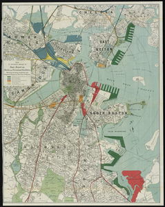
141. Map of Boston Proper. Charlestown, South Boston and East Boston Showing Original Territory of Old Boston, the Areas Filled and Reclaimed from Tide Water and the Areas... Creator: Geo. H. Walker & Co Format: Maps/Atlases Collection: Historic Maps Date: 1894 Institution: Salem State University Archives and Special Collections
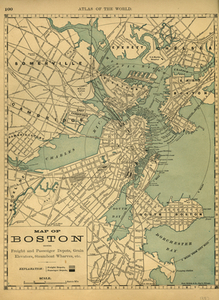
142. Map of Boston Showing Freight and Passenger Depots, Grain Elevators, Steamboat Wharves, etc. Creator: Rand, McNally & Co Format: Maps/Atlases Collection: Historic Maps Date: 1887 Institution: Salem State University Archives and Special Collections
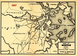
143. Map of Boston Showing the Location of Electric Car Tracks Creator: Stone & Webster Co Format: Maps/Atlases Collection: Historic Maps Date: 1898 Institution: Salem State University Archives and Special Collections
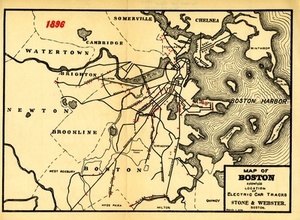
144. Map of Boston Showing the Location of Electric Car Tracks Creator: Stone & Webster Co Format: Maps/Atlases Collection: Historic Maps Date: 1898 Institution: Salem State University Archives and Special Collections
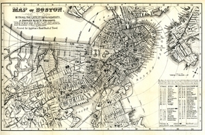
145. Map of Boston, With All the Latest Improvements.: A Complete Guide to Strangers. Creator: D. Appleton and Co Format: Maps/Atlases Collection: Historic Maps Date: 1880 Institution: Salem State University Archives and Special Collections
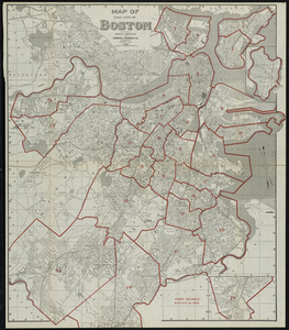
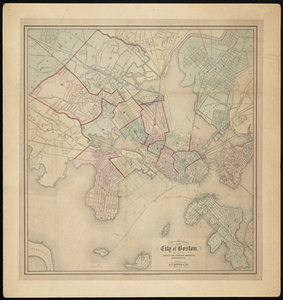
146. Map of the City of Boston Creator: Sampson & Murdock Co Format: Maps/Atlases Collection: Historic Maps Date: 1920 Institution: Salem State University Archives and Special Collections
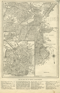
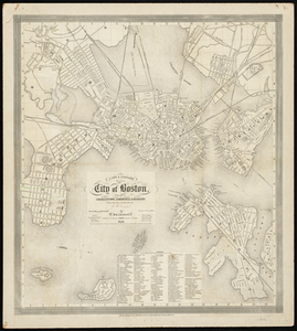
147. Map of the City of Boston, Massachusetts. Creator: Rowland, G. T. Format: Maps/Atlases Collection: Historic Maps Date: 1905 Institution: Salem State University Archives and Special Collections
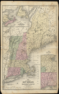
148. Map of the New England or Eastern States: Engraved to Illustrate Mitchell's School and Family Geography Creator: Mitchell, S. Augustus Format: Maps/Atlases Collection: Historic Maps Date: 1852 Institution: Salem State University Archives and Special Collections
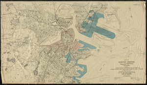
149. Map to Accompany Report of State Board on Docks and Terminal Facilities: Showing Existing Conditions and Proposed Changes at the Port of Boston Creator: Geo. H. Walker & Co Format: Maps/Atlases Collection: Historic Maps Date: 1896 Institution: Salem State University Archives and Special Collections
150. Mather Elementary School Creator: Pearson, Fannie L. Format: Photographs Collection: Community-Based Collecting Projects Institution: University of Massachusetts Boston, Joseph P. Healey Library
151. Melvin Meister Creator: Yiddish Book Center (Liz) Format: Film/Video Collection: Oral Histories Date: February 13, 2019 Institution: Yiddish Book Center
152. Milly Guberman Kravetz Creator: Yiddish Book Center (Benno) Format: Film/Video Collection: Oral Histories Date: March 12, 2012 Institution: Yiddish Book Center
153. Miriam Mazor Format: Film/Video Collection: Oral Histories Date: November 6, 2011 Institution: Yiddish Book Center
154. Molly Fogarty Creator: Yiddish Book Center (Liz) Format: Film/Video Collection: Oral Histories Date: February 12, 2016 Institution: Yiddish Book Center
155. A New & Complete Map of the City of Boston with Part of Charlestown, Cambridge and Roxbury. Creator: Boynton, George W.; Dearborn, Nathaniel Format: Maps/Atlases Collection: Historic Maps Date: 1846 Institution: Salem State University Archives and Special Collections
156. A New & Complete Map of the City of Boston, with part of Charlestown, Cambridge, Brookline, Dorchester &c. Creator: E.P. Dutton Format: Maps/Atlases Collection: Historic Maps Date: 1868 Institution: Salem State University Archives and Special Collections
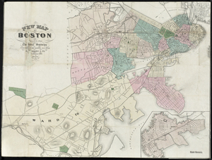
157. New Map of Boston Compiled from the Latest Surveys Creator: A. Williams & Co; Mayer & Co Format: Maps/Atlases Collection: Historic Maps Date: 1870 Institution: Salem State University Archives and Special Collections
158. New Map of Boston: Comprising the Whole City with the New Boundaries of the Wards Creator: Boynton, George W.; John P. Jewett and Company (Boston, Mass.) Format: Maps/Atlases Collection: Historic Maps Date: 1855 Institution: Salem State University Archives and Special Collections
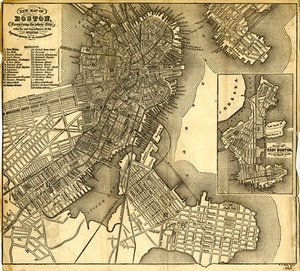
159. New Map of Boston: Comprising the Whole City, With the New Boundaries of the Wards. Creator: Boynton, George W., Brown & Taggard, and Damrell & Moore Format: Maps/Atlases Collection: Historic Maps Date: 1861 Institution: Salem State University Archives and Special Collections
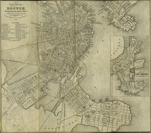
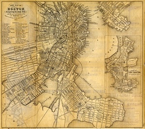
160. New Map of Boston: Comprising the Whole City, With the New Boundaries of the Wards. Creator: Sharp, W. C. Format: Maps/Atlases Collection: Historic Maps Date: 1865 Institution: Salem State University Archives and Special Collections