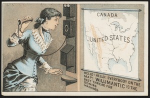
161. Canada, United States. Hello! Hello! Everybody on the map! Willimantic is the best thread for sewing machines. Format: Postcards/Cards Collection: 19th Century American Trade Cards Date: [ca. 1870–1900] Institution: Boston Public Library
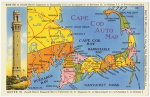
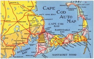
162. Cape Cod Auto Map Format: Postcards/Cards Collection: Tichnor Brothers Postcard Collection Date: [ca. 1930–1945] Institution: Boston Public Library
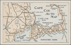
163. Cape Cod auto map Format: Postcards/Cards Collection: Historical Society of Old Yarmouth Archives and Local History Collection Date: [ca. 1850–2001] Institution: Historical Society of Old Yarmouth
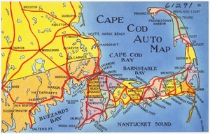
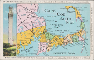
164. Cape Cod Auto Map Format: Postcards/Cards Collection: Tichnor Brothers Postcard Collection Date: [ca. 1930–1945] Institution: Boston Public Library
165. Cape Cod Auto Map Format: Postcards/Cards Collection: Tichnor Brothers Postcard Collection Date: [ca. 1930–1945] Institution: Boston Public Library
166. Cape Cod auto map with drawing of pilgrim monument Format: Postcards/Cards Collection: Historical Society of Old Yarmouth Archives and Local History Collection Date: [ca. 1850–2001] Institution: Historical Society of Old Yarmouth
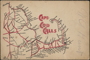
167. Cape Cod calls map Format: Postcards/Cards Collection: Historical Society of Old Yarmouth Archives and Local History Collection Date: [ca. 1915] Institution: Historical Society of Old Yarmouth
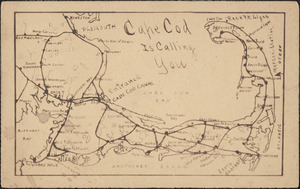
168. Cape Cod is calling you map Format: Postcards/Cards Collection: Historical Society of Old Yarmouth Archives and Local History Collection Date: [ca. 1850–2001] Institution: Historical Society of Old Yarmouth
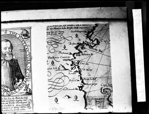
169. Capt. John Smith, map of New England, 1614 Creator: Parker, Warren S. Format: Photographs Collection: Parker Collection Date: [ca. 1870–1930] Institution: Thomas Crane Public Library
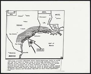
170. Carla Continues In Texas--Arrow traces route of Hurricane Carla as it reached the Austin, Texas, area today after crossing the coast near Matagorda Island, Hurricane... Creator: Associated Press Format: Photographs Collection: Boston Herald-Traveler Photo Morgue Date: [ca. September 1961] Institution: Boston Public Library
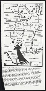
171. Carla Expected to Travel Northward-Arrows indicate probable path of Hurricane Carla which is expected to travel up the middle of the country Creator: Associated Press Format: Photographs Collection: Boston Herald-Traveler Photo Morgue Date: [ca. August 1961] Institution: Boston Public Library
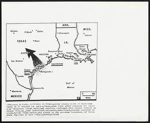
172. Carla Threatens Texas Coast--Hurricane Carla is still off the Gulf Coast of Texas today as hurricane warnings from U.S. Weather Bureau continue to fly from Corpus... Creator: Associated Press Format: Photographs Collection: Boston Herald-Traveler Photo Morgue Date: [ca. September 1961] Institution: Boston Public Library
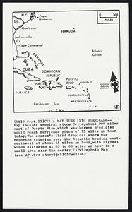
173. Celia May Turn into Hurricane--Map locates tropical storm Celia, about 900 miles east of Puerto Rico, which weathermen predicted would reach hurricane pitch of 75... Creator: Associated Press Format: Photographs Collection: Boston Herald-Traveler Photo Morgue Date: [ca. September 1962] Institution: Boston Public Library
174. Circle K Motor Hotel, 1939 W. Van Buren, Phoenix, Arizona Format: Postcards/Cards Collection: Tichnor Brothers Postcard Collection Date: [ca. 1930–1945] Institution: Boston Public Library
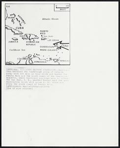
175. Cleo Batters Guadeloupe--Hurricane Cleo battered the Guadeloupe group of islands today with 115 mile an hour winds and headed for Puerto Rico and the south coast of... Creator: Associated Press Format: Photographs Collection: Boston Herald-Traveler Photo Morgue Date: [ca. August 1964] Institution: Boston Public Library
176. Cleo Goes West--Hurricane Cleo skirted Puerto Rico today and headed west northwest toward Puerto Rico today and headed west northwest toward the Dominican Republic and... Creator: Associated Press Format: Photographs Collection: Boston Herald-Traveler Photo Morgue Date: [ca. August 1964] Institution: Boston Public Library
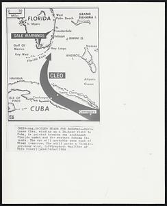
177. Cleo Heads for Bahamas--Hurricane Cleo, winding up a 24-hour visit to Cuba, is pointed towards the southeast Florida coast and the western Bahama Islands. The eye will... Creator: Associated Press Format: Photographs Collection: Boston Herald-Traveler Photo Morgue Date: [ca. August 1964] Institution: Boston Public Library
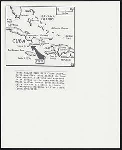
178. Cleo Hits Cuban Coast--Hurricane Cleo today lashed the Cape Cruz peninsula of Cuba and appeared to be moving out to open waters. The Miami weather bureau predicts... Creator: Associated Press Format: Photographs Collection: Boston Herald-Traveler Photo Morgue Date: [ca. August 1964] Institution: Boston Public Library
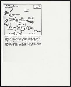
179. Cleo Kicks up her Heels-Cleo, the season's third tropical storm, today was making her way in open Atlantic seas, heading on a west-northwest course. She was packing... Creator: Associated Press Format: Photographs Collection: Boston Herald-Traveler Photo Morgue Date: [ca. August 1964] Institution: Boston Public Library
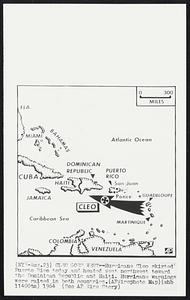
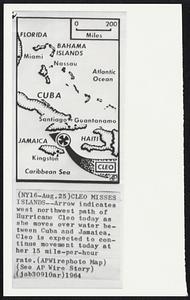
180. Cleo Misses Islands--Arrow indicates west northwest path of Hurricane Cleo today as she moves over water between Cuba and Jamaica. Cleo is expected to continue... Creator: Associated Press Format: Photographs Collection: Boston Herald-Traveler Photo Morgue Date: [ca. August 1964] Institution: Boston Public Library