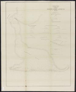
401. Edgartown harbor and Cotamy Bay, Mass. Creator: Massachusetts. Board of Harbor Commissioners; United States Coast Survey Format: Maps/Atlases Collection: Massachusetts Board of Harbor and Land Commissioners Date: 1871 Institution: State Library of Massachusetts
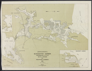
402. Gloucester Harbor: Annisquam-Little & Mill Rivers and Rockport Harbor Creator: Board of Harbor and Land Commissioners of Massachusetts Format: Maps/Atlases Collection: Massachusetts Board of Harbor and Land Commissioners Date: 1915 Institution: State Library of Massachusetts
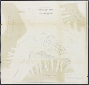
403. Hydrographic plan of Man of War Shoal, Boston upper harbor Creator: Board of Harbor and Land Commissioners of Massachusetts Format: Maps/Atlases Collection: Massachusetts Board of Harbor and Land Commissioners Date: 1874 Institution: State Library of Massachusetts
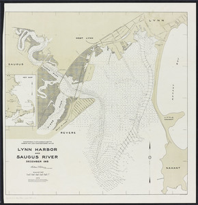
404. Lynn Harbor and Saugus River Creator: Board of Harbor and Land Commissioners of Massachusetts Format: Maps/Atlases Collection: Massachusetts Board of Harbor and Land Commissioners Date: 1915 Institution: State Library of Massachusetts
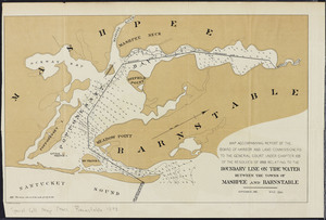
405. Map accompanying report of the Board of Harbor and Land Commissioners to the General Court: under Chapter 105 of the Resolves of 1893 relating to the boundary line on... Creator: Board of Harbor and Land Commissioners of Massachusetts Format: Maps/Atlases Collection: Massachusetts Board of Harbor and Land Commissioners Date: 1894 Institution: State Library of Massachusetts
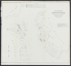
406. Map of a portion of Boston Harbor: showing the locations of excavations already done, in progress of execution, and proposed Creator: Board of Harbor and Land Commissioners of Massachusetts Format: Maps/Atlases Collection: Massachusetts Board of Harbor and Land Commissioners Date: 1876 Institution: State Library of Massachusetts
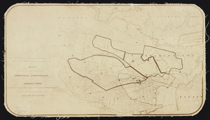
407. Map of a portion of the cities of Cambridge, Somerville and Charlestown, showing the drainage area of Millers River and Basins Creator: Massachusetts. Dept. of Public Health; Massachusetts. Board of Harbor Commissioners Format: Maps/Atlases Collection: Massachusetts Board of Harbor and Land Commissioners Date: 1872 Institution: State Library of Massachusetts
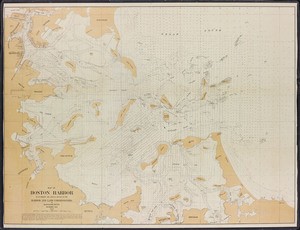
408. Map of Boston Harbor: to accompany the annual report of the Harbor and Land Commissioners of Massachusetts, December 1895 Creator: Board of Harbor and Land Commissioners of Massachusetts Format: Maps/Atlases Collection: Massachusetts Board of Harbor and Land Commissioners Date: 1895 Institution: State Library of Massachusetts
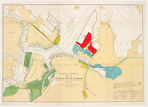
409. Map of Boston Inner Harbor: to accompany report under Chapter 93, Resolves of 1907 Creator: Board of Harbor and Land Commissioners of Massachusetts Format: Maps/Atlases Collection: Massachusetts Board of Harbor and Land Commissioners Date: 1907 Institution: State Library of Massachusetts
410. Map of Boston upper harbor: illustrating improvements made in its channels, 1878 Creator: Massachusetts. Board of Harbor Commissioners Format: Maps/Atlases Collection: Massachusetts Board of Harbor and Land Commissioners Date: 1878 Institution: State Library of Massachusetts
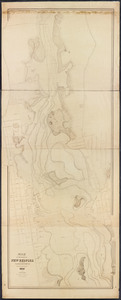
411. Map of the harbor of New Bedford in the state of Massachusetts Creator: Wood, Asa, cartographer, 1847.; Massachusetts. Harbor Commissioners (1846-47) Format: Maps/Atlases Collection: Massachusetts Board of Harbor and Land Commissioners Date: 1847 Institution: State Library of Massachusetts
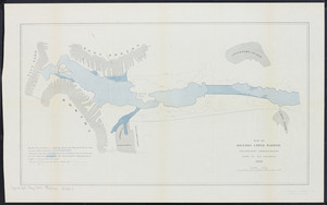
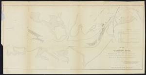
412. Map of Wareham River showing a scheme of harbor lines and improvement Creator: Massachusetts. Board of Harbor Commissioners Format: Maps/Atlases Collection: Massachusetts Board of Harbor and Land Commissioners Date: 1871 Institution: State Library of Massachusetts
413. Map showing changes in Cotamy Beach, and openings through same, 1846 to 1886 Creator: Board of Harbor and Land Commissioners of Massachusetts Format: Maps/Atlases Collection: Massachusetts Board of Harbor and Land Commissioners Date: 1886 Institution: State Library of Massachusetts
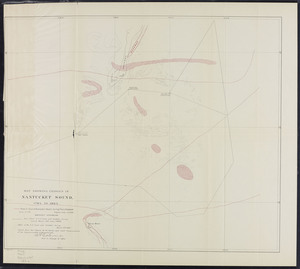
414. Map showing changes in Nantucket Sound, 1784 to 1885 Creator: Board of Harbor and Land Commissioners of Massachusetts Format: Maps/Atlases Collection: Massachusetts Board of Harbor and Land Commissioners Date: 1886 Institution: State Library of Massachusetts
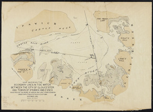
415. Map showing the boundary lines in tide water between the city of Gloucester and towns of Ipswich and Essex Creator: Board of Harbor and Land Commissioners of Massachusetts Format: Maps/Atlases Collection: Massachusetts Board of Harbor and Land Commissioners Date: 1890 Institution: State Library of Massachusetts
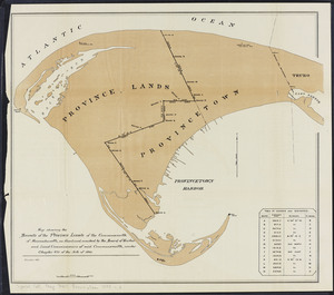
416. Map showing the bounds of the Province lands of the Commonwealth of Massachusetts Creator: Board of Harbor and Land Commissioners of Massachusetts Format: Maps/Atlases Collection: Massachusetts Board of Harbor and Land Commissioners Date: 1893 Institution: State Library of Massachusetts
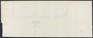
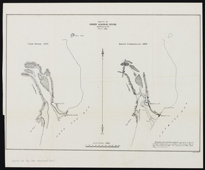
417. Mouth of Green Harbor River, Massachusetts Creator: Massachusetts. Board of Harbor Commissioners Format: Maps/Atlases Collection: Massachusetts Board of Harbor and Land Commissioners Date: 1876 Institution: State Library of Massachusetts
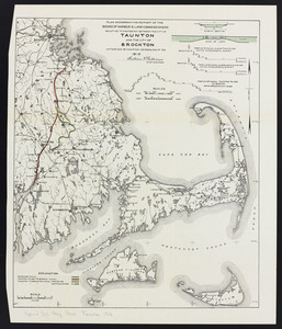
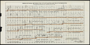
418. Plan accompanying report of the Board of Harbor & Land Commissioners relative to a waterway between the city of Taunton and Brockton Creator: Board of Harbor and Land Commissioners of Massachusetts Format: Maps/Atlases Collection: Massachusetts Board of Harbor and Land Commissioners Date: 1916 Institution: State Library of Massachusetts
419. Plan accompanying report of the Board of Harbor & Land Commissioners relative to a waterway between the city of Taunton and Brockton Creator: Board of Harbor and Land Commissioners of Massachusetts Format: Maps/Atlases Collection: Massachusetts Board of Harbor and Land Commissioners Date: 1916 Institution: State Library of Massachusetts
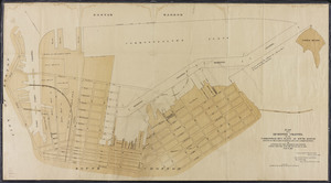
420. Plan for a reserved channel on the Commonwealth's Flats at South Boston Creator: Board of Harbor and Land Commissioners of Massachusetts Format: Maps/Atlases Collection: Massachusetts Board of Harbor and Land Commissioners Date: 1888 Institution: State Library of Massachusetts