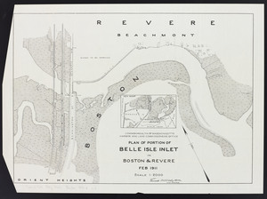
461. Plan of portion of Belle Isle Inlet: in Boston & Revere Creator: Board of Harbor and Land Commissioners of Massachusetts Format: Maps/Atlases Collection: Massachusetts Board of Harbor and Land Commissioners Institution: State Library of Massachusetts
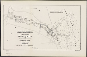
462. Plan of portion of Herring River in the town of Harwich Creator: Board of Harbor and Land Commissioners of Massachusetts Format: Maps/Atlases Collection: Massachusetts Board of Harbor and Land Commissioners Date: 1901 Institution: State Library of Massachusetts
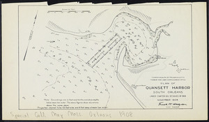
463. Plan of Quansett Harbor, South Orleans Creator: Board of Harbor and Land Commissioners of Massachusetts Format: Maps/Atlases Collection: Massachusetts Board of Harbor and Land Commissioners Date: November 1908 Institution: State Library of Massachusetts
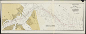
464. Plan of Saugus River below Salem Turnpike Creator: Board of Harbor and Land Commissioners of Massachusetts Format: Maps/Atlases Collection: Massachusetts Board of Harbor and Land Commissioners Date: 1905 Institution: State Library of Massachusetts
465. Plan of Saugus River: below Salem Turnpike Creator: Board of Harbor and Land Commissioners of Massachusetts Format: Maps/Atlases Collection: Massachusetts Board of Harbor and Land Commissioners Date: 1905 Institution: State Library of Massachusetts
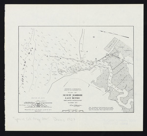
466. Plan of Sesuit Harbor in East Dennis: under Chapter 32 Resolves of 1907 Creator: Board of Harbor and Land Commissioners of Massachusetts Format: Maps/Atlases Collection: Massachusetts Board of Harbor and Land Commissioners Date: December 1907 Institution: State Library of Massachusetts
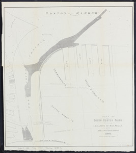
467. Plan of South Boston flats: showing location of sea walls and area of excavations Creator: Massachusetts. Board of Harbor Commissioners Format: Maps/Atlases Collection: Massachusetts Board of Harbor and Land Commissioners Date: 1875 Institution: State Library of Massachusetts
468. Plan of South Boston Flats: showing location of sea walls and area of excavations and filling Creator: Board of Harbor and Land Commissioners of Massachusetts Format: Maps/Atlases Collection: Massachusetts Board of Harbor and Land Commissioners Date: 1876 Institution: State Library of Massachusetts
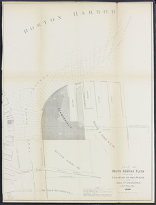
469. Plan of South Boston flats: showing present condition and sketch of proposed docks and streets Creator: Board of Harbor and Land Commissioners of Massachusetts Format: Maps/Atlases Collection: Massachusetts Board of Harbor and Land Commissioners Date: 1896 Institution: State Library of Massachusetts
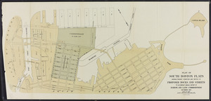
470. Plan of South Boston Flats: showing present condition and sketch of proposed docks and streets Creator: Board of Harbor and Land Commissioners of Massachusetts Format: Maps/Atlases Collection: Massachusetts Board of Harbor and Land Commissioners Date: 1903 Institution: State Library of Massachusetts
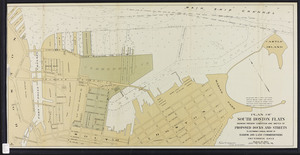
471. Plan of South Boston Flats: showing present condition and sketch of proposed docks and streets Creator: Board of Harbor and Land Commissioners of Massachusetts Format: Maps/Atlases Collection: Massachusetts Board of Harbor and Land Commissioners Date: 1910 Institution: State Library of Massachusetts
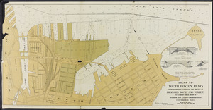
472. Plan of South Boston Flats: showing present condition and sketch of proposed docks to accompany annual report of Harbor and Land Commissioners, December, 1894 Creator: Board of Harbor and Land Commissioners of Massachusetts Format: Maps/Atlases Collection: Massachusetts Board of Harbor and Land Commissioners Date: 1894 Institution: State Library of Massachusetts
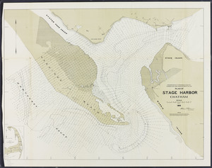
473. Plan of Stage Harbor, Chatham Creator: Board of Harbor and Land Commissioners of Massachusetts Format: Maps/Atlases Collection: Massachusetts Board of Harbor and Land Commissioners Date: 1915 Institution: State Library of Massachusetts
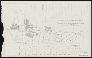
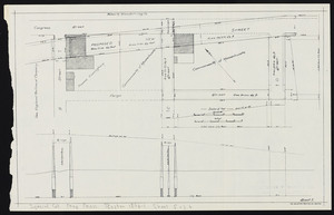
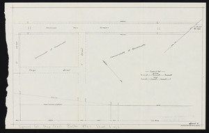
474. Plan of the abolition of the grade crossing: of Congress Street with the New England Railroad. Sheet 1 Creator: Board of Harbor and Land Commissioners of Massachusetts Format: Maps/Atlases Collection: Massachusetts Board of Harbor and Land Commissioners Date: 1896 Institution: State Library of Massachusetts
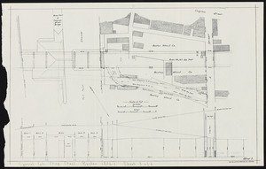
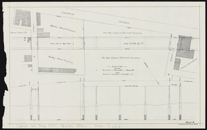
475. Plan of the abolition of the grade crossing: of Congress Street with the New England Railroad. Sheet 2 Creator: Board of Harbor and Land Commissioners of Massachusetts Format: Maps/Atlases Collection: Massachusetts Board of Harbor and Land Commissioners Date: 1896 Institution: State Library of Massachusetts
476. Plan of the abolition of the grade crossing: of Congress Street with the New England Railroad. Sheet 3 Creator: Board of Harbor and Land Commissioners of Massachusetts Format: Maps/Atlases Collection: Massachusetts Board of Harbor and Land Commissioners Date: 1896 Institution: State Library of Massachusetts
477. Plan of the abolition of the grade crossing: of Congress Street with the New England Railroad. Sheet 4 Creator: Board of Harbor and Land Commissioners of Massachusetts Format: Maps/Atlases Collection: Massachusetts Board of Harbor and Land Commissioners Date: 1896 Institution: State Library of Massachusetts
478. Plan of the abolition of the grade crossing: of Congress Street with the New England Railroad. Sheet 5 Creator: Board of Harbor and Land Commissioners of Massachusetts Format: Maps/Atlases Collection: Massachusetts Board of Harbor and Land Commissioners Date: 1896 Institution: State Library of Massachusetts
479. Plan of the abolition of the grade crossing: of Congress Street with the New England Railroad. Sheet 6 Creator: Board of Harbor and Land Commissioners of Massachusetts Format: Maps/Atlases Collection: Massachusetts Board of Harbor and Land Commissioners Date: 1896 Institution: State Library of Massachusetts
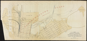
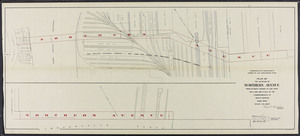
480. Plan of the location of Northern Avenue: from Atlantic Avenue to and over the land and flats of the Commonwealth at South Boston Creator: Board of Harbor and Land Commissioners of Massachusetts Format: Maps/Atlases Collection: Massachusetts Board of Harbor and Land Commissioners Date: 1901 Institution: State Library of Massachusetts