Search


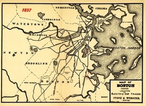
![[Map of Boston and vicinity]](https://bpldcassets.blob.core.windows.net/derivatives/images/commonwealth:9s161d374/image_thumbnail_300.jpg)


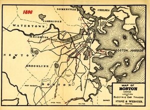
![[Map of Boston and vicinity]](https://bpldcassets.blob.core.windows.net/derivatives/images/commonwealth:wd376691q/image_thumbnail_300.jpg)


Limit your search
- Norman B. Leventhal Map & Education Center Collection221
- Massachusetts Board of Harbor and Land Commissioners202
- Boston and New England Maps (Collection of Distinction)180
- Historic Maps33
- Applied Geographics, Inc. Records19
- David Judkins Weaver Papers19
- American Revolutionary War-Era Maps (Collection of Distinction)12
- Urban Maps (Collection of Distinction)11