Skip to search
Skip to main content
Skip to first result
Digital Commonwealth
Folders
Sign Up / Log In
Search for
Search
Search
Search
Basic
Advanced
Explore
Map
Collections
Institutions
Formats
For Educators
Primary Source Sets
Lesson Plans
Using Primary Sources
Searching Digital Commonwealth
For Institutions
Join Digital Commonwealth
Conferences, Trainings, & Events
How to Contribute Collections
Digitization Services
Board & Committees
Frequently Asked Questions
About
About Digital Commonwealth
News & Announcements
Copyright & Terms of Use
Harmful Content Statement
Partners
API
Contact Us
Search
Search Constraints
Start Over
Save Search
Your search:
More Like
commonwealth-oai:ww72bd325
✖
Remove constraint More Like: commonwealth-oai:ww72bd325
« Prev.
|
141
-
160
of
500
|
Next »
Sort
by relevance
relevance
title
date (asc)
date (desc)
recently added
Number of results to display per page
20
per page
per page
10
per page
20
per page
50
per page
100
per page
View results as:
List
list view
Maps
map view
Gallery
grid view
Search Results
141.
Map of Massachusetts
142.
Map of Massachusetts : to accompany the Massachusetts register & business directory
143.
Map of Massachusetts
144.
Map of Massachusetts
145.
Map of Massachusetts
146.
Map of Massachusetts
147.
Map of Massachusetts and Rhode Island
148.
A map of Massachusetts, exhibiting the boundary lines of each town and county : compiled from the latest authorities, embracing...
149.
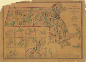
Map of Massachusetts exhibiting the representative, senatorial and councillor districts
150.
Map of Massachusetts, from the best authorities
151.
Map of Massachusetts proper
152.
Map of Massachusetts proper
153.
Map of Massachusetts showing population according to United States Census of 1900 and congressional districts
154.
Map of Massachusetts showing state highways laid out & petitioned for
155.
Map of Massachusetts showing state highways laid out & petitioned for
156.
Map of Massachusetts showing state highways laid out and petitioned for
157.
A map of Massachusetts, showing the congressional districts, as proposed by the Senate of 1852
158.
Map of street railways in eastern Massachusetts
159.
Map of the Boston-Worcester century run
160.
Map of the city and vicinity of Boston Massachusetts
« Previous
Next »
1
2
…
4
5
6
7
8
9
10
11
12
…
24
25
Limit your search
Subject
Massachusetts--Maps
285
Boston (Mass.)--Maps
61
Harbors--Massachusetts--Boston--Maps
59
Connecticut--Maps
47
Railroads--Massachusetts--Maps
40
Rhode Island--Maps
37
Massachusetts
32
Roads--Massachusetts--Maps
18
more
Subject
»
Place
North and Central America
500
United States
482
Massachusetts
474
Suffolk (county)
131
Boston
126
Connecticut
41
Rhode Island
37
Plymouth (county)
33
more
Place
»
Format
Maps/Atlases
454
Books
43
Manuscripts
4
Photographs
2
Prints
1
Available to use
No known restrictions
213
Creative Commons license
12
Date
View distribution
Current results range from
1762
to
2020
Date range begin
Date range end
View larger »
Unknown
3
Collection
Norman B. Leventhal Map & Education Center Collection
221
Massachusetts Board of Harbor and Land Commissioners
202
Boston and New England Maps (Collection of Distinction)
180
Historic Maps
33
Applied Geographics, Inc. Records
19
David Judkins Weaver Papers
19
American Revolutionary War-Era Maps (Collection of Distinction)
12
Urban Maps (Collection of Distinction)
11
more
Collection
»
Institution
State Library of Massachusetts
225
Boston Public Library
221
Salem State University Archives and Special Collections
33
American Antiquarian Society
8
Phillips Academy
8
Private Collection
3
Massachusetts Historical Society
1
Melrose Public Library
1