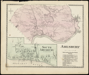
1. Amesbury Creator: D.G. Beers & Co Format: Maps/Atlases Collection: Historic Maps Date: 1872 Institution: Salem State University Archives and Special Collections
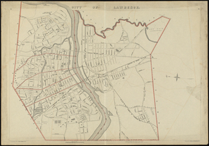
2. The City of Lawrence, Mass. North Side Creator: D.G. Beers & Co Format: Maps/Atlases Collection: Historic Maps Date: 1872 Institution: Salem State University Archives and Special Collections
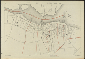
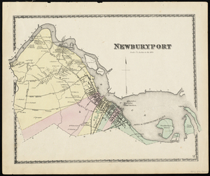
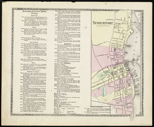
3. City of Newburyport Creator: Geo. H. Walker & Co Format: Maps/Atlases Collection: Historic Maps Date: 1884 Institution: Salem State University Archives and Special Collections
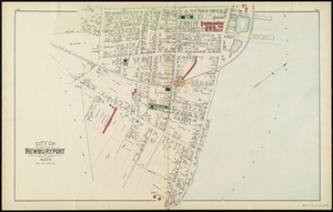
4. City of Newburyport Creator: Geo. H. Walker & Co Format: Maps/Atlases Collection: Historic Maps Date: 1891 Institution: Salem State University Archives and Special Collections
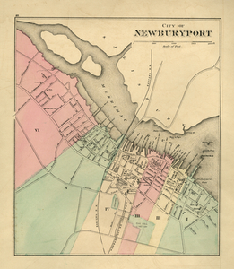
5. City of Newburyport Creator: Walling, Henry Francis; Gray, Ormando Willis Format: Maps/Atlases Collection: Historic Maps Date: 1871 Institution: Salem State University Archives and Special Collections
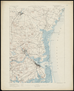
6. Massachusetts-New Hampshire, Newburyport sheet Creator: U.S. Geological Survey Format: Maps/Atlases Collection: Historic Maps Date: 1890 Institution: Salem State University Archives and Special Collections
7. Newburyport Creator: D.G. Beers & Co Format: Maps/Atlases Collection: Historic Maps Date: 1872 Institution: Salem State University Archives and Special Collections
8. Newburyport Creator: D.G. Beers & Co Format: Maps/Atlases Collection: Historic Maps Date: 1872 Institution: Salem State University Archives and Special Collections
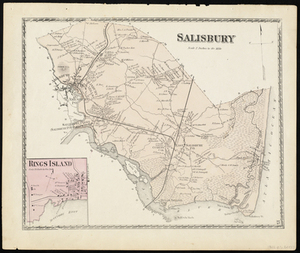
9. Salisbury Creator: D.G. Beers & Co Format: Maps/Atlases Collection: Historic Maps Date: 1872 Institution: Salem State University Archives and Special Collections
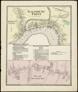
10. Salisbury Point Creator: D.G. Beers & Co Format: Maps/Atlases Collection: Historic Maps Date: 1872 Institution: Salem State University Archives and Special Collections
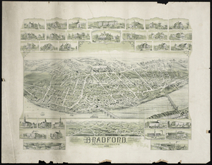
11. Bradford Massachusetts Creator: O.H. Bailey & Co Format: Maps/Atlases Collection: Historic Maps Date: 1892 Institution: Salem State University Archives and Special Collections
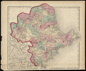
12. Essex County Creator: Walling & Gray Format: Maps/Atlases Collection: Historic Maps Date: 1871 Institution: Salem State University Archives and Special Collections
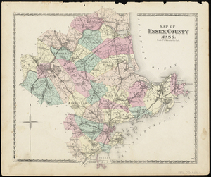
13. Map of Essex County Mass. Creator: D.G. Beers & Co Format: Maps/Atlases Collection: Historic Maps Date: 1872 Institution: Salem State University Archives and Special Collections
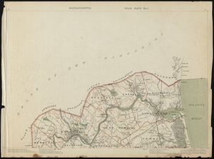
14. Massachusetts. Atlas Plate no. 1 Creator: Geo. H. Walker & Co Format: Maps/Atlases Collection: Historic Maps Date: 1891 Institution: Salem State University Archives and Special Collections
15. Amesbury Creator: D. G. Beers & Co Format: Maps/Atlases Collection: Historic Maps Date: 1872 Institution: Salem State University Archives and Special Collections
16. City of Lawrence Creator: Geo. H. Walker & Co Format: Maps/Atlases Collection: Historic Maps Date: 1891 Institution: Salem State University Archives and Special Collections
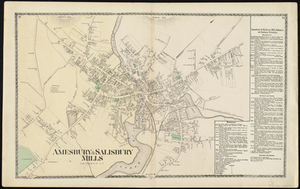
17. Amesbury & Salisbury Mills Creator: D.G. Beers & Co Format: Maps/Atlases Collection: Historic Maps Date: 1872 Institution: Salem State University Archives and Special Collections
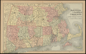
18. Atlas Maps of Massachusetts, Connecticut and Rhode Island, from the Latest Official Surveys. Creator: Gaskell's Family & Business Atlas Format: Maps/Atlases Collection: Historic Maps Date: 1894 Institution: Salem State University Archives and Special Collections
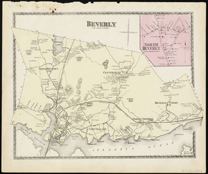
19. Beverly Creator: D.G. Beers & Co Format: Maps/Atlases Collection: Historic Maps Date: 1872 Institution: Salem State University Archives and Special Collections
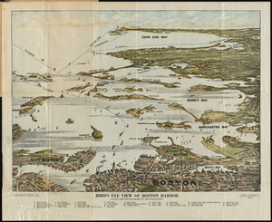
20. Bird's Eye View of Boston Harbor : in Colors, Along the South Shore to Plymouth, Cape Cod Canal and Provincetown Showing All the Steamboat Routes Creator: Union News Company (Boston, Mass.); Federal Engraving & Publishing Co Format: Maps/Atlases Collection: Historic Maps Date: 1920 Institution: Salem State University Archives and Special Collections