Skip to search
Skip to main content
Skip to first result
Digital Commonwealth
Folders
Sign Up / Log In
Search for
Search
Search
Search
Basic
Advanced
Explore
Map
Collections
Institutions
Formats
For Educators
Primary Source Sets
Lesson Plans
Using Primary Sources
Searching Digital Commonwealth
For Institutions
Join Digital Commonwealth
Conferences, Trainings, & Events
How to Contribute Collections
Digitization Services
Board & Committees
Frequently Asked Questions
About
About Digital Commonwealth
News & Announcements
Copyright & Terms of Use
Harmful Content Statement
Partners
API
Contact Us
Search
Search Constraints
Start Over
Save Search
Your search:
More Like
commonwealth-oai:z029pn518
✖
Remove constraint More Like: commonwealth-oai:z029pn518
« Prev. |
1
-
20
of
291
|
Next »
Sort
by relevance
relevance
title
date (asc)
date (desc)
recently added
Number of results to display per page
20
per page
per page
10
per page
20
per page
50
per page
100
per page
View results as:
List
list view
Maps
map view
Gallery
grid view
Search Results
1.
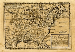
A Map of New France Containing Canada, Louisiana & c. in Nth. America.
2.
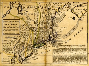
New England, New York, New Jersey and Pensilvania.
3.
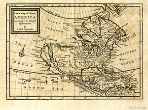
A New Map of North America According to the Newest Observations By H. Moll, Geographer.
4.
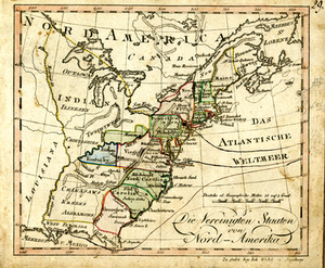
Die Vereinigten Staaten von Nord-Amerika.
5.
[Western Hemisphere]
6.
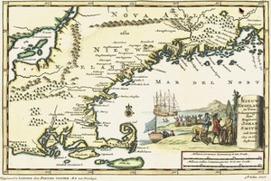
Nieuw Engeland in Twee Scheeptogten door Kapitein Johan Smith inde iaren 1614 en 1615 bestevend
7.
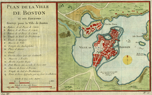
Plan De La Ville De Boston et ses environs
8.
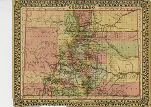
Colorado
9.
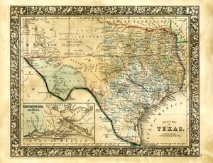
County Map of Texas
10.
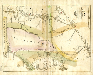
A Map Of The Country Which Was The Scene Of Operations Of the Northern Army: Including The Wilderness Through Which Genl....
11.
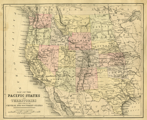
Map of the Pacific States and Territories: With a Part of the Central and Southern States
12.
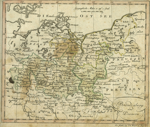
Brandenburg und Pommern
13.
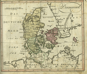
Daenemark
14.
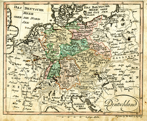
Deutschland
15.
[Eastern Hemisphere]
16.
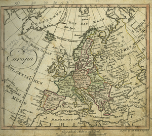
Europa
17.
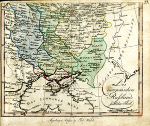
Des Europäischen Russlands Juedlicher Theil.
18.
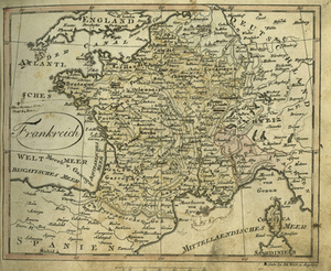
Frankreich
19.
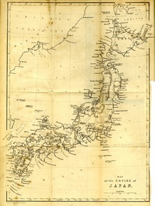
Map of the Empire of Japan.
20.
[Northern Hemisphere]
« Previous
Next »
1
2
3
4
5
…
14
15
Limit your search
Subject
Massachusetts
236
Boston
74
Coastal
73
Essex county
64
Boston (Mass.)--Maps
49
Essex County
38
Massachusetts--Maps
33
Beverly (Mass.)--Maps
29
more
Subject
»
Place
North and Central America
258
United States
246
Massachusetts
238
Essex (county)
98
Boston
65
Suffolk (county)
65
Beverly
30
Newburyport
14
more
Place
»
Format
Maps/Atlases
290
Prints
1
Available to use
No known restrictions
13
Date
View distribution
Current results range from
1684
to
1920
Date range begin
Date range end
View larger »
Unknown
1
Collection
Historic Maps
278
Norman B. Leventhal Map & Education Center Collection
13
Institution
Salem State University Archives and Special Collections
278
Boston Public Library
13
We'd love your feedback!
×
Would you be interested in taking a short survey about Digital Commonwealth?
![[Western Hemisphere]](https://bpldcassets.blob.core.windows.net/derivatives/metadata/commonwealth-oai:jd473360b/image_thumbnail_300.jpg)
![[Eastern Hemisphere]](https://bpldcassets.blob.core.windows.net/derivatives/metadata/commonwealth-oai:n583z209z/image_thumbnail_300.jpg)
![[Northern Hemisphere]](https://bpldcassets.blob.core.windows.net/derivatives/metadata/commonwealth-oai:hh63t345p/image_thumbnail_300.jpg)