Skip to search
Skip to main content
Digital Commonwealth
Sign Up / Log In
Search for
Search
Search
Search
Basic
Advanced
Explore
Map
Collections
Institutions
Formats
For Educators
Primary Source Sets
Lesson Plans
Using Primary Sources
Searching Digital Commonwealth
For Institutions
Join Digital Commonwealth
Conferences, Trainings, & Events
How to Contribute Collections
Digitization Services
Board & Committees
Frequently Asked Questions
About
About Digital Commonwealth
News & Announcements
Copyright & Terms of Use
Harmful Content Statement
Partners
API
Contact Us
Boston Public Library
Norman B. Leventhal Map & Education Center Collection
/
Urban Maps (Collection of Distinction)
/
Boston and New England Maps (Collection of Distinction)
/
Applied Geographics, Inc. Records
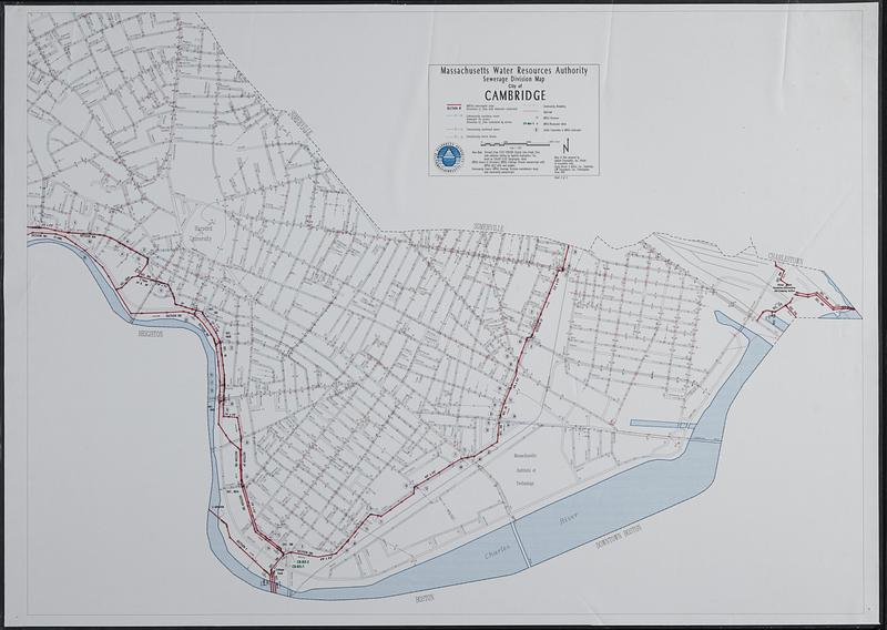
Sewerage division map city of Cambridge
Sewerage division map city of Cambridge
×
Item Information
Title:
Sewerage division map city of Cambridge
Cartographer:
Applied Geographics, Inc.
Publisher:
Massachusetts Water Resources Authority
Name on Item:
Massachusetts Water Resources Authority ; maps & data prepared by Applied Geographics, Inc., Boston in association with Camp Dresser & McKee, Inc., Cambridge, CDW Consultants, Inc., Framingham
Date:
1993
Format:
Maps/Atlases
Location:
Boston Public Library
Norman B. Leventhal Map & Education Center
Collection (local):
Applied Geographics, Inc. Records
Subjects:
Cambridge (Mass.)--Maps
Sewerage--Massachusetts--Cambridge--Maps
Places:
Massachusetts
>
Middlesex (county)
>
Cambridge
Extent:
1 map : color, plastic-coated ; 84 x 117 cm
Permalink:
https://ark.digitalcommonwealth.org/ark:/50959/63961k367
Terms of Use:
No known copyright restrictions.
No known restrictions on use.
Publisher:
Boston : Massachusetts Water Resources Authority
Scale:
Scale 1:4,800
Language:
English
Notes:
Shows interceptor pipes, sewers, storm drains, MWRA structures, MWRA meters, and public connections to MWRA interceptor.
"Sheet 2 of 2."
Identifier:
06_01_018939
Call #:
AppGeo Folder 4 no. 6
Barcode:
30000008056783
show more...
View MODS XML
More Like This
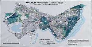
Maximum allowable zoning heights : contrast of zoning heights
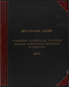
Atlas of Middlesex County. Vol. 1. Cambridge, Somerville, ...
Atlas of the boundaries of the cities of Cambridge, Somerville, ...
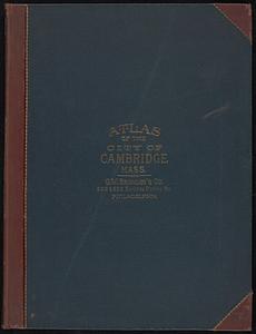
Atlas of the city of Cambridge, Massachusetts
Find More Like This >>
Tools
Share
Facebook
Pinterest
X
Reddit
Tumblr
Email
Copy link
Add to Folder
Questions/Comments
Cite This Item
IIIF Manifest
Downloads
Primary (full resolution, uncompressed)
(TIF, 563 MB)
Large (full resolution)
(JPEG, 47.3 MB)
Medium
(JPEG, 78.1 KB)