New England regional transportation map = Mapa do transporte regional da Nova Inglaterra = Nueva Inglaterra, mapa regional de transporte = Carte de transport régionale de la Nouvelle Angleterre = 新英格蘭區域交通路線圖
New England regional transportation map = Mapa do transporte regional da Nova Inglaterra = Nueva Inglaterra, mapa regional de transporte = Carte de transport régionale de la Nouvelle Angleterre = 新英格蘭區域交通路線圖
Description:
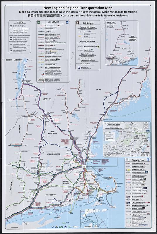
Map of New England showing intercity bus and passenger rail lines and ferry routes.
developed by Massachusetts Department of Transportation in coordination with Connecticut Department of Transportation ; MaineDOT ; New Hampshire Department of Transportation ; RIdot ; VTrans
Includes 3 insets: Maine inset -- Stop locations in downtown Boston -- [Martha's Vineyard ferry routes].
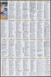
On verso: route diagrams showing station locations, notes, and color illustrations.
Non-Latin script record
Notes (language):
In English, Portuguese, Spanish, Chinese, and French.