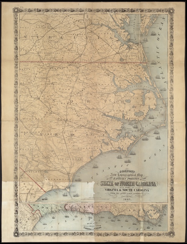
Colton's new topographical map of the eastern portion of the State of North Carolina with part of Virginia & South Carolina from the latest & best authorities
Coltons new topographical map of the eastern portion of the State of North Carolina with part of Virginia & South Carolina from the latest & best authorities
Item Information
Title:
Colton's new topographical map of the eastern portion of the State of North Carolina with part of Virginia & South Carolina from the latest & best authorities
Another issue.
Copyright statement inside the bottom neat line has been changed to read "Entered according to Act of Congress in the year 1861 by J. H. Colton [& Co.]"
Bar scale has been added to this and subsequent issues.
Printed by Lang & Laing, N.Y.
"No. 11" is printed in the upper left corner.
General map. Coastal forts and naval blockade are depicted.
Inset: Plan of the sea coast from Virginia to Florida. 13 x 65 cm.
Description derived from published bibliography.