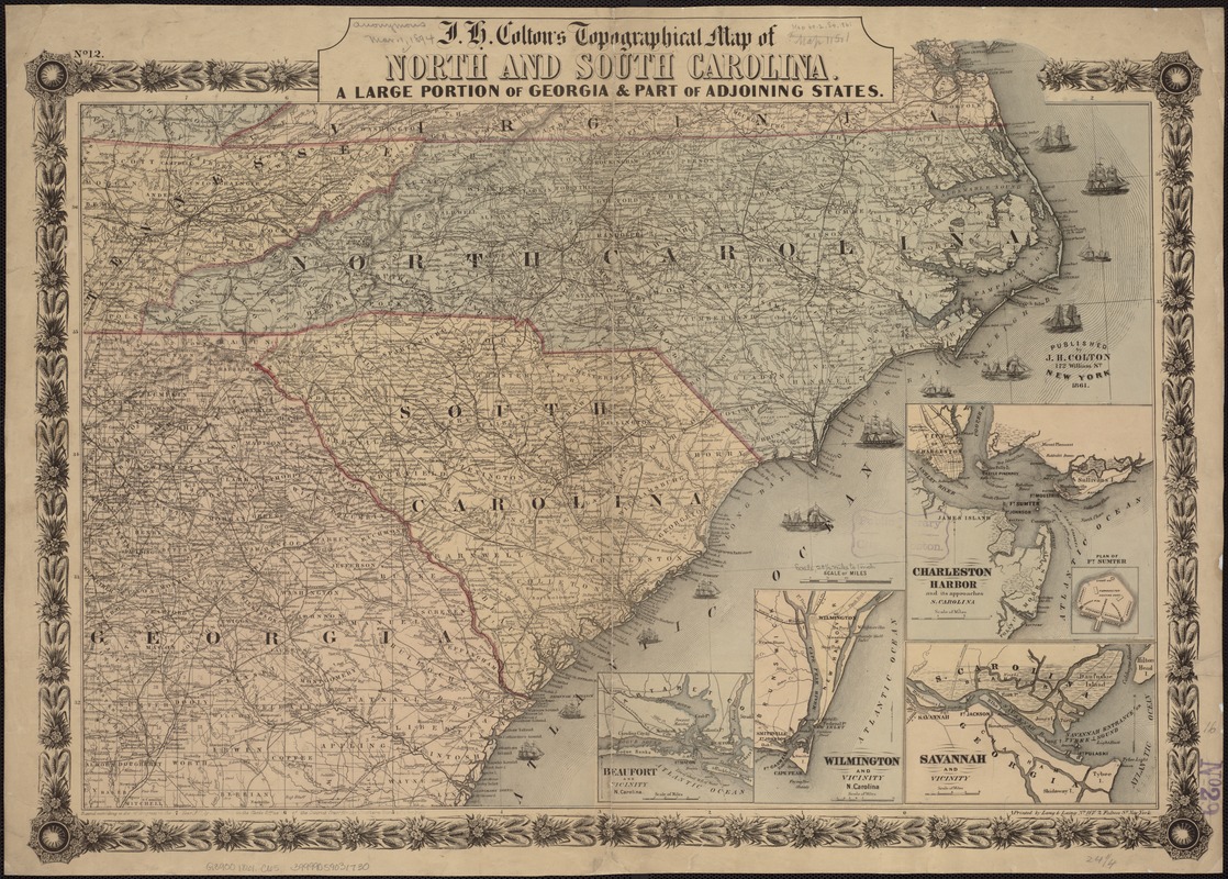
No. 12 in upper left corner.
Copyright no. "410" and the date "Sept. 10, 1861" written in ink in lower margin.
Indicates forts, towns, roads, railroads, county names and boundaries, geographic coordinates, and rivers. Drawings of ships offshore denote naval blockade.
Insets: Beaufort and vicinity, N. Carolina. 8 x 9 cm. -- Wilmington and vicinity, N. Carolina. 13 x 9 cm. -- Charleston Harbor and its approaches, S. Carolina. 14 x 15 cm. -- Plan of Ft. Sumter. 4 x 4 cm.-Savannah and vicinity. 10 x 15 cm.
Description derived from published bibliography.