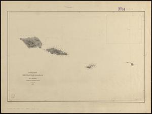
1. Samoan or Navigator Islands Creator: Wilkes, Charles, 1798-1877, Sherman & Smith, and United States Exploring Expedition (1838-1842) Format: Maps/Atlases Collection: Maritime Charts and Atlases (Collection of Distinction) / Norman B. Leventhal Map & Education Center Collection Date: [1839] Institution: Boston Public Library
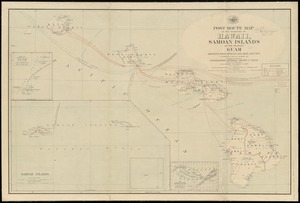
2. Post route map of the territory of Hawaii, Samoan Islands and the island of Guam showing post offices in operation on the 1st of December, 1903 Creator: United States. Post Office Dept Format: Maps/Atlases Collection: Norman B. Leventhal Map & Education Center Collection Date: 1903 Institution: Boston Public Library
3. Spezialkarte der Samoa-Inseln Creator: Langhans, Paul, 1867-1952; Justus Perthes (Firm : Gotha, Germany) Format: Maps/Atlases Collection: Norman B. Leventhal Map & Education Center Collection Date: 1900 Institution: Boston Public Library
4. The 100th anniversary map of Abraham Lincoln's visit to Massachusetts, September 11-23, 1848 Creator: Lufkin, Richard F. (Richard Friend) Format: Maps/Atlases Collection: Norman B. Leventhal Map & Education Center Collection Date: 1948 Institution: Boston Public Library
5. 1630 shoreline Creator: Metropolitan Planning Organization (Mass.). Central Transportation Planning Staff Format: Maps/Atlases Collection: Norman B. Leventhal Map & Education Center Collection Date: 2011 Institution: Boston Public Library
6. 1879. Progress map of the U.S. Geographical Surveys west of the 100th Meridian : prepared under the direction of 1st Lieut. George M. Wheeler, Corps of Engineers U. S.... Creator: Geographical Surveys West of the 100th Meridian (U.S.) Format: Maps/Atlases Collection: Norman B. Leventhal Map & Education Center Collection Date: [1879?] Institution: Boston Public Library
7. 1903 Map of Salem and surrounding places Creator: Henry M. Meek Pub. Co. (Salem, Mass.) Format: Maps/Atlases Collection: Norman B. Leventhal Map & Education Center Collection Date: 1903 Institution: Boston Public Library
8. 19th annual convention of the National Association of Real Estate Boards : at Tulsa, June 7 to June 11 in 1926 Creator: National Association of Real Estate Boards, R.R. Donnelley and Sons Company, and Sahula-Dycke, Ignatz, 1900-1982 Format: Maps/Atlases Collection: Norman B. Leventhal Map & Education Center Collection Date: 1926 Institution: Boston Public Library
9. 2005 significant U.S. hurricane strikes Creator: National Climatic Data Center (U.S.), National Climatic Data Center (U.S.), and United States. National Oceanic and Atmospheric Administration Format: Posters Collection: Norman B. Leventhal Map & Education Center Collection Date: [2005] Institution: Boston Public Library
10. 227 Harzgerode Creator: Prussia (Kingdom). Armee. Grosser Generalstab, Meyer, A., and Ruzek Format: Maps/Atlases Collection: Norman B. Leventhal Map & Education Center Collection Date: 1868 Institution: Boston Public Library
11. 305 Glatz Creator: Prussia (Kingdom). Armee. Grosser Generalstab; Petters, H. Format: Maps/Atlases Collection: Norman B. Leventhal Map & Education Center Collection Date: 1870 Institution: Boston Public Library
12. 38,000,000 escaped -- 10,000,000 died Creator: Russian War Relief, Inc.; Means, E. Format: Maps/Atlases Collection: Norman B. Leventhal Map & Education Center Collection Date: [ca. 1940–1949] Institution: Boston Public Library
13. 4 Kinten Creator: Prussia (Kingdom). Armee. Grosser Generalstab; Siebert, Selmar Format: Maps/Atlases Collection: Norman B. Leventhal Map & Education Center Collection Date: 1860 Institution: Boston Public Library
14. 660 Wakulah St., Roxbury Creator: Boston Redevelopment Authority Format: Maps/Atlases Collection: Boston Redevelopment Authority Collection / Boston and New England Maps (Collection of Distinction) / Norman B. Leventhal Map & Education Center Collection / Urban Maps (Collection of Distinction) Date: May 1989 Institution: Boston Public Library
15. 74 miles on the ocean scenic highway U.S. 1 Creator: Mono Press Company Format: Maps/Atlases Collection: Boston and New England Maps (Collection of Distinction) / Norman B. Leventhal Map & Education Center Collection Date: [ca. 1937] Institution: Boston Public Library
16. [A chart of Boston Bay and vicinity] Creator: Des Barres, Joseph F. W. (Joseph Frederick Wallet), 1722-1824 Format: Maps/Atlases Collection: American Revolutionary War-Era Maps (Collection of Distinction) / Maritime Charts and Atlases (Collection of Distinction) / Norman B. Leventhal Map & Education Center Collection Date: 1776 Institution: Boston Public Library
17. [A chart of New York Island & North River : East River, passage through Hell Gate, Flushing Bay, Hampstead Bay, Oyster, Huntington Bay, Cow Harbour, East Chester... Creator: Des Barres, Joseph F. W. (Joseph Frederick Wallet), 1722-1824 Format: Maps/Atlases Collection: American Revolutionary War-Era Maps (Collection of Distinction) / Norman B. Leventhal Map & Education Center Collection Date: [1770–1779] Institution: Boston Public Library
18. The A.A.A. key road map of continental Europe Creator: American Automobile Association Format: Maps/Atlases Collection: Norman B. Leventhal Map & Education Center Collection Date: 1911 Institution: Boston Public Library
19. Aaron Bohrod's America, its history Creator: Bohrod, Aaron Format: Maps/Atlases Collection: Norman B. Leventhal Map & Education Center Collection Date: 1946 Institution: Boston Public Library
20. ABC pathfinder railway guide map : eastern division Format: Maps/Atlases Collection: Boston and New England Maps (Collection of Distinction) / Norman B. Leventhal Map & Education Center Collection Date: [1880?–1889?] Institution: Boston Public Library


![[A chart of Boston Bay and vicinity]](https://bpldcassets.blob.core.windows.net/derivatives/images/commonwealth:cj82m2976/image_thumbnail_300.jpg)


