Skip to search
Skip to main content
Skip to first result
Digital Commonwealth
Folders
Sign Up / Log In
Search for
Search
Search
Search
Basic
Advanced
Explore
Map
Collections
Institutions
Formats
For Educators
Primary Source Sets
Lesson Plans
Using Primary Sources
Searching Digital Commonwealth
For Institutions
Join Digital Commonwealth
Conferences, Trainings, & Events
How to Contribute Collections
Digitization Services
Board & Committees
Frequently Asked Questions
About
About Digital Commonwealth
News & Announcements
Copyright & Terms of Use
Harmful Content Statement
Partners
API
Contact Us
Search
Search Constraints
Start Over
Save Search
Your search:
More Like
commonwealth:2b88vr376
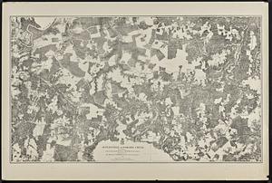
✖
Remove constraint More Like: commonwealth:2b88vr376
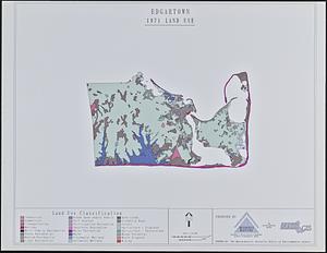
« Prev.
|
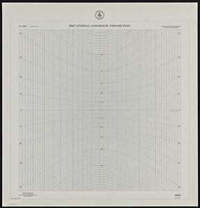
41
-
60
of
121
|
Next »
Sort
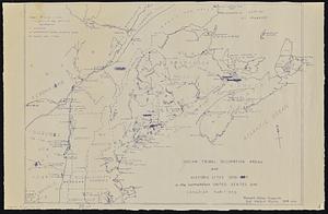
by relevance
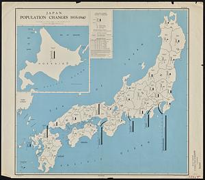
relevance
title
date (asc)
date (desc)
recently added
Number of results to display per page
20
per page
per page
10
per page
20
per page
50
per page
100
per page
View results as:
List
list view
Maps
map view
Gallery
grid view
Search Results
41.
Chesapeake Bay, environmentally sensitive areas
42.
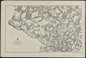
Cold Harbor
43.
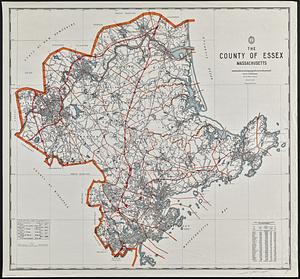
The county of Essex, Massachusetts
44.
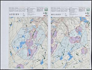
DEP water supply contamination correction program underground storage tank locations compared to natural resource data : Auburn...
45.
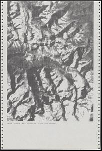
Dot matrix printouts of Landsat satellite images
46.
Edgartown 1971 to 1985 land use change
47.
EOEA MassGIS geographic information system transition document : The EOEA geographic information system: MassGIS
48.
Equatorial gnomonic projection
49.
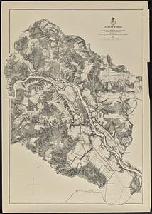
Fredericksburg
50.
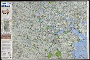
Free 1978 Boston bikemap : featuring an illustrated guide to commuting & recreation
51.
General plan of the MWRA/MDC water system
52.
Gnomonic projection : polar-equatorial
53.
Gulf of Maine watershed : with major river basins
54.
Harper's Ferry
55.
High Bridge and Farmville
56.
Indian tribal occupation areas and historic sites 1500-1600 in the northeastern United States and Canadian Maritimes
57.
Japan, population changes 1935-1940
58.
Jetersville and Sailors Creek
59.
Land use in northern Worcester County, Mass. ; open spaces and protected areas in the northern Worcester County, Mass.
60.
Land use shading test plot shadeset PI and lu21-pi.lut
« Previous
Next »
1
2
3
4
5
6
7
Limit your search
Subject
Gloucester (Mass.)--Maps
23
Massachusetts--Maps
19
United States--History--Civil War, 1861-1865--Maps
10
Essex County (Mass.)--Maps
7
Land use--Massachusetts--Maps
7
Massachusetts
7
Virginia--History--Civil War, 1861-1865--Maps
7
Coastal
6
more
Subject
»
Place
North and Central America
106
United States
104
Massachusetts
73
Essex (county)
28
Gloucester
20
Virginia
13
Boston
9
Suffolk (county)
9
more
Place
»
Format
Maps/Atlases
118
Books
4
Ephemera
2
Documents
1
Posters
1
Available to use
No known restrictions
105
Date
View distribution
Current results range from
1822
to
2015
Date range begin
Date range end
View larger »
Collection
Norman B. Leventhal Map & Education Center Collection
105
David Judkins Weaver Papers
96
Boston and New England Maps (Collection of Distinction)
67
Urban Maps (Collection of Distinction)
13
Historic Maps
8
Massachusetts Board of Harbor and Land Commissioners
4
Massachusetts Real Estate Atlases
4
Institution
Boston Public Library
105
Salem State University Archives and Special Collections
8
State Library of Massachusetts
8