41. Hammond's enlarged map of Europe of to-day showing boundaries of the new states as determined by the peace conference Creator: C.S. Hammond & Company Format: Maps/Atlases Collection: Norman B. Leventhal Map & Education Center Collection Date: [1920] Institution: Boston Public Library
42. Hark! Hark! The dogs do bark! : with note by Walter Emanuel = Horch! Horch! Die hunde bellen! : mit einer begleitschrift von Walter Emanuel Creator: Johnson, Riddle & Co., Emanuel, Walter, 1869-1915, Nölting, W., Zimmermann, E., and G.W. Bacon & Co. Format: Maps/Atlases Collection: Norman B. Leventhal Map & Education Center Collection Date: 1914 Institution: Boston Public Library
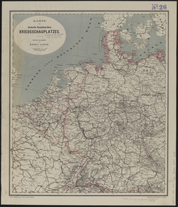
43. Karte des deutsch-französischen kriegsschauplatzes Creator: Lange, Henry, 1821-1893; F.A. Brockhaus Verlag Leipzig Format: Maps/Atlases Collection: Norman B. Leventhal Map & Education Center Collection Date: [1870] Institution: Boston Public Library
44. Karte vom kriegschauplatz Creator: Kümmerly + Frey Format: Maps/Atlases Collection: Norman B. Leventhal Map & Education Center Collection Date: [1914–1918] Institution: Boston Public Library
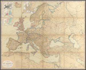
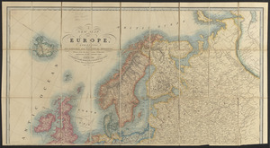
45. Karte von Europa und dem Mittelländischen Meere Creator: Petermann, A. (August), 1822-1878, Bär, J. C., Stülpnagel, F. von, and Justus Perthes (Firm : Gotha, Germany) Format: Maps/Atlases Collection: Norman B. Leventhal Map & Education Center Collection Date: 1867 Institution: Boston Public Library
46. The lesson of the war map Creator: Edward Stanford Ltd. Format: Maps/Atlases Collection: Norman B. Leventhal Map & Education Center Collection Date: [1917?] Institution: Boston Public Library
47. Letts's war map of Central Europe Creator: Letts, Son & Co. Format: Maps/Atlases Collection: Norman B. Leventhal Map & Education Center Collection Date: 1870 Institution: Boston Public Library
48. The Literary Digest liberty map of the Western Front of the Great World War showing the battle line of liberty as it stood September 5th, 1918 : also showing the lines... Creator: Matthews-Northrup Company; Funk & Wagnalls Company Format: Maps/Atlases Collection: Norman B. Leventhal Map & Education Center Collection Date: 1918 Institution: Boston Public Library
49. Map of Europe : drawn from all the best surveys and rectified by astronomical observations Creator: Arrowsmith, A., Tanner, Henry Schenck, 1786-1858, and W. & S. Harrison Format: Maps/Atlases Collection: Norman B. Leventhal Map & Education Center Collection Date: 1831 Institution: Boston Public Library
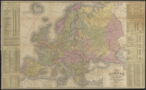
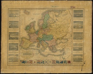
50. Map of Europe : compiled from the latest authorities Creator: Young, J. H. (James Hamilton); Charles Desilver (Firm) Format: Maps/Atlases Collection: Norman B. Leventhal Map & Education Center Collection Date: 1859 Institution: Boston Public Library
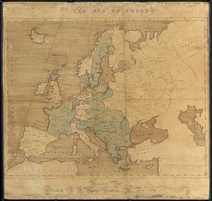
51. The map of Europe Creator: Mann, Elizabeth B. M. Format: Maps/Atlases Collection: Norman B. Leventhal Map & Education Center Collection Date: 1825 Institution: Boston Public Library
52. A map of Europe, and the countries bordering on the Mediterranean & Black Seas, from the latest authorities Creator: Barber, John Warner, 1798-1885 Format: Maps/Atlases Collection: Norman B. Leventhal Map & Education Center Collection Date: 1831 Institution: Boston Public Library
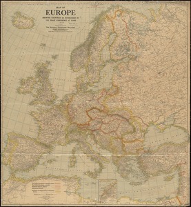
53. Map of Europe showing countries as established by the Peace Conference at Paris Creator: Matthews-Northrup Company Format: Maps/Atlases Collection: Norman B. Leventhal Map & Education Center Collection Date: 1920 Institution: Boston Public Library
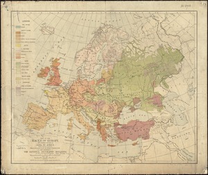
54. Map of the races of Europe and adjoining portions of Asia and Africa Creator: Bumstead, Albert H. (Albert Hoit), 1875-1940 Format: Maps/Atlases Collection: Norman B. Leventhal Map & Education Center Collection Date: 1919 Institution: Boston Public Library
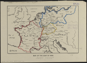
55. Map of the seat of war Creator: Shepherd, G. H. Format: Maps/Atlases Collection: Norman B. Leventhal Map & Education Center Collection Date: [1870–1871] Institution: Boston Public Library
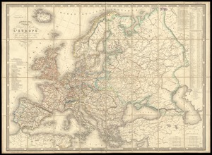
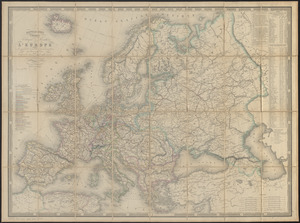
56. Maps of Europe Format: Maps/Atlases Collection: Norman B. Leventhal Map & Education Center Collection Date: [ca. 1870–1879] Institution: Boston Public Library
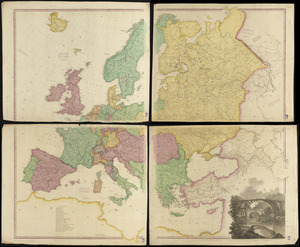
57. Navigation à vapeur dans le bassin de la Méditerranée et chemins de fer de l'Europe Centrale Creator: Chardon, Alfred, -1897, Smith, Rousset, P., and Andriveau-Goujon, E. (Eugène), 1832-1897 Format: Maps/Atlases Collection: Norman B. Leventhal Map & Education Center Collection Date: 1868 Institution: Boston Public Library
58. A new map of Europe, exhibiting its natural and political divisions : drawn from the most recent authorities (improves to the present time) Creator: Cruchley, G. F. Format: Maps/Atlases Collection: Norman B. Leventhal Map & Education Center Collection Date: [1864?] Institution: Boston Public Library
59. Nouvelle carte physique, politique & routière de l'Europe : indiquant les grandes voies de communication par mer et par terre Creator: Chartier, A. T. Format: Maps/Atlases Collection: Norman B. Leventhal Map & Education Center Collection Date: 1867 Institution: Boston Public Library
60. Nouvelle carte physique, politique & routière de l'Europe : indiquant les grandes voies de communication par mer et par terre Creator: Chartier, A. T., Logerot, A. (Auguste), and Mangeon Format: Maps/Atlases Collection: Norman B. Leventhal Map & Education Center Collection Date: 1867 Institution: Boston Public Library