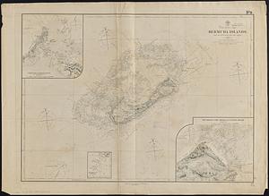
1. North Atlantic Ocean, Bermuda Islands : from the most recent Brit. Admty. surveys, 1877 Creator: United States. Hydrographic Office Format: Maps/Atlases Collection: Maritime Charts and Atlases (Collection of Distinction) / Norman B. Leventhal Map & Education Center Collection Date: [1889] Institution: Boston Public Library
2. A map of the Bermuda Islands : ya des demonios, isles of the devils Creator: Shurtleff, Elizabeth, 1890-, Shurtleff, Elizabeth, 1890-, McMillin, Elizabeth L., McMillin, Helen F., Graphic History Association, and Tudor Press Format: Maps/Atlases Collection: Norman B. Leventhal Map & Education Center Collection Date: 1930 Institution: Boston Public Library
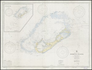
3. North Atlantic Ocean, Bermuda Islands : from British surveys to 1926, with additions and corrections to 1936 Creator: United States. Hydrographic Office Format: Maps/Atlases Collection: Norman B. Leventhal Map & Education Center Collection Date: 1938 Institution: Boston Public Library
4. The British governments in Nth. America : laid down agreeable to the proclamation of Octr. 7, 1763 Creator: Gibson, J. (John), active 1750-1792 Format: Maps/Atlases Collection: American Antiquarian Society Collection / American Revolutionary War-Era Maps (Collection of Distinction) Date: [1763] Institution: American Antiquarian Society
5. Les Isles Antilles et le Golfe du Méxique Creator: Bonne, Rigobert, 1727-1794 Format: Maps/Atlases Collection: American Antiquarian Society Collection / American Revolutionary War-Era Maps (Collection of Distinction) Date: [1780?] Institution: American Antiquarian Society
6. The 100th anniversary map of Abraham Lincoln's visit to Massachusetts, September 11-23, 1848 Creator: Lufkin, Richard F. (Richard Friend) Format: Maps/Atlases Collection: Norman B. Leventhal Map & Education Center Collection Date: 1948 Institution: Boston Public Library
7. 1630 shoreline Creator: Metropolitan Planning Organization (Mass.). Central Transportation Planning Staff Format: Maps/Atlases Collection: Norman B. Leventhal Map & Education Center Collection Date: 2011 Institution: Boston Public Library
8. 1879. Progress map of the U.S. Geographical Surveys west of the 100th Meridian : prepared under the direction of 1st Lieut. George M. Wheeler, Corps of Engineers U. S.... Creator: Geographical Surveys West of the 100th Meridian (U.S.) Format: Maps/Atlases Collection: Norman B. Leventhal Map & Education Center Collection Date: [1879?] Institution: Boston Public Library
9. 1903 Map of Salem and surrounding places Creator: Henry M. Meek Pub. Co. (Salem, Mass.) Format: Maps/Atlases Collection: Norman B. Leventhal Map & Education Center Collection Date: 1903 Institution: Boston Public Library
10. 19th annual convention of the National Association of Real Estate Boards : at Tulsa, June 7 to June 11 in 1926 Creator: National Association of Real Estate Boards, R.R. Donnelley and Sons Company, and Sahula-Dycke, Ignatz, 1900-1982 Format: Maps/Atlases Collection: Norman B. Leventhal Map & Education Center Collection Date: 1926 Institution: Boston Public Library
11. 2005 significant U.S. hurricane strikes Creator: National Climatic Data Center (U.S.), National Climatic Data Center (U.S.), and United States. National Oceanic and Atmospheric Administration Format: Posters Collection: Norman B. Leventhal Map & Education Center Collection Date: [2005] Institution: Boston Public Library
12. 227 Harzgerode Creator: Prussia (Kingdom). Armee. Grosser Generalstab, Meyer, A., and Ruzek Format: Maps/Atlases Collection: Norman B. Leventhal Map & Education Center Collection Date: 1868 Institution: Boston Public Library
13. 305 Glatz Creator: Prussia (Kingdom). Armee. Grosser Generalstab; Petters, H. Format: Maps/Atlases Collection: Norman B. Leventhal Map & Education Center Collection Date: 1870 Institution: Boston Public Library
14. 38,000,000 escaped -- 10,000,000 died Creator: Russian War Relief, Inc.; Means, E. Format: Maps/Atlases Collection: Norman B. Leventhal Map & Education Center Collection Date: [ca. 1940–1949] Institution: Boston Public Library
15. 4 Kinten Creator: Prussia (Kingdom). Armee. Grosser Generalstab; Siebert, Selmar Format: Maps/Atlases Collection: Norman B. Leventhal Map & Education Center Collection Date: 1860 Institution: Boston Public Library
16. 660 Wakulah St., Roxbury Creator: Boston Redevelopment Authority Format: Maps/Atlases Collection: Boston Redevelopment Authority Collection / Boston and New England Maps (Collection of Distinction) / Norman B. Leventhal Map & Education Center Collection / Urban Maps (Collection of Distinction) Date: May 1989 Institution: Boston Public Library
17. 74 miles on the ocean scenic highway U.S. 1 Creator: Mono Press Company Format: Maps/Atlases Collection: Boston and New England Maps (Collection of Distinction) / Norman B. Leventhal Map & Education Center Collection Date: [ca. 1937] Institution: Boston Public Library
18. [A chart of Boston Bay and vicinity] Creator: Des Barres, Joseph F. W. (Joseph Frederick Wallet), 1722-1824 Format: Maps/Atlases Collection: American Revolutionary War-Era Maps (Collection of Distinction) / Maritime Charts and Atlases (Collection of Distinction) / Norman B. Leventhal Map & Education Center Collection Date: 1776 Institution: Boston Public Library
19. [A chart of New York Island & North River : East River, passage through Hell Gate, Flushing Bay, Hampstead Bay, Oyster, Huntington Bay, Cow Harbour, East Chester... Creator: Des Barres, Joseph F. W. (Joseph Frederick Wallet), 1722-1824 Format: Maps/Atlases Collection: American Revolutionary War-Era Maps (Collection of Distinction) / Norman B. Leventhal Map & Education Center Collection Date: [1770–1779] Institution: Boston Public Library
20. The A.A.A. key road map of continental Europe Creator: American Automobile Association Format: Maps/Atlases Collection: Norman B. Leventhal Map & Education Center Collection Date: 1911 Institution: Boston Public Library


![[A chart of Boston Bay and vicinity]](https://bpldcassets.blob.core.windows.net/derivatives/images/commonwealth:cj82m2976/image_thumbnail_300.jpg)

