Skip to search
Skip to main content
Skip to first result
Digital Commonwealth
Folders
Sign Up / Log In
Search for
Search
Search
Search
Basic
Advanced
Explore
Map
Collections
Institutions
Formats
For Educators
Primary Source Sets
Lesson Plans
Using Primary Sources
Searching Digital Commonwealth
For Institutions
Join Digital Commonwealth
Conferences, Trainings, & Events
How to Contribute Collections
Digitization Services
Board & Committees
Frequently Asked Questions
About
About Digital Commonwealth
News & Announcements
Copyright & Terms of Use
Harmful Content Statement
Partners
API
Contact Us
Search
Search Constraints
Start Over
Save Search
Your search:
More Like
commonwealth:hq37vv584
✖
Remove constraint More Like: commonwealth:hq37vv584
« Prev.
|
121
-
140
of
163
|
Next »
Sort
by relevance
relevance
title
date (asc)
date (desc)
recently added
Number of results to display per page
20
per page
per page
10
per page
20
per page
50
per page
100
per page
View results as:
List
list view
Maps
map view
Gallery
grid view
Search Results
121.
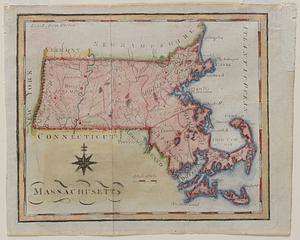
Massachusetts
122.
Massachusetts
123.
Massachusetts and Rhode Island
124.
A new and accurate map of the colony of Massachusets Bay, in North America, from a late survey
125.
A new and accurate map of the present seat of war in North America : from a late survey
126.
New England and New York
127.
New England and New York
128.
New Englands prospect : A true, lively, and experimentall description of that part of America, commonly called New England:...
129.
A new map of the most considerable plantations of the English in America
130.
The north part of America : conteyning Newfoundland, new England, Virginia, Florida, new Spaine, and Noua Francia wth ye rich...
131.
Nouvelle Angleterre et Nouvel York
132.
Novae insulae XVII, nova tabula
133.
Oceani occidetalis seu terre nove tabula
134.
Old Colony & Newport railway and its connections
135.
Old Colony Railroad and connections
136.
Pars Prima. Speculum Nauticum super navigatione maris Occidentalis confectum, continens omnes oras maritimas Gallia, Hispaniae...
137.
Part of east New Jarsey, New York, and Connecticut
138.
Partie de la carte du Capitaine Cluny, auteur d'un ouvrage anglois intitulé American Traveller publié à Londres en 1769
139.
Pascaert van Nieu Nederland van Hendrick Christiaens Eijland tot staten hoeck of Cabo Cod
140.
Pas-caert van Nieu Nederland, Virginia, Nieu Engeland als mede Penn-silvania, met de stad Philadelfia van Baston tot Carrik = a...
« Previous
Next »
1
2
3
4
5
6
7
8
9
Limit your search
Subject
World maps--Early works to 1800
76
New England--Maps--Early works to 1800
15
America--Maps--Early works to 1800
11
Massachusetts--Maps
8
North America--Maps--Early works to 1800
8
Western Hemisphere--Maps--Early works to 1800
8
Connecticut--Maps--Early works to 1800
5
Cook, James, 1728-1779
5
more
Subject
»
Place
World
69
North and Central America
50
United States
37
New England
21
Massachusetts
17
Rhode Island
8
New York
7
North America
7
more
Place
»
Format
Maps/Atlases
163
Manuscripts
2
Books
1
Available to use
No known restrictions
45
Creative Commons license
19
Date
View distribution
Current results range from
1478
to
1990
Date range begin
Date range end
View larger »
Collection
Sidney R. Knafel Map Collection at Phillips Academy
99
Norman B. Leventhal Map & Education Center Collection
64
American Revolutionary War-Era Maps (Collection of Distinction)
29
Mapping Boston Collection
19
Institution
Phillips Academy
99
Boston Public Library
45
Private Collection
19