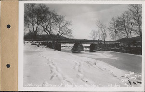
Skip to search
Skip to main content
Skip to first result
Digital Commonwealth
Folders
Sign Up / Log In
Search for
Search
Search
Search
Basic
Advanced
Explore
Map
Collections
Institutions
Formats
For Educators
Primary Source Sets
Lesson Plans
Using Primary Sources
Searching Digital Commonwealth
For Institutions
Join Digital Commonwealth
Conferences, Trainings, & Events
How to Contribute Collections
Digitization Services
Board & Committees
Frequently Asked Questions
About
About Digital Commonwealth
News & Announcements
Copyright & Terms of Use
Harmful Content Statement
Partners
API
Contact Us
Search
Search Constraints
Start Over
Save Search
Your search:
More Like
commonwealth:qr46t620b
✖
Remove constraint More Like: commonwealth:qr46t620b
« Prev. |
1
-
20
of
20,085
|
Next »
Sort
by relevance
relevance
title
date (asc)
date (desc)
recently added
Number of results to display per page
20
per page
per page
10
per page
20
per page
50
per page
100
per page
View results as:
List
list view
Maps
map view
Gallery
grid view
Search Results
1.
Looking downstream at Cabot's Bridge, Enfield, Mass., Dec. 9, 1929
2.
Looking downstream at Enfield bridge, Enfield, Mass., Dec. 9, 1929
3.
Looking downstream at Enfield-Belchertown bridge, Mass., Dec. 9, 1929
4.
Looking downstream at "Red Bridge," West Ware, Mass., Dec. 9, 1929
5.
Looking downstream at West Ware Bridge, Mass., Dec. 9, 1929
6.
Looking upstream at Cabot's Bridge, Enfield, Mass., Dec. 9, 1929
7.
Looking upstream at Enfield bridge, Enfield, Mass., Dec. 9, 1929
8.
Looking upstream at Enfield-Belchertown bridge, Mass., Dec. 9, 1929
9.
Looking upstream at "Red Bridge," West Ware, Mass., Dec. 9, 1929
10.
Looking upstream at West Ware Bridge, Mass., Dec. 9, 1929
11.
Swift River, 1 mile below dam site, looking downstream, bridge at West Ware, Ware, Mass., Oct. 21, 1929
12.
Ware River above diversion, looking upstream at highway bridge, Ware River, Mass., Oct. 22, 1929
13.
Ware River below diversion, looking downstream at highway bridge, Ware River, Mass., Oct. 22, 1929
14.
Chicopee and Connecticut Rivers, Dana S. Coutney [Courtney] Co., hydroelectric station, elevation of water surface = 62.7,...
15.
Highway bridge above Ware River Intake, drainage area = 98 square miles, flow = 1315 cubic feet per second = 13.4 cubic feet...
16.
Quaboag River at bridge on Palmer Three Rivers Road, drainage area = 210 square miles, flow 1240 cubic feet per second = 5.9...
17.
Ware River at Gibbs Crossing, former bridge site, Thorndike, Palmer, Mass., 3:15 PM, Mar. 19, 1936
18.
Ware River at washed out bridge on Route #68 at North Rutland, looking southerly, Rutland, Mass., Mar. 31, 1936 : Parcel no. 168-
19.
Ware River, showing washout at the East Street bridge, Ware, Mass., 1:20 PM, Mar. 19, 1936
20.
Ware River, washed out bridge on Route #68 at North Rutland, looking southwesterly, Rutland, Mass., Mar. 31, 1936 : Parcel no....
« Previous
Next »
1
2
3
4
5
…
1,004
1,005
Limit your search
Subject
waterworks
19,971
reservoirs (water distribution structures)
11,159
real estate
8,745
construction sites
7,824
residential structures
2,743
cemeteries
2,239
dams (hydraulic structures)
1,974
general views
1,888
more
Subject
»
Place
North and Central America
20,069
United States
20,066
Massachusetts
19,048
Worcester (county)
10,414
Hampshire (county)
3,018
Middlesex (county)
3,014
Clinton
1,896
West Boylston
1,794
more
Place
»
Format
Photographs
19,902
Maps/Atlases
112
Ephemera
22
Prints
21
Objects/Artifacts
12
Postcards/Cards
11
Documents
7
Paintings
5
more
Format
»
Available to use
No known restrictions
19,971
Date
View distribution
Current results range from
1658
to
2016
Date range begin
Date range end
View larger »
Unknown
34
Collection
Massachusetts Metropolitan Water Works Photograph Collection, 1876-1930 (bulk, 1895-1921)
8,963
Massachusetts Metropolitan District Water Supply Commission, Quabbin Reservoir, Photographs of Contract Construction (selections from), 1928-1947
3,784
Massachusetts Metropolitan District Water Supply Commission, Quabbin Reservoir, Photographs of Real Estate in the Swift River Valley, and of General Engineering of Quabbin Reservoir, 1927-1950
3,004
Massachusetts Metropolitan District Water Supply Commission, Quabbin Reservoir, Photographs of Cemeteries, 1928-1945
2,112
Massachusetts Metropolitan District Water Supply Commission, Quabbin Reservoir, Photographs of Real Estate, Sanitary Conditions, and Flooding in the Ware River Watershed, and of General Engineering, 1928-1948
2,035
Massachusetts Metropolitan Water Works Wachusett Reservoir Land Survey Plans Indexing Real Estate Photographs, 1896-1898
72
General photographic collection (PC001)
31
Digitized Museum Collections
22
more
Collection
»
Institution
Massachusetts Archives
19,897
Historic New England
114
Massachusetts Department of Conservation and Recreation, Office of Watershed Management, Wachusett Watershed Office, West Boylston
72
Massachusetts Department of Conservation and Recreation
2
We'd love your feedback!
×
Would you be interested in taking a short survey about Digital Commonwealth?