Skip to search
Skip to main content
Digital Commonwealth
Sign Up / Log In
Search for
Search
Search
Search
Basic
Advanced
Explore
Map
Collections
Institutions
Formats
For Educators
Primary Source Sets
Lesson Plans
Using Primary Sources
Searching Digital Commonwealth
For Institutions
Join Digital Commonwealth
Conferences, Trainings, & Events
How to Contribute Collections
Digitization Services
Board & Committees
Frequently Asked Questions
About
About Digital Commonwealth
News & Announcements
Copyright & Terms of Use
Harmful Content Statement
Partners
API
Contact Us
Boston Public Library
Norman B. Leventhal Map & Education Center Collection
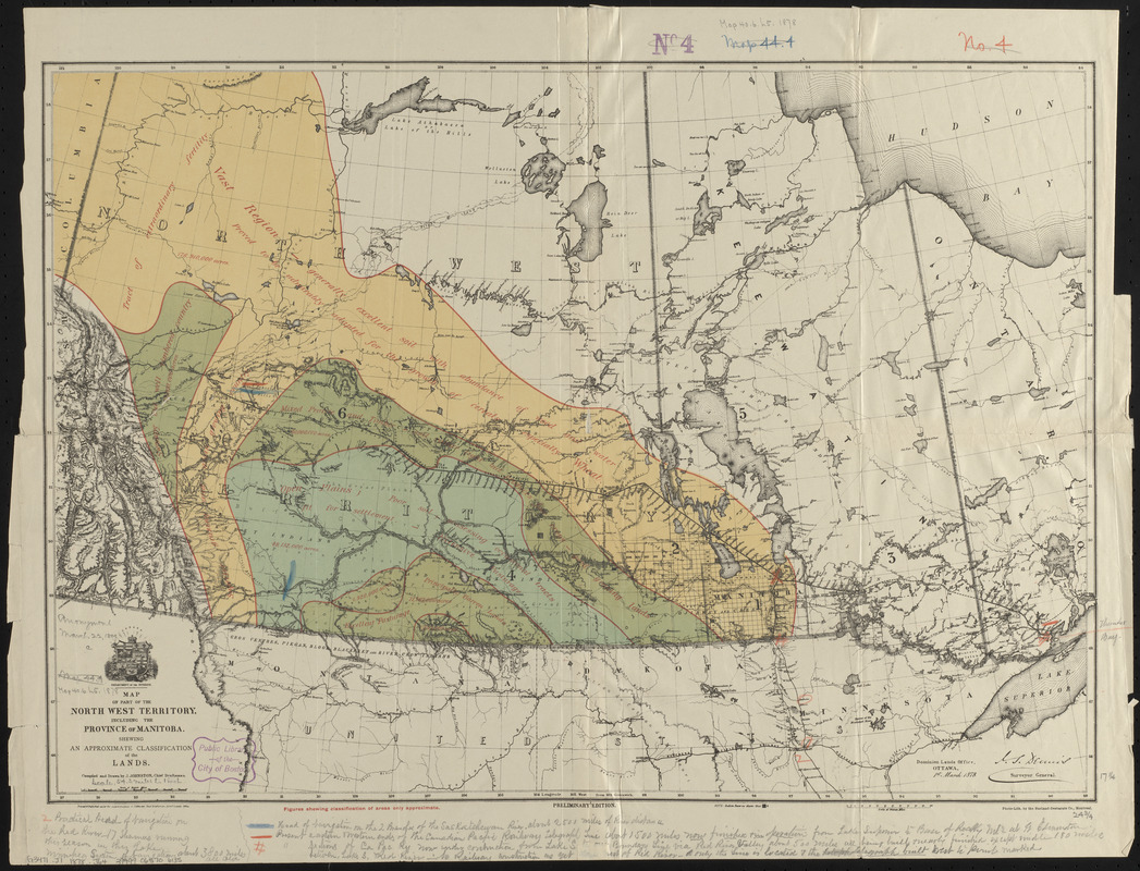
Map of part of the North West Territory, including the province of Manitoba : shewing an approximate classification of the lands
Map of part of the North West Territory, including the province of Manitoba
×
Item Information
Title:
Map of part of the North West Territory, including the province of Manitoba : shewing an approximate classification of the lands
Cartographer:
Johnston, J.
Lithographer:
Burland-Desbarats Company
Publisher:
Canada. Department of the Interior
Name on Item:
compiled and drawn by J. Johnston, chief draftsman ; Department of the Interior
Date:
1878
Format:
Maps/Atlases
Location:
Boston Public Library
Norman B. Leventhal Map & Education Center
Collection (local):
Norman B. Leventhal Map & Education Center Collection
Subjects:
Soils--Prairie Provinces--Classification--Maps
Land capability for agriculture--Prairie Provinces--Maps
Land capability for agriculture--Alberta--Maps
Land capability for agriculture--Saskatchewan--Maps
Land capability for agriculture--Manitoba--Maps
Prairie Provinces--Maps
Bathymetric maps
Places:
Canada
>
Province of Alberta
(province)
Extent:
1 map : color ; 44 x 63 cm
Permalink:
https://ark.digitalcommonwealth.org/ark:/50959/0z7092823
Terms of Use:
No known copyright restrictions.
No known restrictions on use.
Publisher:
Ottawa ; Montreal : Dominion Lands Office ; Burland-Desbarats Co.
Edition:
Preliminary edition
Scale:
Scale approximately 1:3,500,000
Language:
English
Notes:
Relief shown by hachures and spot heights.
Identifier:
06_01_014849
Call #:
G3471.J1 1878 .J64
Barcode:
39999065706135
show more...
View MODS XML
More Like This
Hydrographic map of Delavan and Lauderdale Lakes Walworth Co. ...
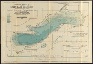
Hydrographic map of Green Lake, Wisconsin
Map of Manitoba, Saskatchewan & Alberta : showing the number of ...
Map of Manitoba, Saskatchewan and Alberta : showing the number of ...
Find More Like This >>
Tools
Share
Facebook
Pinterest
X
Reddit
Tumblr
Email
Copy link
Add to Folder
Questions/Comments
Cite This Item
IIIF Manifest
Downloads
Primary (full resolution, uncompressed)
(TIF, 77.4 MB)
Large (full resolution)
(JPEG, 6.5 MB)
Medium
(JPEG, 375 KB)