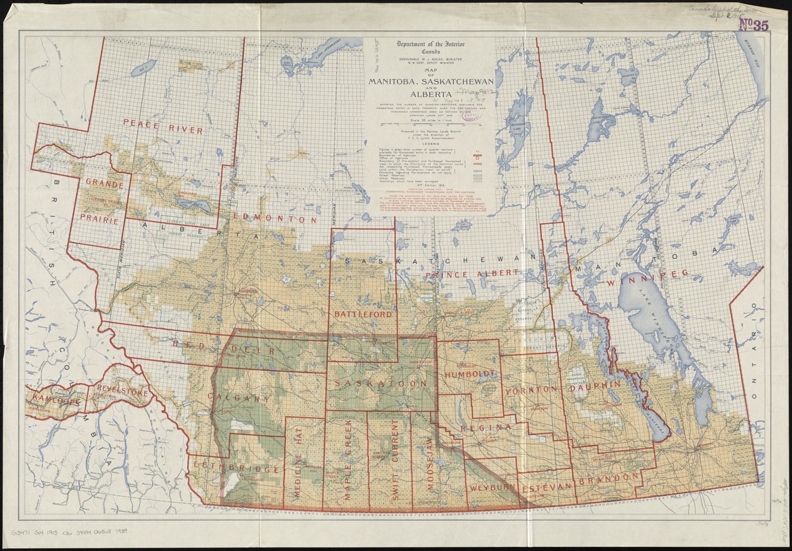
Map of Manitoba, Saskatchewan and Alberta : showing the number of quarter-sections available for homestead entry in each township, also the pre-emption and purchased homestead area as defined by the Dominion Lands Act, 1908
Map of Manitoba, Saskatchewan and Alberta
Item Information
Title:
Map of Manitoba, Saskatchewan and Alberta : showing the number of quarter-sections available for homestead entry in each township, also the pre-emption and purchased homestead area as defined by the Dominion Lands Act, 1908
Shows number of quarter sections, boundaries of agencies, offices of agencies, homesteads to which provisions apply, forest reserves, indian reserves and townships surveyed.
Relief shown by hachures.