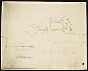
Skip to search
Skip to main content
Skip to first result
Digital Commonwealth
Folders
Sign Up / Log In
Search for
Search
Search
Search
Basic
Advanced
Explore
Map
Collections
Institutions
Formats
For Educators
Primary Source Sets
Lesson Plans
Using Primary Sources
Searching Digital Commonwealth
For Institutions
Join Digital Commonwealth
Conferences, Trainings, & Events
How to Contribute Collections
Digitization Services
Board & Committees
Frequently Asked Questions
About
About Digital Commonwealth
News & Announcements
Copyright & Terms of Use
Harmful Content Statement
Partners
API
Contact Us
Search
Search Constraints
Start Over
Save Search
Your search:
More Like
commonwealth:db78x255k
✖
Remove constraint More Like: commonwealth:db78x255k
« Prev.
|
281
-
300
of
421
|
Next »
Sort
by relevance
relevance
title
date (asc)
date (desc)
recently added
Number of results to display per page
20
per page
per page
10
per page
20
per page
50
per page
100
per page
View results as:
List
list view
Maps
map view
Gallery
grid view
Search Results
281.
A plan of a part of Charlestown and Cambridge showing two routes for the Charlestown Branch Railroad with a part of Boston to...
282.
Plan of Mount Auburn
283.
Plan of [railroad] branch to old Cambridge / Felton and Parker's Office.
284.
Plan of the cemetery of Mount Auburn
285.
Proposed Charles River Park
286.
Proposed Charles River Park
287.
Sewerage division map city of Cambridge
288.
Atlas, city of Everett, Middlesex County, Massachusetts
289.
Atlas of Attleboro town, Massachusetts
290.
Atlas of Barnstable County, Massachusetts : towns of Bourne, Mashpee, Falmouth, Sandwich, Barnstable, Yarmouth, Dennis,...
291.
Atlas of Berkshire County, Massachusetts
292.
Atlas of Brookfield, West Brookfield and North Brookfield towns, Massachusetts
293.
Atlas of Cape Ann, Gloucester, Rockport and Manchester, Essex County, Mass
294.
Atlas of Dorchester, West Roxbury, and Brighton, City of Boston
295.
Atlas of Fall River City, Massachusetts
296.
Atlas of Franklin Co., Massachusetts : from actual surveys
297.
Atlas of Gardner town, Massachusetts
298.
Atlas of Greenfield town, Massachusetts
299.
Atlas of Haverhill and Bradford, Massachusetts
300.
Atlas of Holyoke City, Massachusetts
« Previous
Next »
1
2
…
11
12
13
14
15
16
17
18
19
…
21
22
Limit your search
Subject
Cambridge (Mass.)--Maps
283
Real property--Massachusetts--Cambridge--Maps
220
Landowners--Massachusetts--Cambridge--Maps
194
Real property--Massachusetts--Boston--Maps
37
Fire risk assessment--Massachusetts--Cambridge--Maps
36
Landowners--Massachusetts--Boston--Maps
35
Buildings--Massachusetts--Boston--Maps
34
Boston (Mass.)--Maps
22
more
Subject
»
Place
North and Central America
420
United States
417
Middlesex (county)
301
Massachusetts
282
Cambridge
279
Suffolk (county)
54
Boston
52
Essex (county)
28
more
Place
»
Format
Maps/Atlases
421
Manuscripts
1
Available to use
No known restrictions
267
Creative Commons license
1
Date
View distribution
Current results range from
1831
to
2008
Date range begin
Date range end
View larger »
Unknown
3
Collection
Norman B. Leventhal Map & Education Center Collection
268
Boston and New England Maps (Collection of Distinction)
262
Urban Maps (Collection of Distinction)
261
Massachusetts Real Estate Atlases
143
Massachusetts Board of Railroad Commissioners
5
Historic Maps
3
Applied Geographics, Inc. Records
2
Massachusetts Board of Harbor and Land Commissioners
2
Institution
Boston Public Library
268
State Library of Massachusetts
150
Salem State University Archives and Special Collections
3