Skip to search
Skip to main content
Skip to first result
Digital Commonwealth
Folders
Sign Up / Log In
Search for
Search
Search
Search
Basic
Advanced
Explore
Map
Collections
Institutions
Formats
For Educators
Primary Source Sets
Lesson Plans
Using Primary Sources
Searching Digital Commonwealth
For Institutions
Join Digital Commonwealth
Conferences, Trainings, & Events
How to Contribute Collections
Digitization Services
Board & Committees
Frequently Asked Questions
About
About Digital Commonwealth
News & Announcements
Copyright & Terms of Use
Harmful Content Statement
Partners
API
Contact Us
Search
Search Constraints
Start Over
Save Search
Your search:
More Like
commonwealth:th83pn50p
✖
Remove constraint More Like: commonwealth:th83pn50p
« Prev. |
1
-
20
of
182
|
Next »
Sort
by relevance
relevance
title
date (asc)
date (desc)
recently added
Number of results to display per page
20
per page
per page
10
per page
20
per page
50
per page
100
per page
View results as:
List
list view
Maps
map view
Gallery
grid view
Search Results
1.
Central Westport Homesteads (Crane Survey)
2.
Dartmouth Surveys
3.
Southern New Bedford and Dartmouth Homesteads (Crane Survey)
4.
Southwest Fairhaven (Crane Survey)
5.
Unfinished Southern New Bedford and Dartmouth Homesteads (Crane Survey)
6.
Western Dartmouth (Crane Survey)
7.
Chadwich Farms
8.
The Common
9.
George Howland - Allen St.
10.
Green and Hitchnill Streets
11.
Henry H. Crapo Surveys
12.
Lots in Dispute (Heirs of James Tripp and Joshua Pottere)
13.
Lots of Seth Russell
14.
Map of Bridgewater, Mass
15.
Map of Bristol County Massachusetts
16.
Map of Madman's Neck being a part of 16/ Purchase
17.
Map of the Town of Dartmouth, Bristol County Mass
18.
A Plan of South Boston
19.
Plan of the 26 Men's Purchase in Middleborough
20.
Plan of the Ten Acre Lot sold by Joseph Russell of Dartmouth to Joseph Rotch of Nantucket May 28th 1765
« Previous
Next »
1
2
3
4
5
…
9
10
Limit your search
Subject
Landowners
37
Military topography
11
1700–1799
10
Election districts
9
Railroads
9
Whales
8
Whaling
8
Real property
5
more
Subject
»
Place
North and Central America
133
United States
127
Massachusetts
99
Bristol (county)
66
New Bedford
47
Dartmouth
22
Europe
19
Pacific Ocean
10
more
Place
»
Format
Maps/Atlases
177
Manuscripts
57
Paintings
2
Books
1
Letters/Correspondence
1
Prints
1
Available to use
Creative Commons license
175
Date
View distribution
Current results range from
1695
to
2000
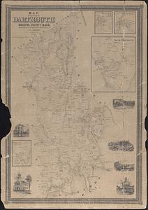
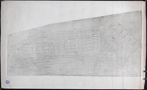
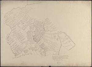
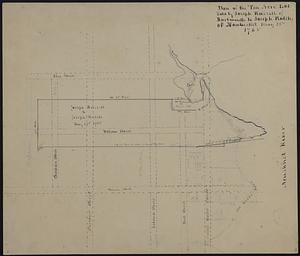
Date range begin
Date range end
View larger »
Collection
Map and Chart Collection
172
Campus Maps from Phillips Academy Archives and Special Collections
4
Selected items from the collections of the Massachusetts Historical Society
2
Boston and New England Maps (Collection of Distinction)
1
Methuen Historic Collection
1
New England Yearly Meeting Quaker History Collection, 1691-1950
1
Wayland Historical Maps and Plans
1
Wilbraham Library Maps Collection
1
Institution
New Bedford Free Public Library
172
Phillips Academy
4
Massachusetts Historical Society
2
Nevins Memorial Library
1
Special Collections and University Archives, University of Massachusetts Amherst Libraries
1
Wayland Free Public Library
1
Wilbraham Public Library
1