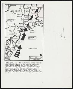
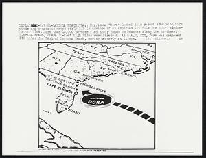
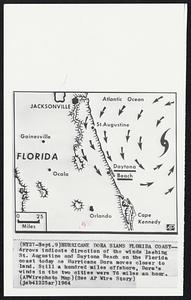
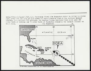
Search
Limit your search
- Baseball2,093
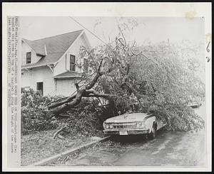
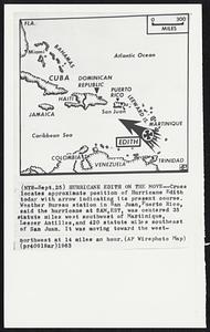
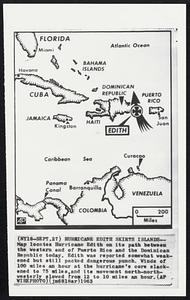
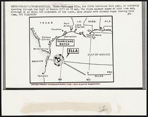
- Hurricanes1,963
- Demonstrations1,141
- Mayors911
- Floods777
- Baseball players601
- Blizzards599
- Earthquakes512
- Boston Herald-Traveler Photo Morgue16,458
- Leslie Jones Collection316
- Press Photography from the Brearley Collection147
- Historical Society of Old Yarmouth Archives and Local History Collection117
- Civil Defense Photographs90
- Arthur Griffin Photographs40
- Barnstable Patriot Photograph Collection, 1931-197839
- The Harvard Forest Map Collection37