Skip to search
Skip to main content
Skip to first result
Digital Commonwealth
Folders
Sign Up / Log In
Search for
Search
Search
Search
Basic
Advanced
Explore
Map
Collections
Institutions
Formats
For Educators
Primary Source Sets
Lesson Plans
Using Primary Sources
Searching Digital Commonwealth
For Institutions
Join Digital Commonwealth
Conferences, Trainings, & Events
How to Contribute Collections
Digitization Services
Board & Committees
Frequently Asked Questions
About
About Digital Commonwealth
News & Announcements
Copyright & Terms of Use
Harmful Content Statement
Partners
API
Contact Us
Search
Search Constraints
Start Over
Save Search
Your search:
More Like
commonwealth:w9509998t
✖
Remove constraint More Like: commonwealth:w9509998t
« Prev.
|
61
-
80
of
121
|
Next »
Sort
by relevance
relevance
title
date (asc)
date (desc)
recently added
Number of results to display per page
20
per page
per page
10
per page
20
per page
50
per page
100
per page
View results as:
List
list view
Maps
map view
Gallery
grid view
Search Results
61.
Major thoroughfare system, city of Boston, June 1972
62.
Major transportation system : Boston region MAPC area
63.
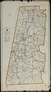
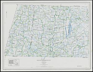
Map of Berkshire County, Massachusetts
64.
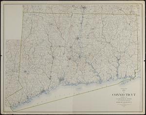
Map of Connecticut
65.
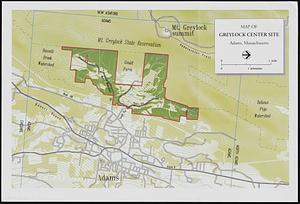
Map of Greylock center site, Adams, Massachusetts
66.
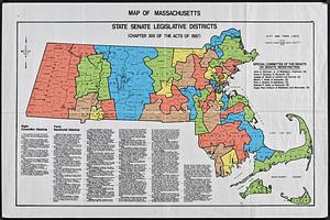
Map of Massachusetts : state Senate legislative districts : (Chapter 305 of the Acts of 1987)
67.
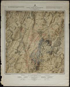
Map of the battle field of Gettysburg : July 1st, 2nd, 3rd, 1863
68.
Map of United States showing drainage areas and index numbers
69.
Massachusetts areas of critical environmental concern
70.
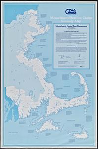
Massachusetts coastal zone management program : volume 1, summary map
71.
Massachusetts drainage basins
72.
Massachusetts land use - 1985
73.
Massachusetts land use - 1985
74.
Massachusetts open space and recreation facilities
75.
Massachusetts river basins
76.
Massachusetts river basins
77.
Massachusetts shoreline change summary map
78.
Massachusetts water resources study
79.
Metacomet-Monadnock Trail : an analysis of landuse
80.
New England fishery, recreation and scenic resources
« Previous
Next »
1
2
3
4
5
6
7
Limit your search
Subject
Essex County (Mass.)--Maps
27
Massachusetts--Maps
18
United States--History--Civil War, 1861-1865--Maps
10
Land use--Massachusetts--Maps
7
Massachusetts
7
Virginia--History--Civil War, 1861-1865--Maps
7
Essex county
6
Landowners--Massachusetts--Essex County--Maps
6
more
Subject
»
Place
North and Central America
106
United States
105
Massachusetts
74
Essex (county)
24
Virginia
13
Boston
8
Suffolk (county)
8
Connecticut
5
more
Place
»
Format
Maps/Atlases
118
Books
5
Ephemera
2
Documents
1
Manuscripts
1
Posters
1
Available to use
No known restrictions
111
Date
View distribution
Current results range from
1812
to
2015
Date range begin
Date range end
View larger »
Collection
Norman B. Leventhal Map & Education Center Collection
111
David Judkins Weaver Papers
96
Boston and New England Maps (Collection of Distinction)
74
Urban Maps (Collection of Distinction)
13
Historic Maps
7
Massachusetts Real Estate Atlases
2
Massachusetts Board of Harbor and Land Commissioners
1
Institution
Boston Public Library
111
Salem State University Archives and Special Collections
7
State Library of Massachusetts
3