Skip to search
Skip to main content
Skip to first result
Digital Commonwealth
Folders
Sign Up / Log In
Search for
Search
Search
Search
Basic
Advanced
Explore
Map
Collections
Institutions
Formats
For Educators
Primary Source Sets
Lesson Plans
Using Primary Sources
Searching Digital Commonwealth
For Institutions
Join Digital Commonwealth
Conferences, Trainings, & Events
How to Contribute Collections
Digitization Services
Board & Committees
Frequently Asked Questions
About
About Digital Commonwealth
News & Announcements
Copyright & Terms of Use
Harmful Content Statement
Partners
API
Contact Us
Search
Search Constraints
Start Over
Save Search
Your search:
More Like
commonwealth:2b88vr376
✖
Remove constraint More Like: commonwealth:2b88vr376
« Prev.
|
81
-
100
of
121
|
Next »
Sort
by relevance
relevance
title
date (asc)
date (desc)
recently added
Number of results to display per page
20
per page
per page
10
per page
20
per page
50
per page
100
per page
View results as:
List
list view
Maps
map view
Gallery
grid view
Search Results
81.
New England regional transportation map = Mapa do transporte regional da Nova Inglaterra = Nueva Inglaterra, mapa regional de...
82.
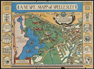
A newe mapp of Wellesley
83.
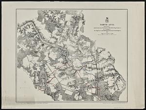
North Anna
84.
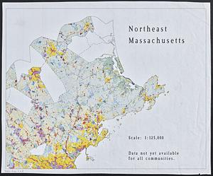
Northeast Massachusetts
85.
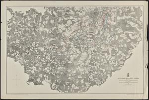
Open space map of Connecticut, lands dedicated as open space, and selected undeveloped land, lands managed but not dedicated as...
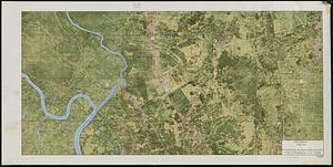
86.
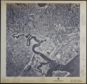
Orthophoto map of Boston, Lynn Common
87.
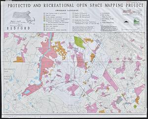
Outline map of 17th-century Boston drawn on an outline map of modern Boston
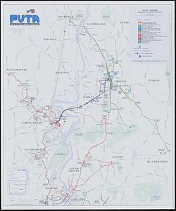
88.
Outline map of towns on the Massachusetts coast
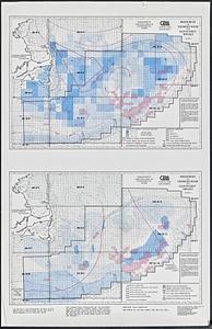
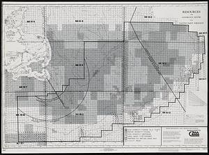
89.
Outline maps for the construction of a model of the world, based on the Lambert conformal conic projection
90.
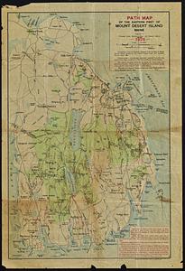
Path map of the eastern part of Mount Desert Island, Maine
91.
Petersburg and Five Forks
92.
Pictomap
93.
Printer test page
94.
Properties of the Trustees of Reservations and other protected open space
95.
Protected and recreational open space mapping project : Bedford
96.
PVTA bus map & guide
97.
The regional open space system : [Boston, Massachusetts metropolitan area]
98.
Resources on Georges Bank and Nantucket Shoals
99.
Resources on Georges Bank and Nantucket Shoals
100.
Richmond
« Previous
Next »
1
2
3
4
5
6
7
Limit your search
Subject
Gloucester (Mass.)--Maps
23
Massachusetts--Maps
19
United States--History--Civil War, 1861-1865--Maps
10
Essex County (Mass.)--Maps
7
Land use--Massachusetts--Maps
7
Massachusetts
7
Virginia--History--Civil War, 1861-1865--Maps
7
Coastal
6
more
Subject
»
Place
North and Central America
106
United States
104
Massachusetts
73
Essex (county)
28
Gloucester
20
Virginia
13
Boston
9
Suffolk (county)
9
more
Place
»
Format
Maps/Atlases
118
Books
4
Ephemera
2
Documents
1
Posters
1
Available to use
No known restrictions
105
Date
View distribution
Current results range from
1822
to
2015
Date range begin
Date range end
View larger »
Collection
Norman B. Leventhal Map & Education Center Collection
105
David Judkins Weaver Papers
96
Boston and New England Maps (Collection of Distinction)
67
Urban Maps (Collection of Distinction)
13
Historic Maps
8
Massachusetts Board of Harbor and Land Commissioners
4
Massachusetts Real Estate Atlases
4
Institution
Boston Public Library
105
Salem State University Archives and Special Collections
8
State Library of Massachusetts
8