Skip to search
Skip to main content
Skip to first result
Digital Commonwealth
Folders
Sign Up / Log In
Search for
Search
Search
Search
Basic
Advanced
Explore
Map
Collections
Institutions
Formats
For Educators
Primary Source Sets
Lesson Plans
Using Primary Sources
Searching Digital Commonwealth
For Institutions
Join Digital Commonwealth
Conferences, Trainings, & Events
How to Contribute Collections
Digitization Services
Board & Committees
Frequently Asked Questions
About
About Digital Commonwealth
News & Announcements
Copyright & Terms of Use
Harmful Content Statement
Partners
API
Contact Us
Search
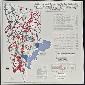
Search Constraints
Start Over
Save Search
Your search:
More Like
commonwealth:w9509998t
✖
Remove constraint More Like: commonwealth:w9509998t
« Prev.
|
21
-
40
of
121
|
Next »
Sort
by relevance
relevance
title
date (asc)
date (desc)
recently added
Number of results to display per page
20
per page
per page
10
per page
20
per page
50
per page
100
per page
View results as:
List
list view
Maps
map view
Gallery
grid view
Search Results
21.
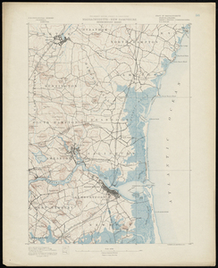
Massachusetts-New Hampshire, Newburyport sheet
22.
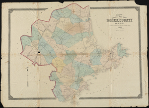
New Driving Road Map of Essex County, Mass.
23.
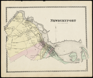
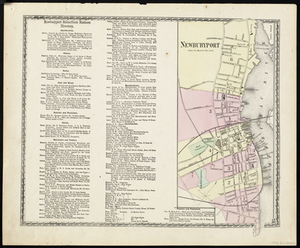
Newburyport
24.
Newburyport
25.
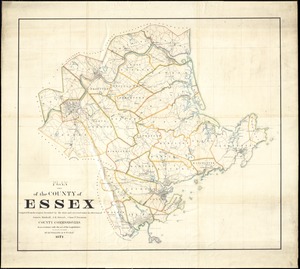
Plan of the county of Essex : compiled from the original furnished by the state and corrected under the direction of James...
26.
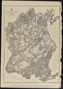
A topographical map of Essex County, Massachusetts : based upon the trigonometrical survey of the state
27.
Worcester County : Essex County
28.
The 1976 proposed regional open space plan
29.
Airbrush base for the Pelorus Linea region of Europa
30.
Aitoff's equal area projection of the sphere
31.
Antietam
32.
Appomattox Court House
33.
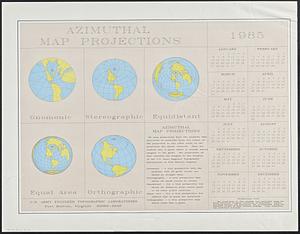
Azimuthal map projections
34.
Bermuda Hundred
35.
Black in New England 1840
36.
Boston bikemap : toward intelligent commuting
37.
Boston's bikemap : Arlington, Belmont, Brookline, Cambridge, Chelsea, Everett, Lexington, Malden, Medford, Needham, Newton,...
38.
Buffers around tributaries to the Wachusett Reservoir compared to 1985 urban landuse and currently protected open space in...
39.
Cape Cod
40.
Cape Cod open space : SCORP-GIS integration project
« Previous
Next »
1
2
3
4
5
6
7
Limit your search
Subject
Essex County (Mass.)--Maps
27
Massachusetts--Maps
18
United States--History--Civil War, 1861-1865--Maps
10
Land use--Massachusetts--Maps
7
Massachusetts
7
Virginia--History--Civil War, 1861-1865--Maps
7
Essex county
6
Landowners--Massachusetts--Essex County--Maps
6
more
Subject
»
Place
North and Central America
106
United States
105
Massachusetts
74
Essex (county)
24
Virginia
13
Boston
8
Suffolk (county)
8
Connecticut
5
more
Place
»
Format
Maps/Atlases
118
Books
5
Ephemera
2
Documents
1
Manuscripts
1
Posters
1
Available to use
No known restrictions
111
Date
View distribution
Current results range from
1812
to
2015
Date range begin
Date range end
View larger »
Collection
Norman B. Leventhal Map & Education Center Collection
111
David Judkins Weaver Papers
96
Boston and New England Maps (Collection of Distinction)
74
Urban Maps (Collection of Distinction)
13
Historic Maps
7
Massachusetts Real Estate Atlases
2
Massachusetts Board of Harbor and Land Commissioners
1
Institution
Boston Public Library
111
Salem State University Archives and Special Collections
7
State Library of Massachusetts
3