1. Carte de la Caroline et Georgie. : Pour servir à l'Histoire générale des voyages Creator: Bellin, Jacques Nicolas, 1703-1772; Frost, Donald McKay, 1877-1958 Format: Maps/Atlases Collection: American Antiquarian Society Collection / American Revolutionary War-Era Maps (Collection of Distinction) Date: [ca. 1757] Institution: American Antiquarian Society
2. Carte de la Caroline et Georgie. : Pour servir à l'Histoire générale des voyages Creator: Bellin, Jacques Nicolas, 1703-1772 Format: Maps/Atlases Collection: American Antiquarian Society Collection / American Revolutionary War-Era Maps (Collection of Distinction) Date: [ca. 1757] Institution: American Antiquarian Society
3. A new & accurate map of the provinces of North & South Carolina Georgia &c Creator: Bowen, Emanuel, -1767 Format: Maps/Atlases Collection: American Antiquarian Society Collection / American Revolutionary War-Era Maps (Collection of Distinction) Date: [1752] Institution: American Antiquarian Society
4. A New and accurate map of the chief parts of South Carolina, and Georgia Creator: Bew, John, -1793; Lodge, John Format: Maps/Atlases Collection: American Antiquarian Society Collection / American Revolutionary War-Era Maps (Collection of Distinction) Date: [1780] Institution: American Antiquarian Society
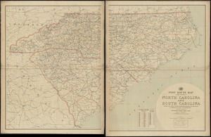
5. J.H. Colton's topographical map of North and South Carolina : a large portion of Georgia & part of adjoining states Creator: Colton, J. H. (Joseph Hutchins), 1800-1893 Format: Maps/Atlases Collection: Norman B. Leventhal Map & Education Center Collection Date: 1861 Institution: Boston Public Library
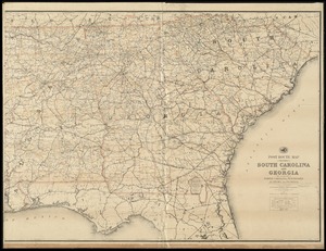
6. Middle Georgia & South Carolina Creator: United States Coast Survey Format: Maps/Atlases Collection: Norman B. Leventhal Map & Education Center Collection Date: [1865?] Institution: Boston Public Library
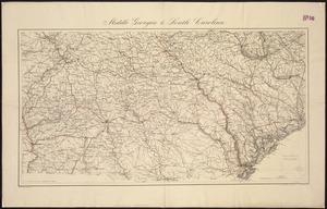
7. [Middle Georgia and South Carolina] Creator: United States Coast Survey Format: Maps/Atlases Collection: Norman B. Leventhal Map & Education Center Collection Date: 1865 Institution: Boston Public Library
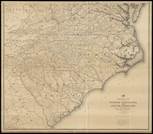
8. North Carolina & South Carolina Creator: Lindenkohl, A. Format: Maps/Atlases Collection: Norman B. Leventhal Map & Education Center Collection Date: 1865 Institution: Boston Public Library
9. Post route map of the states of North Carolina and South Carolina showing post offices with the intermediate distances and mail routes in operation on the 1st of... Creator: United States. Post Office Dept Format: Maps/Atlases Collection: Norman B. Leventhal Map & Education Center Collection Date: 1897 Institution: Boston Public Library
10. Post route map of the states of North Carolina and South Carolina showing post offices with the intermediate distances and mail routes in operation on the 1st of... Creator: United States. Post Office Dept Format: Maps/Atlases Collection: Norman B. Leventhal Map & Education Center Collection Date: 1903 Institution: Boston Public Library
11. Post route map of the states of North Carolina and South Carolina with adjacent parts of Georgia, Tennessee, Kentucky, West Virginia and Virginia : showing post... Creator: United States. Post Office Dept Format: Maps/Atlases Collection: Norman B. Leventhal Map & Education Center Collection Date: 1891 Institution: Boston Public Library
12. Post route map of the States of South Carolina and Georgia with adjacent parts of North Carolina, Tennessee, Alabama and Florida : showing post offices with the... Creator: United States. Post Office Dept Format: Maps/Atlases Collection: Norman B. Leventhal Map & Education Center Collection Date: 1891 Institution: Boston Public Library
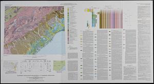
13. Quaternary geologic map of the Savannah 4° x 6° quadrangle, United States Creator: Geological Survey (U.S.), Colquhoun, Donald J., Richmond, Gerald Martin, 1914-, Fullerton, David S., Weide, David L., and Georgia Geologic Survey Format: Maps/Atlases Collection: Applied Geographics, Inc. Records / Norman B. Leventhal Map & Education Center Collection Date: 1987 Institution: Boston Public Library
14. The Rand McNally new commercial atlas map of South Carolina Creator: Rand McNally and Company Format: Maps/Atlases Collection: Norman B. Leventhal Map & Education Center Collection Date: 1913 Institution: Boston Public Library
15. South Carolina Creator: Doolittle, Amos, 1754-1832, Carey, Mathew, 1760-1839, and Carey, Mathew, 1760-1839 Format: Maps/Atlases Collection: Norman B. Leventhal Map & Education Center Collection Date: 1806 Institution: Boston Public Library
16. The state of South Carolina : from the best authorities Creator: Lewis, Samuel, 1753 or 4-1822, Lewis, Samuel, 1753 or 4-1822, Barker, W. (William), active 1795-1803, and Carey, Mathew, 1760-1839 Format: Maps/Atlases Collection: American Revolutionary War-Era Maps (Collection of Distinction) / Norman B. Leventhal Map & Education Center Collection Date: [1800] Institution: Boston Public Library
17. 1st. sheet of De Witt's state-map of New York Creator: De Witt, Simeon, 1756-1834; Tiebout, Cornelius, 1777-1832 Format: Maps/Atlases Collection: American Antiquarian Society Collection / American Revolutionary War-Era Maps (Collection of Distinction) Date: [1792] Institution: American Antiquarian Society
18. An accurate map of North America Creator: Robert de Vaugondy, Gilles, 1688-1766; Rollos, G., active 1754-1789 Format: Maps/Atlases Collection: American Antiquarian Society Collection / American Revolutionary War-Era Maps (Collection of Distinction) Date: [1760?] Institution: American Antiquarian Society
19. An accurate map, of the District of Maine : being part of the commonwealth of Massachusetts Creator: Carleton, Osgood, 1742-1816, Carleton, Osgood, 1742-1816, Norman, John, 1748?-1817, and Norman, William, -1807 Format: Maps/Atlases Collection: American Antiquarian Society Collection / American Revolutionary War-Era Maps (Collection of Distinction) Date: [1795] Institution: American Antiquarian Society
20. An Accurate map of the United States of America. : According to the Treaty of Peace of 1783 Creator: Anderson, Alexander, 1775-1870; Smith, Reid & Wayland Format: Maps/Atlases Collection: American Antiquarian Society Collection / American Revolutionary War-Era Maps (Collection of Distinction) Date: [1796] Institution: American Antiquarian Society


![[Middle Georgia and South Carolina]](https://bpldcassets.blob.core.windows.net/derivatives/images/commonwealth:7h14b2665/image_thumbnail_300.jpg)